
Thanksgiving in Utah
December 4, 2024
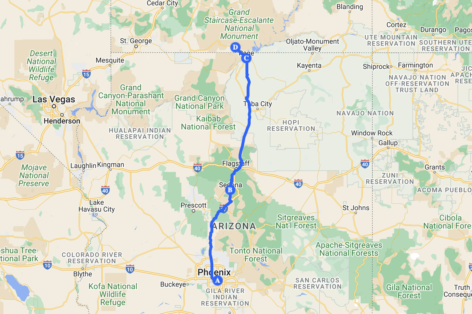
I had no idea where to go for this Thanksgiving at first. I went through my map, trying to find the gaps among the places I had been to. I found a huge gap in Utah. The last time I was in Utah, my main goal was to see Antelope Canyon. Now I know about so many other beautiful spots, so this is it. Flying to Phoenix since I’ve never been to Phoenix before.
The vibe for this road trip was RAYE and Tove Lo. I listened to tons of their songs before, during, and after the trip. I can't remember how many times I played 'Escapism.' by RAYE. My road trip vibe for the past few months had always been Maneskin. I can never fall asleep driving while listening to their music. I also love that line from 'THE DRIVER': If there’s nowhere to go when you wanna go wild, I wanna be the driver.
Day 1 Into Utah
 First day
Leaving home on a Saturday morning for an airport I had never been to. The road was surprisingly quiet and peaceful, the neighborhood was surprisingly quiet and peaceful, and the airport was surprisingly quiet and peaceful.
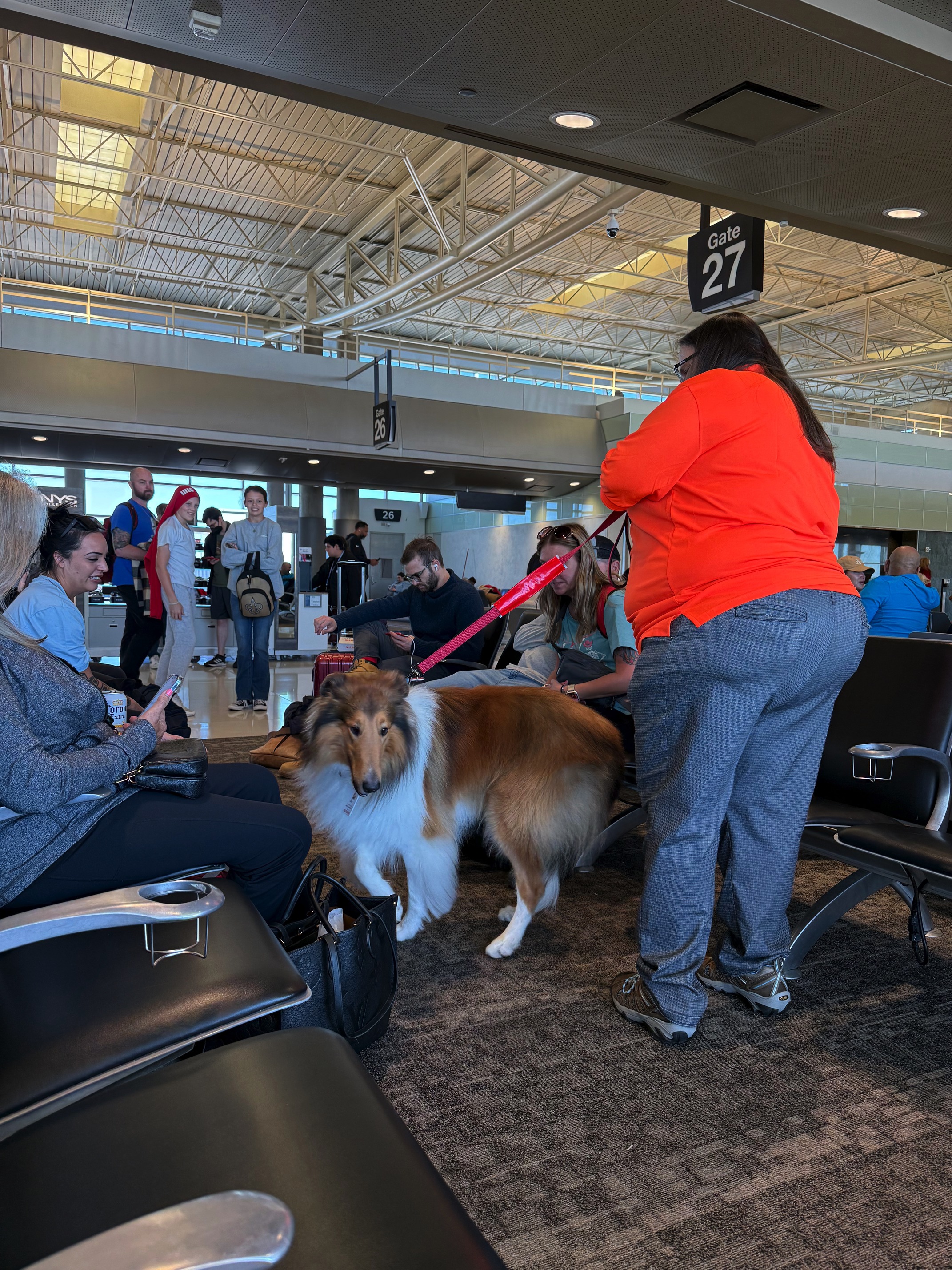 Little star in the airport
I did my research before going. I knew I was aiming for lots of off-road attractions, so I rented a standard SUV, hoping it would at least be AWD. When I got to the counter, the lady told me the standard SUVs weren’t AWD or 4WD. She said I could upgrade to a 4x4, which would be a Jeep Wrangler, and it was the cheapest option. I hesitated. It seemed like too much. I did want to drive this cool car, but I had also heard rumors about how difficult it is to handle. That lady assured me, 'It’s super easy to drive, SUPER EASY.' Now with the opportunity right in front of me, there’s no way I could say no. Destiny wanted me to drive a badass Wrangler.
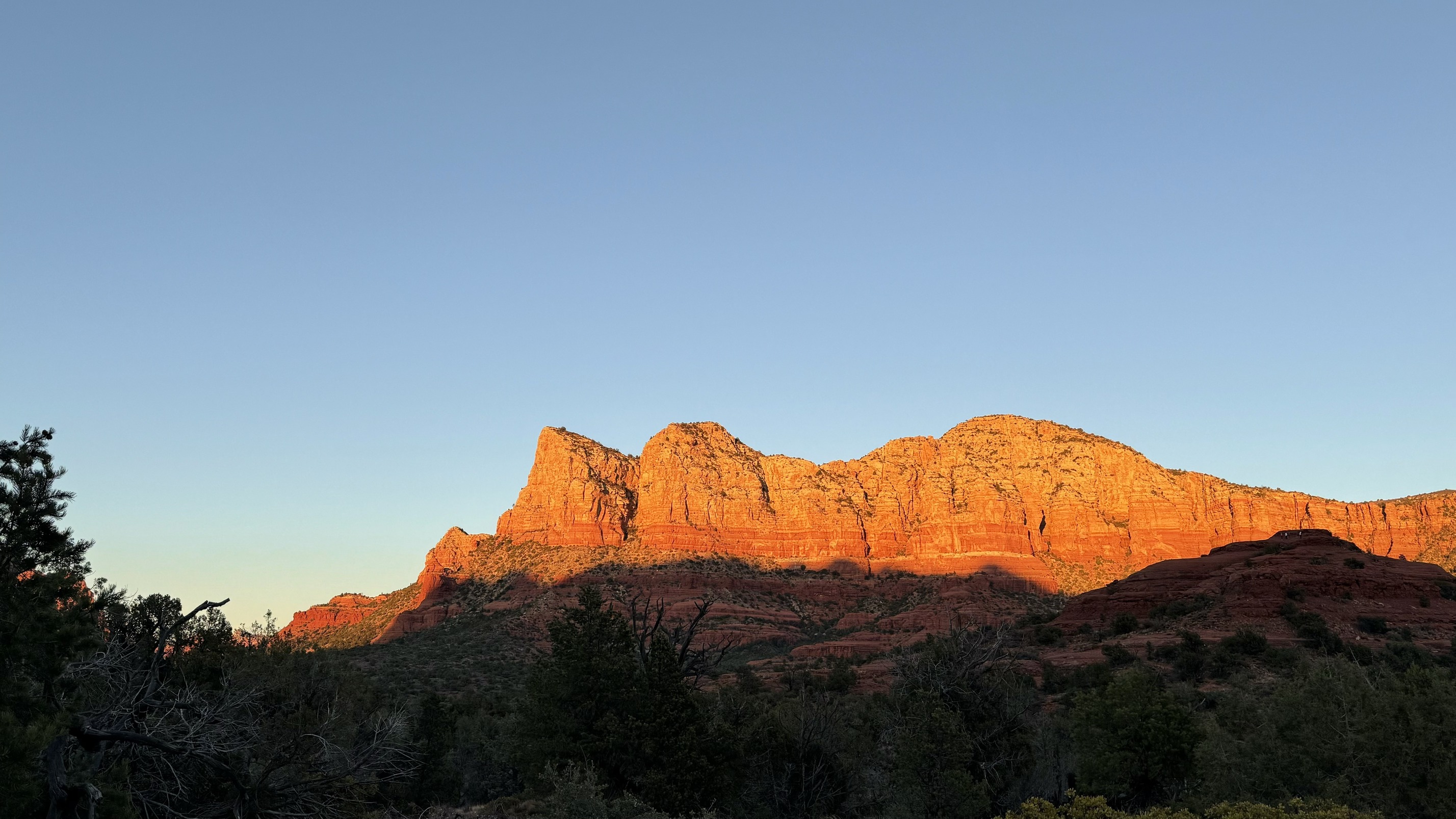
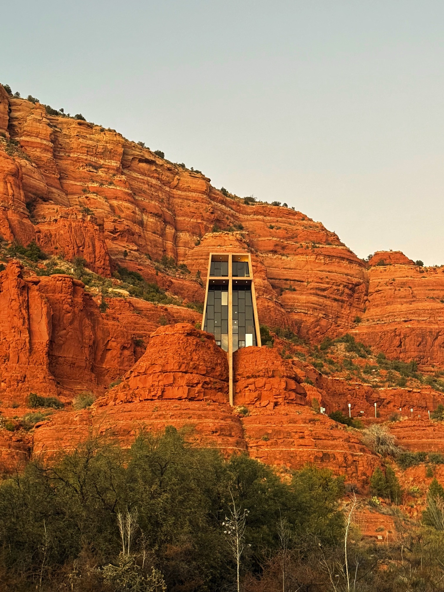
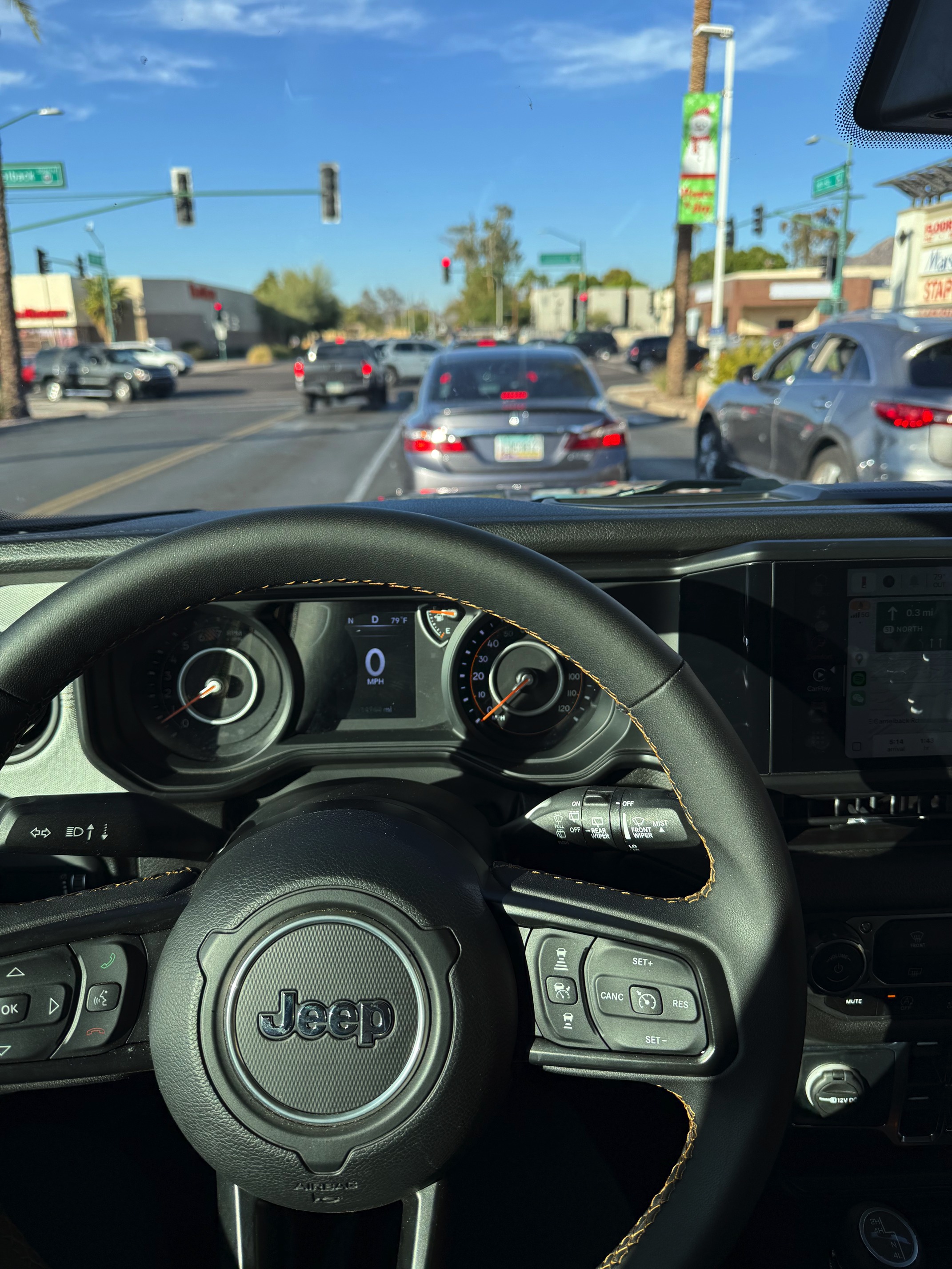 BADASS
I made a quick stop in Sedona to catch the sunset. By the time I was on my way to the Chapel of the Holy Cross, it was already golden hour.
 Just a random pullout point in Sedona
I missed the chapel's opening hours. Even though the gate was open, I didn’t go inside because of the "No Trespassing" sign.
 A quick picture in front of someone's house
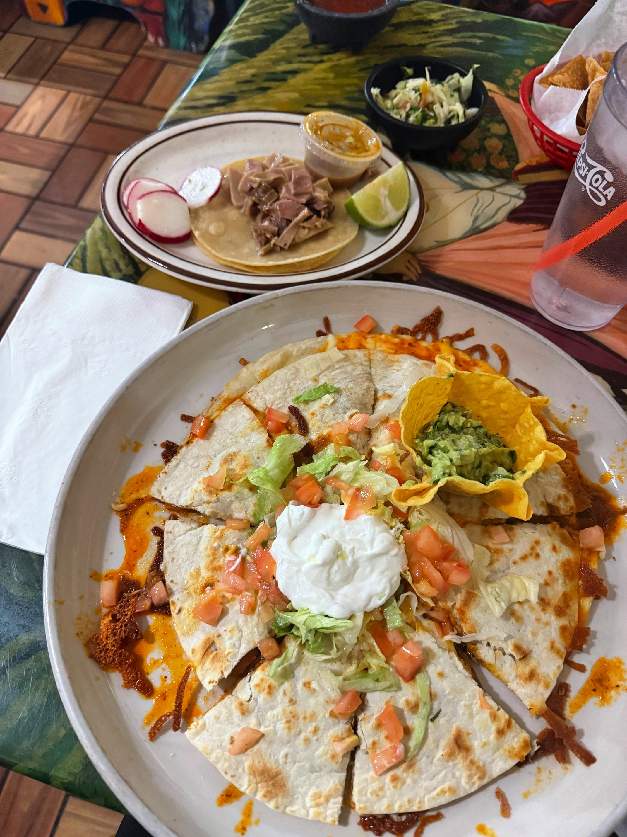
Time for dinner. Big Water is a small town with no dining options, but I happen to have a favorite restaurant in Page—El Tapatio. I was here two years ago, and their pig stomach tacos are everything.
No luck with the stars for that night though. It was pretty cloudy.
Day 2 Going Wild
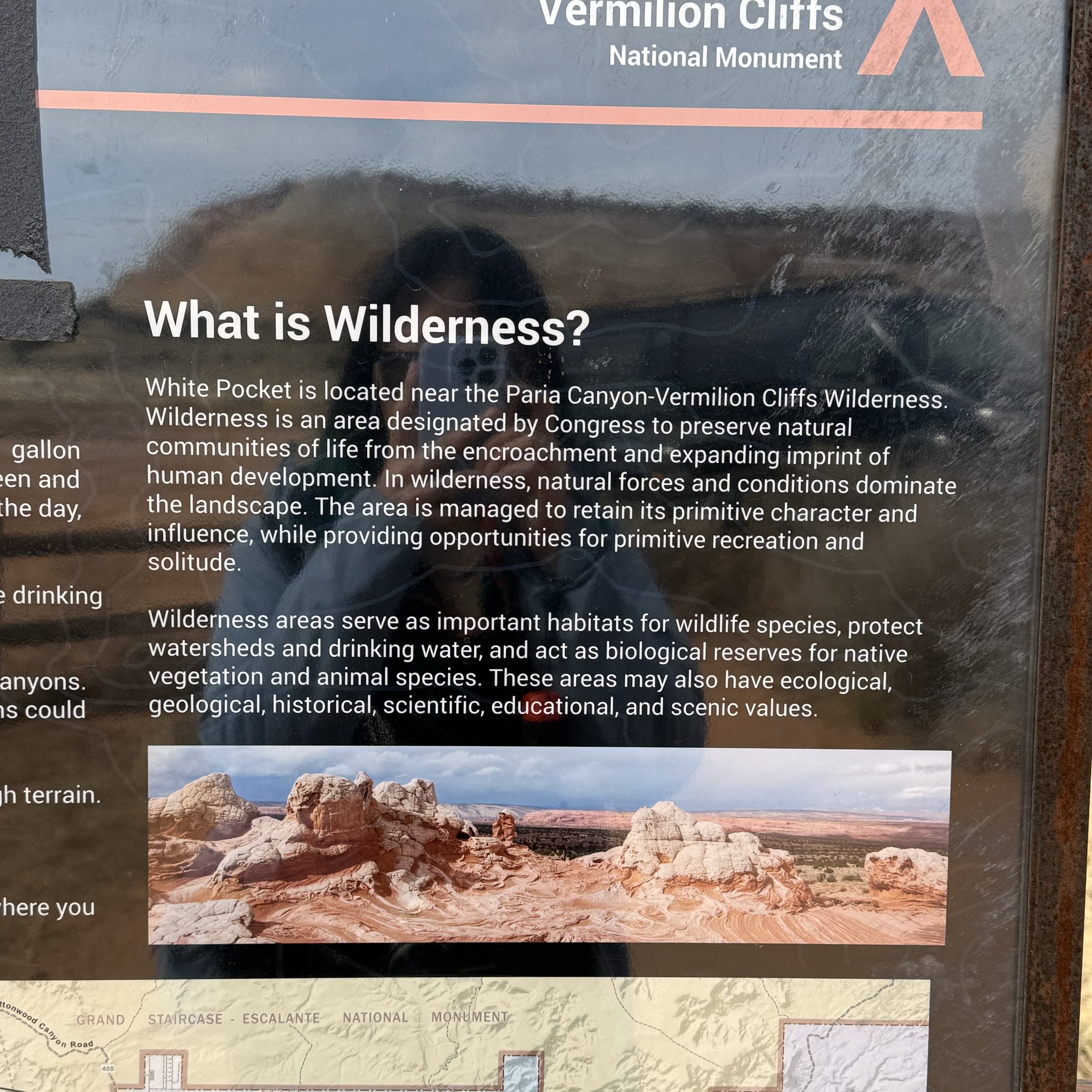
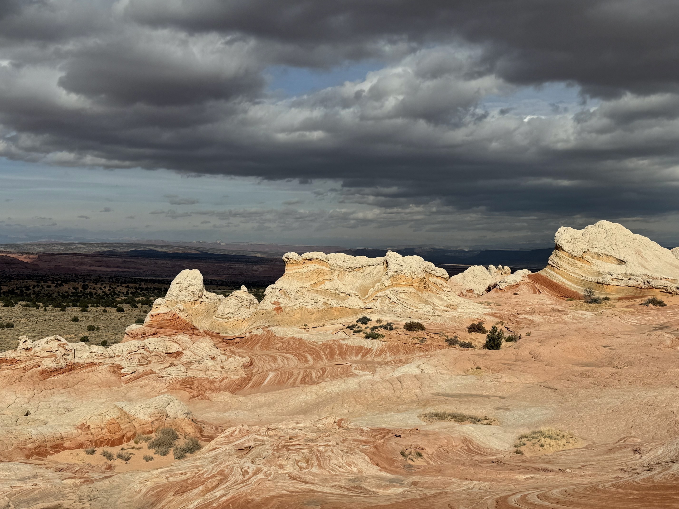
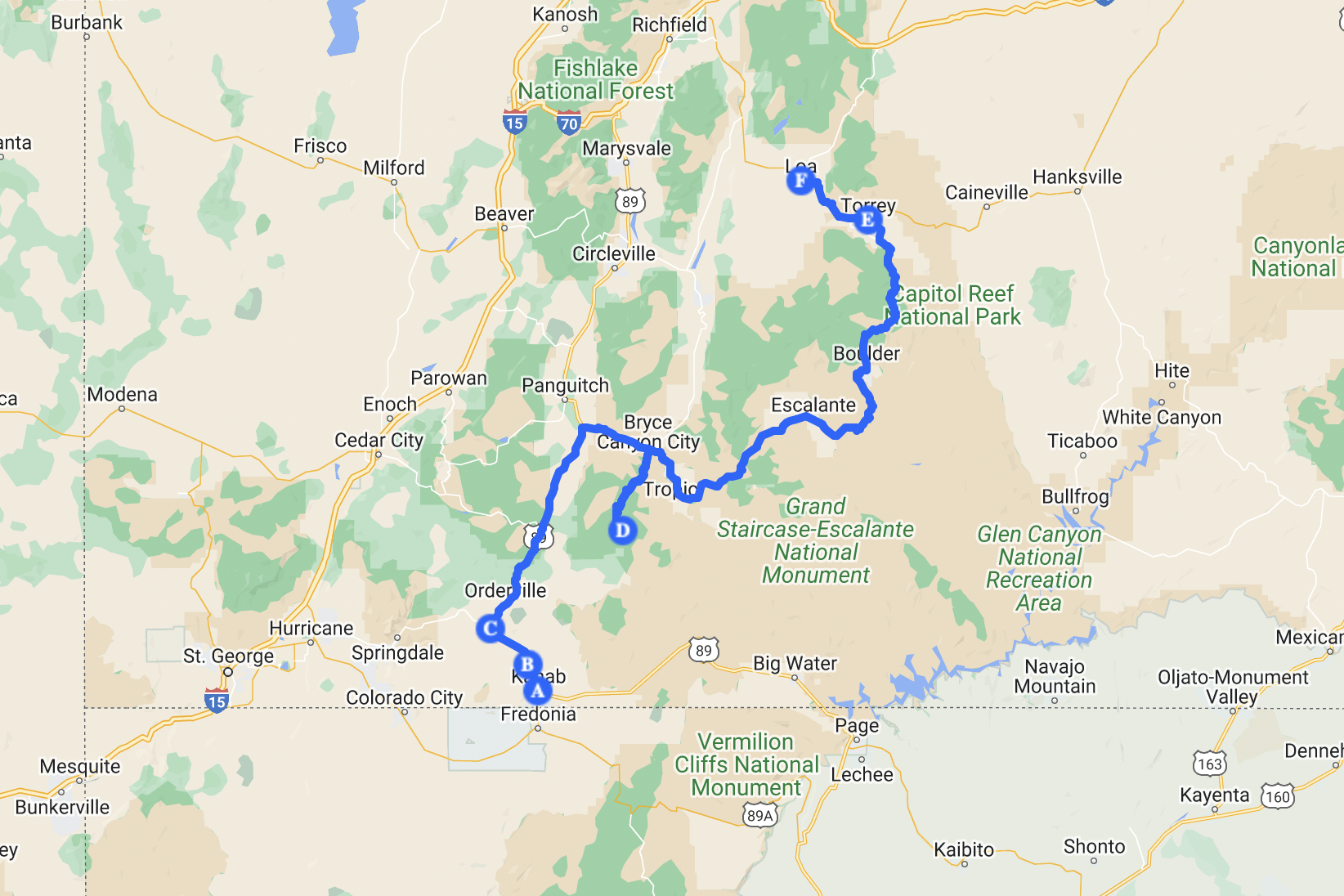
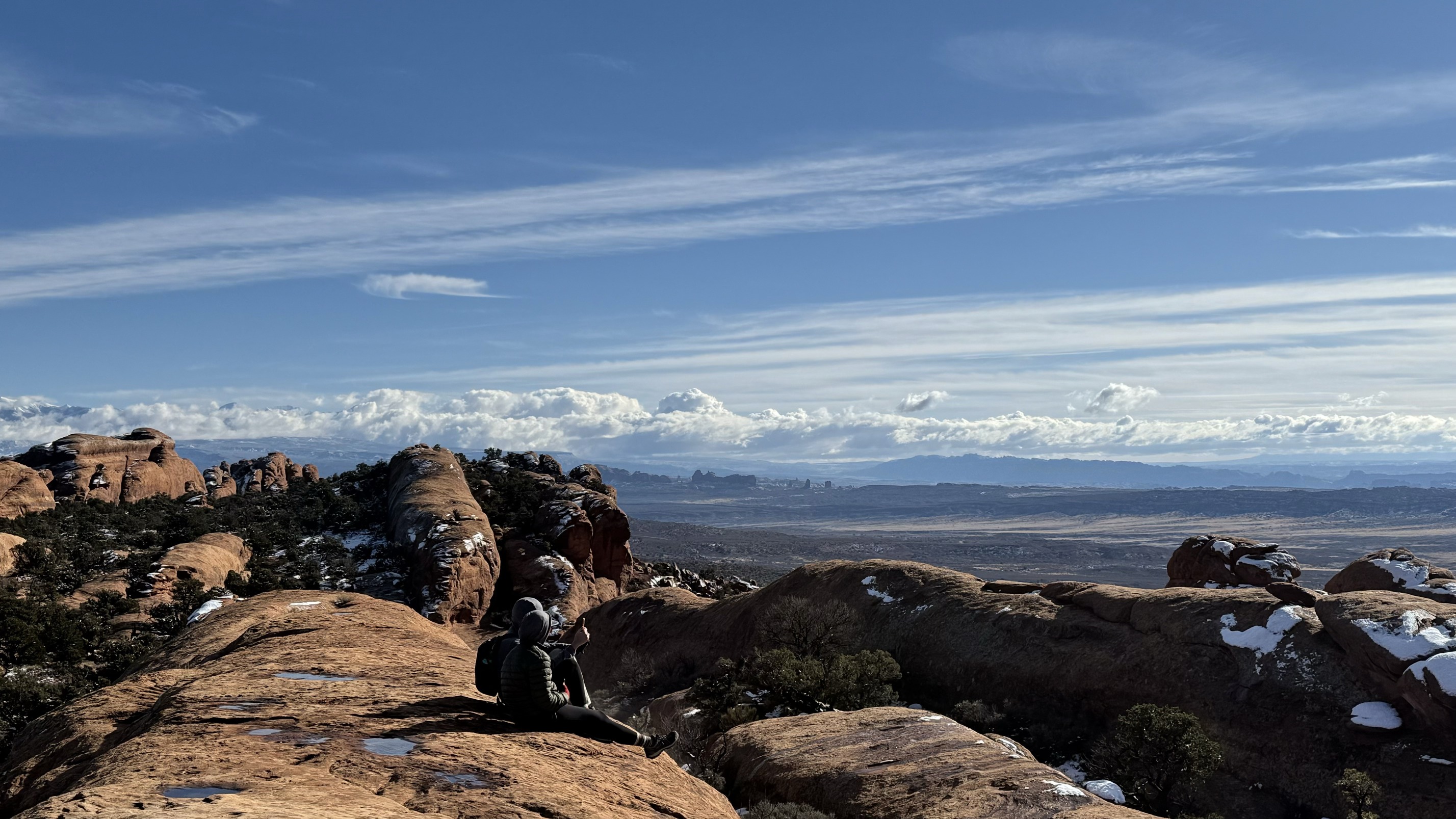
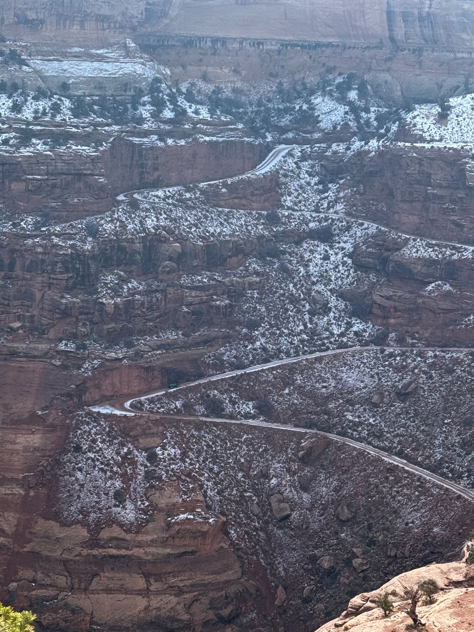
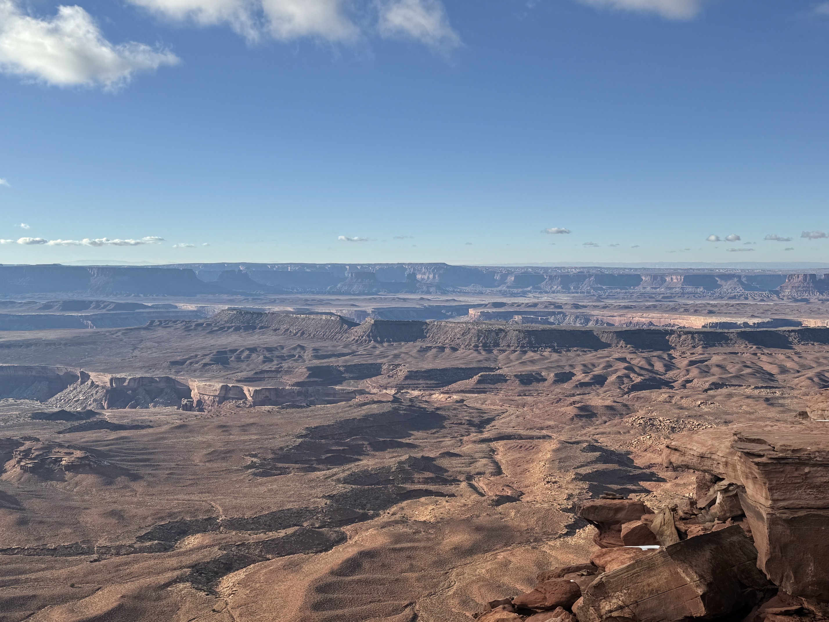
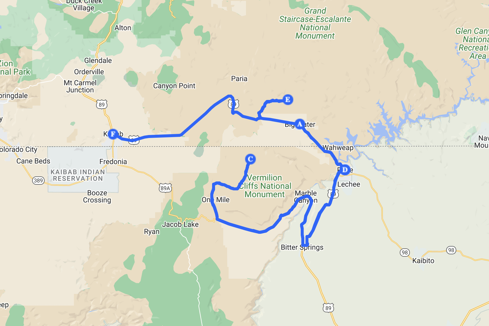 For White Pocket(C) and White Hoodoos(E)
I had plans for other places, but time wouldn’t allow it. Just these two spots alone required at least 7 hours of driving, and both of them involve a lot of rough off-road driving.
I joined the lottery for The Wave but didn’t have any luck. If I had gotten the permit, my plan for the day would simply be The Wave. But looking back, White Pocket was truly something special and hard to let go of. Maybe The Wave is even more charming. There’s no way to find out this time.
I found a very convincing reason to leave early for White Pocket: the earlier you arrive, the better your chances of getting roadside assistance if you get stuck. I read about people waiting 6 hours for rescue and ending up with a $6,000 bill after getting trapped in the sand.
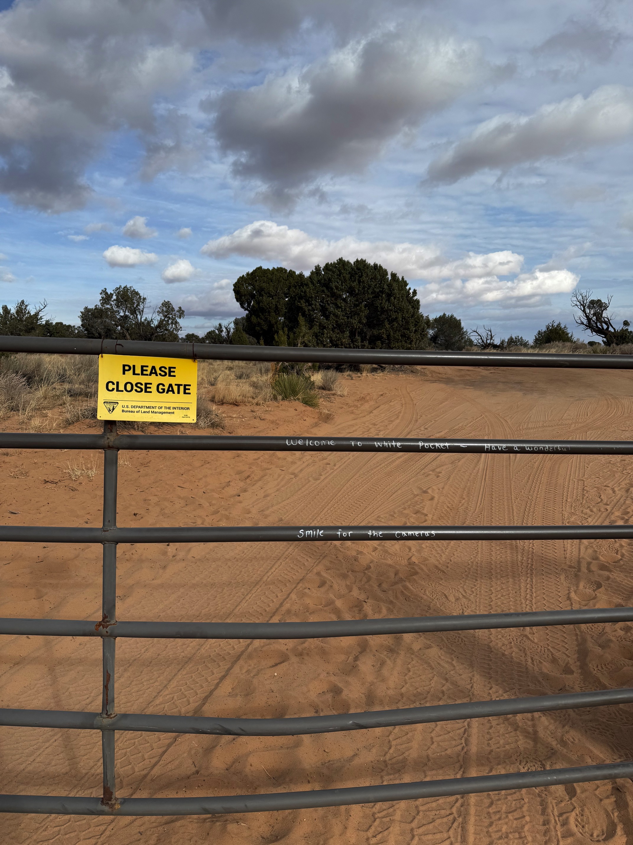 A gate you need to go through
It’s actually difficult to go the wrong way if you stick to the official guides. The first half of the off-road drive was gravel and dirt. I drove carefully and slowly until another Wrangler flew past me. That gave me the confidence to pick up the pace. The second half was mostly sand, with some rocks sticking out that made the ride pretty bumpy. I don’t think it’s easy to get stuck as long as you stay on the path, follow the tire marks left by others, and avoid going full speed on the sand—because it’s so easy to drift.
The road was narrow, so we often had to give way to each other. There weren’t many people I came across while driving, but everyone I did meet was so nice. We showed respect, waved, and said hi to each other. It was truly lovely.
I think the drive was pretty fun. I felt the charm of the Wrangler and the thrill of going off-road with bare concern.
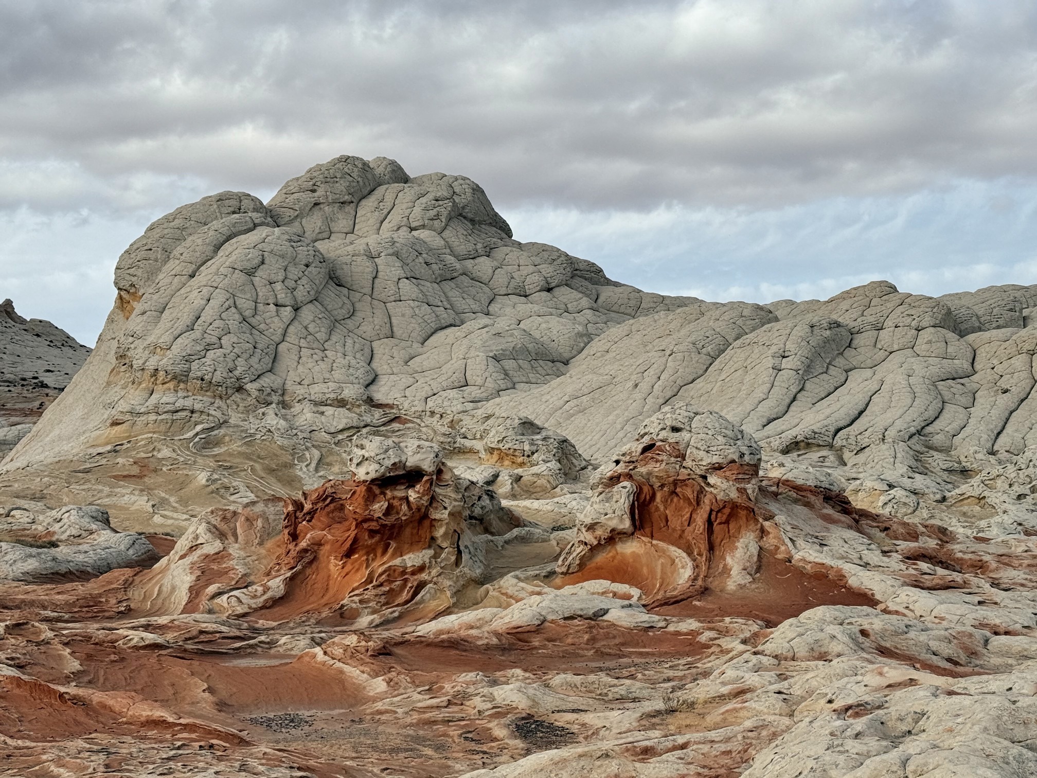
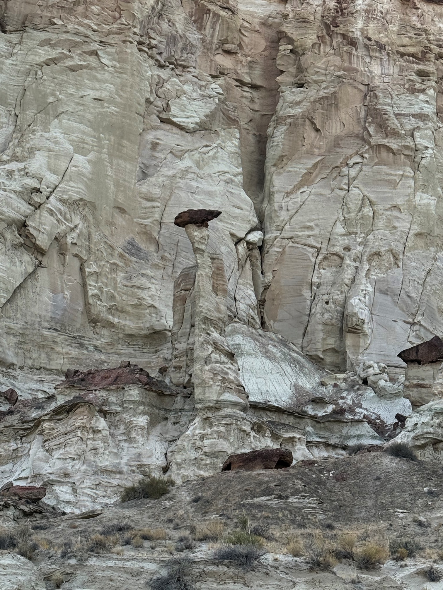
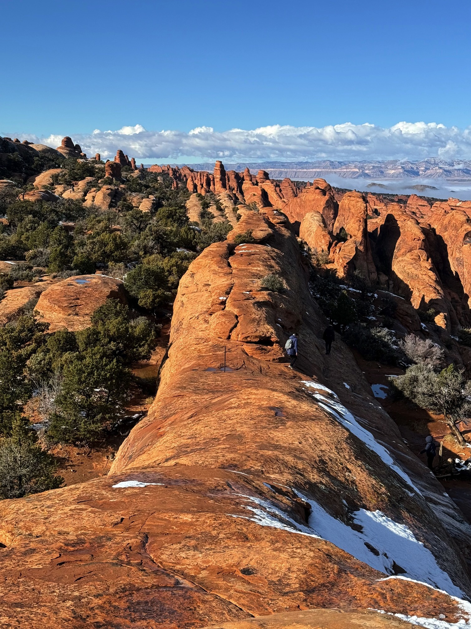
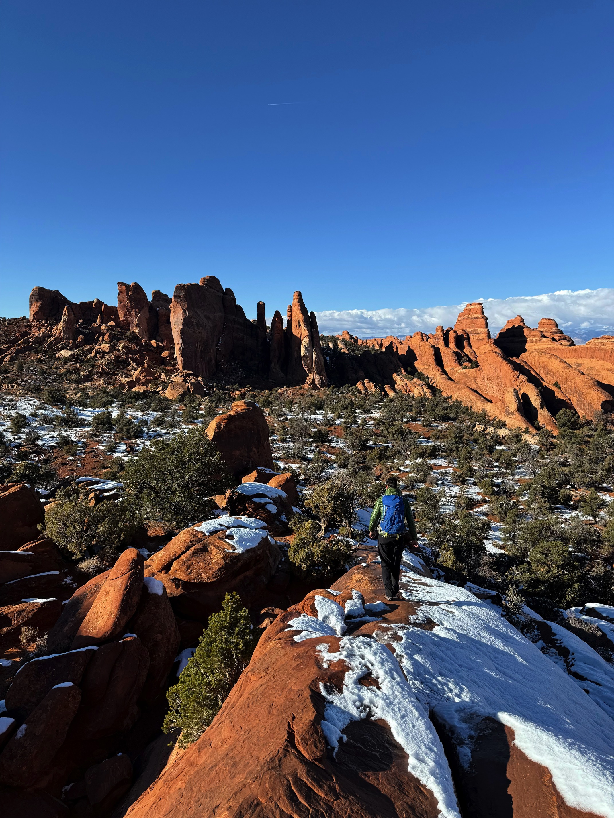
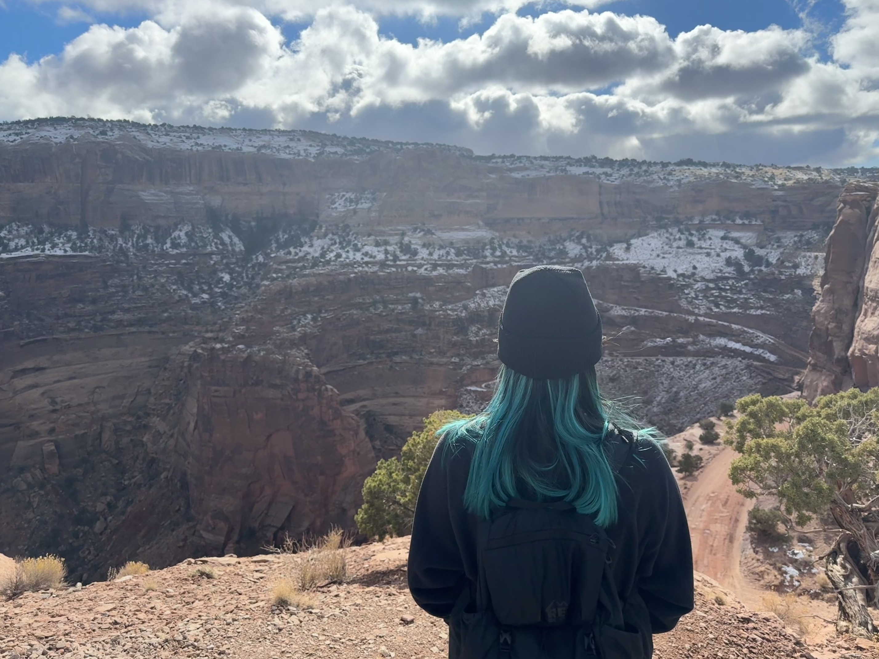
 You are free to explore anywhere at White Pocket
You need to walk a short distance to reach the White Pocket area. The fact that you can step anywhere is amazing. I had so much fun climbing up and down taking pictures.
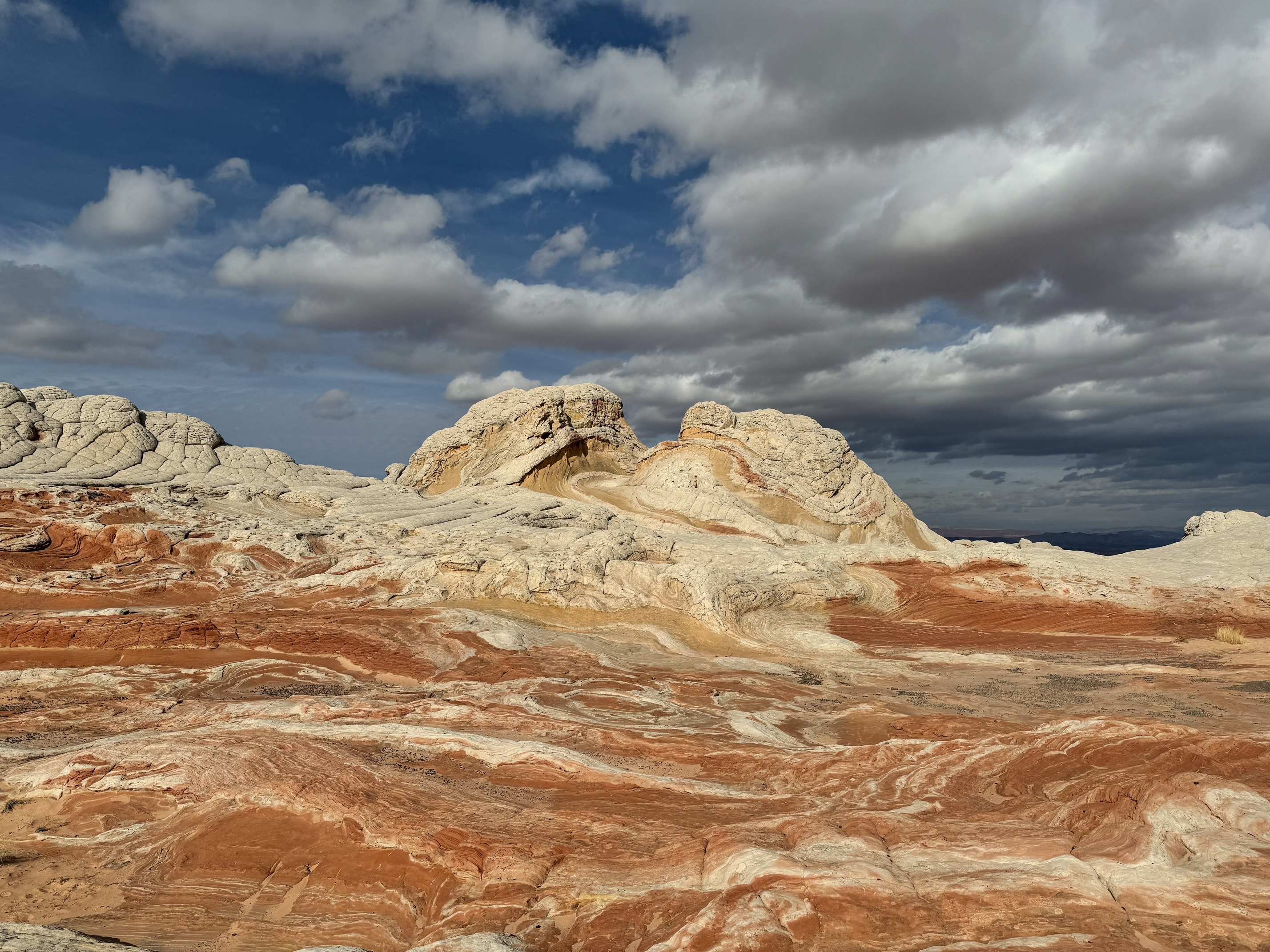
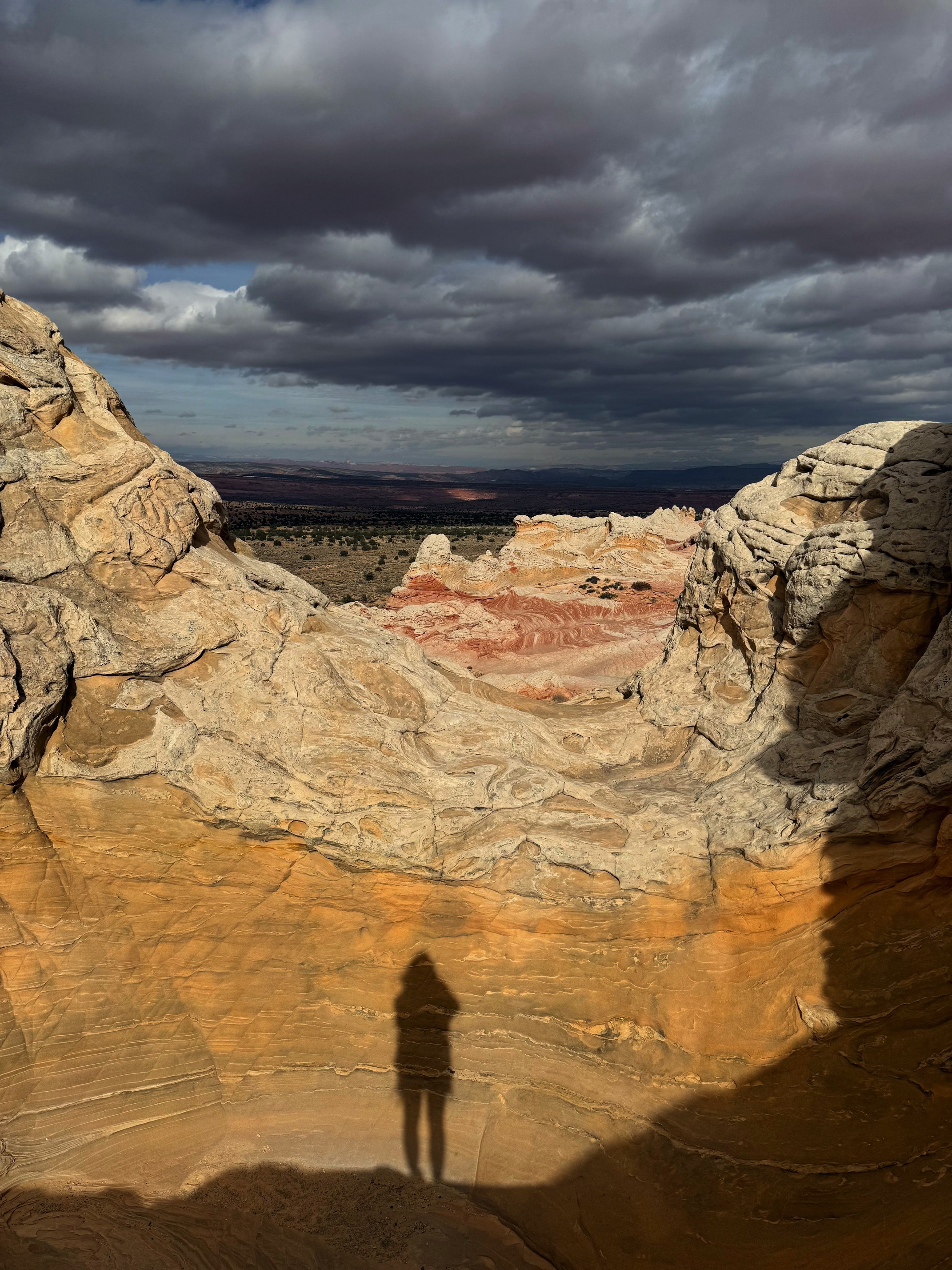
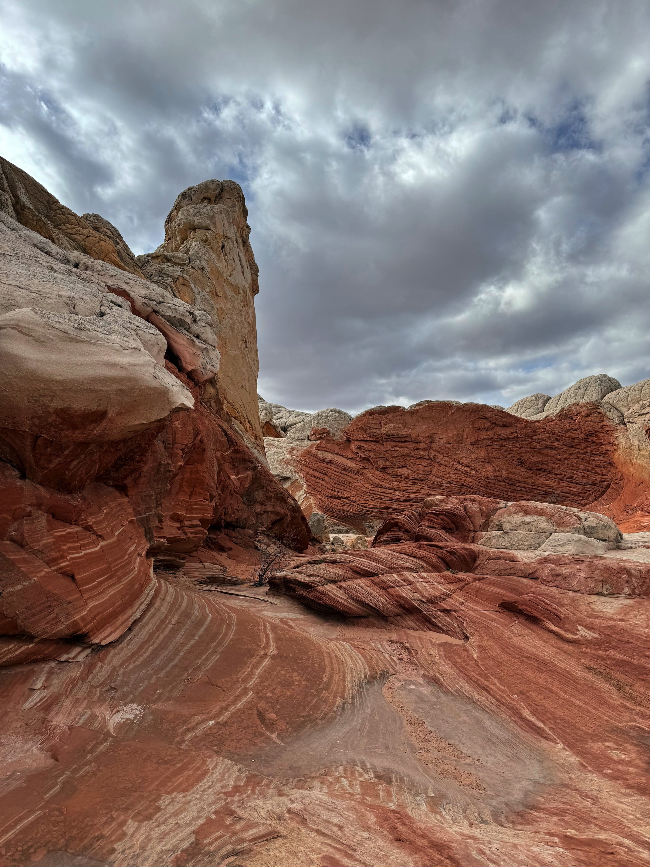
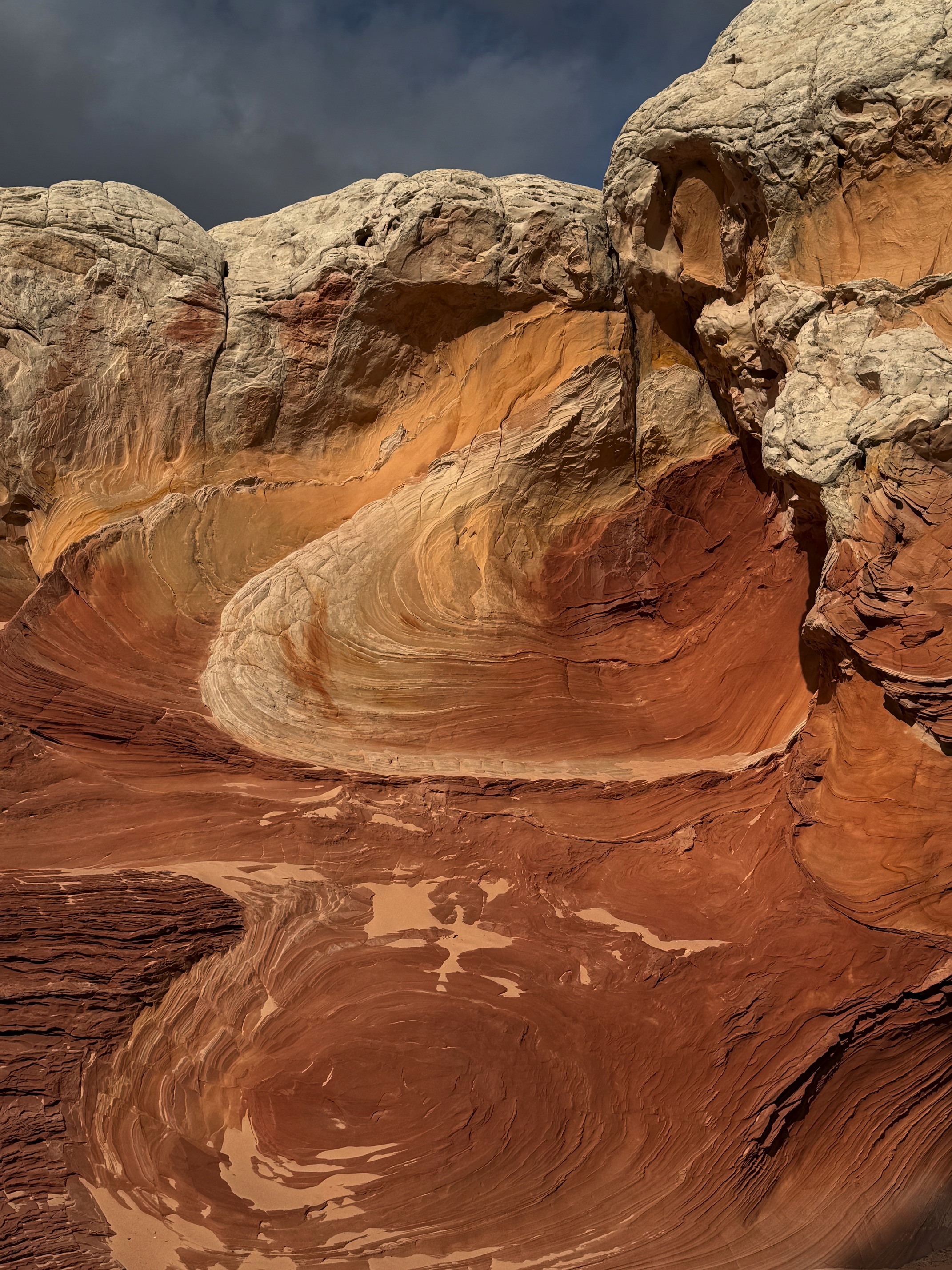
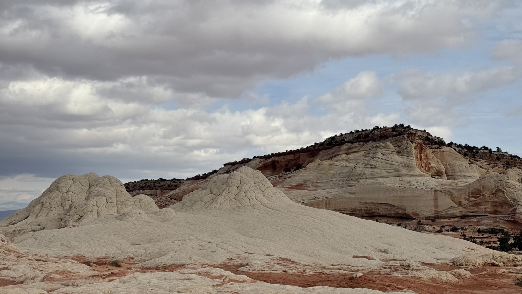 THE White Pocket
I hated to leave but time was ticking. I wanted to leave White Hoodoos before dark. The drive back felt much more confident than the drive in. Went back to Page for gas and a quick bite, then I hit the road again.
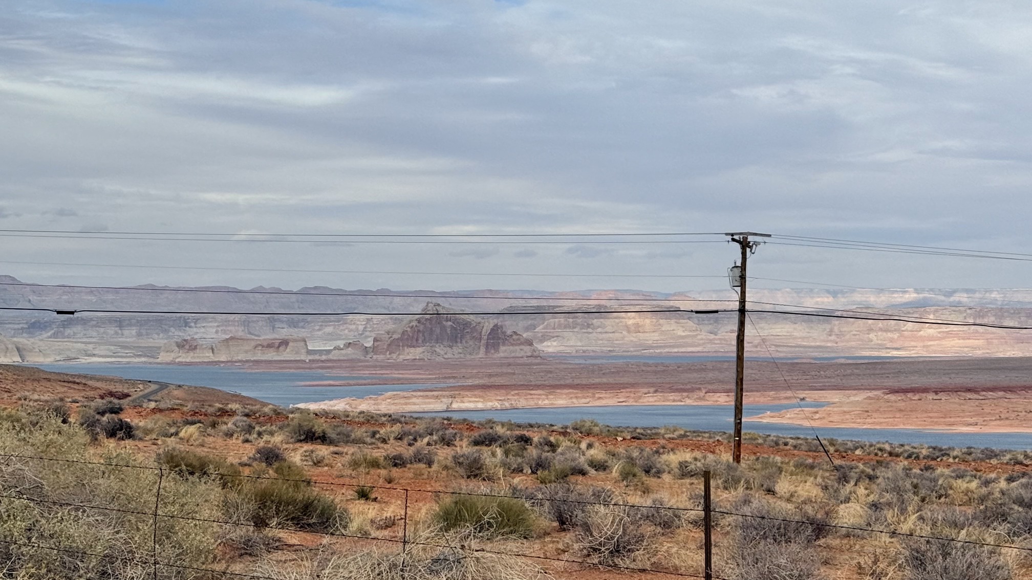
I had visited Lake Powell before, so I didn’t include it in my plans this time. Still, it’s stunning and definitely worth a visit.
 Stopped by a pullout point when leaving Page
Before I came, I heard everyone talking about how difficult the drive to White Pocket is. Honestly, I don’t think that’s true. As long as you have a high-clearance 4x4 vehicle, drive cautiously, you’ll be fine. But the drive to White Hoodoos is a different story. The off-road section wasn’t as long, but it was much bumpier, going up and down hills with sharp turns.
When I got close to the unmarked trailhead for White Hoodoos, I saw another car parked there, and my GPS told me I had arrived. Thinking I was in the right spot, I parked next to that car. The way to White Hoodoos was to follow the dry riverbed. I noticed a small opening in the fence surrounding the area and saw lots of footprints, so I went for it.
 In fact the wrong spot to go
I was so wrong. The footprints led me to a cliff overlooking the dry riverbed. That’s when I saw people walking on the riverbed below and finally understood what "follow the dry riverbed" actually meant. I started looking for a way to climb down but quickly realized I couldn’t, unless I jumped off the cliff and surely broke my neck. I wandered around and ended up on a small hill. From there, I saw two other cars parked not far from mine, so I rushed back, hopped in my car, and drove to that spot.
Now I saw the correct way to go. The opening in the fence was so small that it could only fit one person. There was no chance you could see it from afar.
After getting lost and then finding the right path, I had wasted some precious time. My original plan would have worked perfectly if nothing had gone wrong. I was supposed to be out of the off-road area before dark, but now I wasn’t so sure. I had to hurry up.
The hike to the hoodoos was said to be about a mile. When I was barely halfway there, I met a guy heading back who told me, "You’re almost there." I naively thought: almost there.
I started questioning myself when I hit 1 mile but still saw nothing. Then, I noticed the tire marks continued (someone had driven in before, you shouldn't do that!!!). I followed them and finally reached the hoodoos. They weren’t as stunning as I expected. I’m not sure if it was the time of day—there was no direct sunlight—or something else, but the scene didn’t match the effort I put in at all. Also, if you want a close-up photo, you’ll need to take your time climbing those rocks.
The sunset started before I hiked back. I could see the golden tops on the other side of the canyon and pink clouds, but since I was at a lower point, my view was obstructed. The ground was covered in pebbles and mud, making it really difficult to walk fast. I managed to get back and caught the last bit of the sunset.
As I mentioned, the off-road drive to White Hoodoos isn’t easy, let alone when it’s dark. I drove like crazy, trying my best to get out of there before it was completely dark. When I finally made it out, I pulled over to the side of the road and rested for a while. I couldn’t believe what I had just gone through.
Drove to Kanab for dinner and to stay the night. Nicholas and Celeste were my Airbnb hosts. I didn’t expect much from their place, considering it was cheap and in a small town. But their place felt like a castle. I was totally blown away.
Day 3 Caves and Bryce Canyon NP
 New plan for the day
My original plan was to hike to Cosmic Ashtray. But since I was so tired from the previous day’s drive, I made a spur-of-the-moment decision to skip the hike and aim on sightseeing spots that were accessible by car. Nicholas gave me plenty of great advice, I marked all of them on my map and here we go.
Before I left, I had something important to do—meet the other family members: two donkeys and a horse.
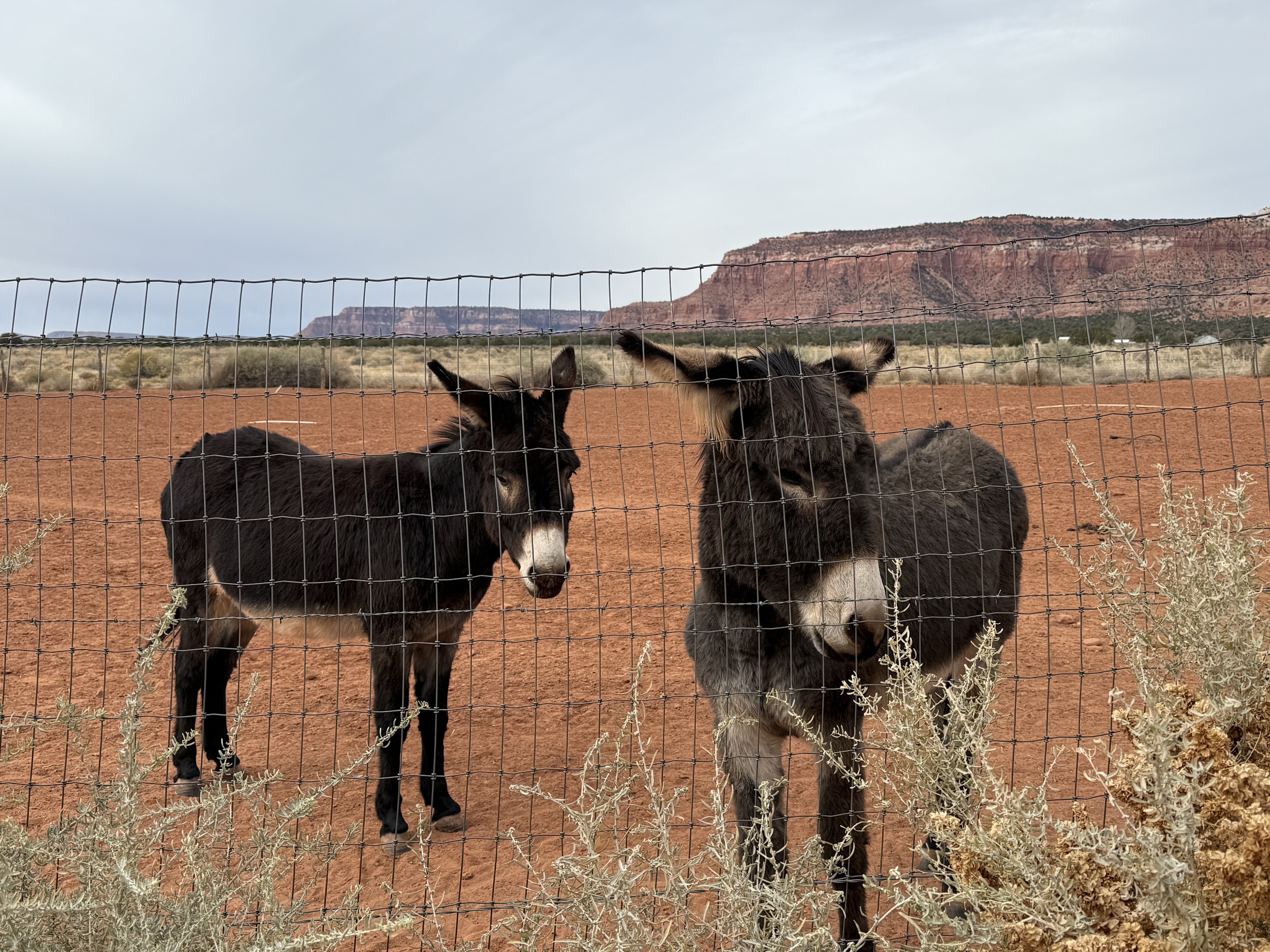
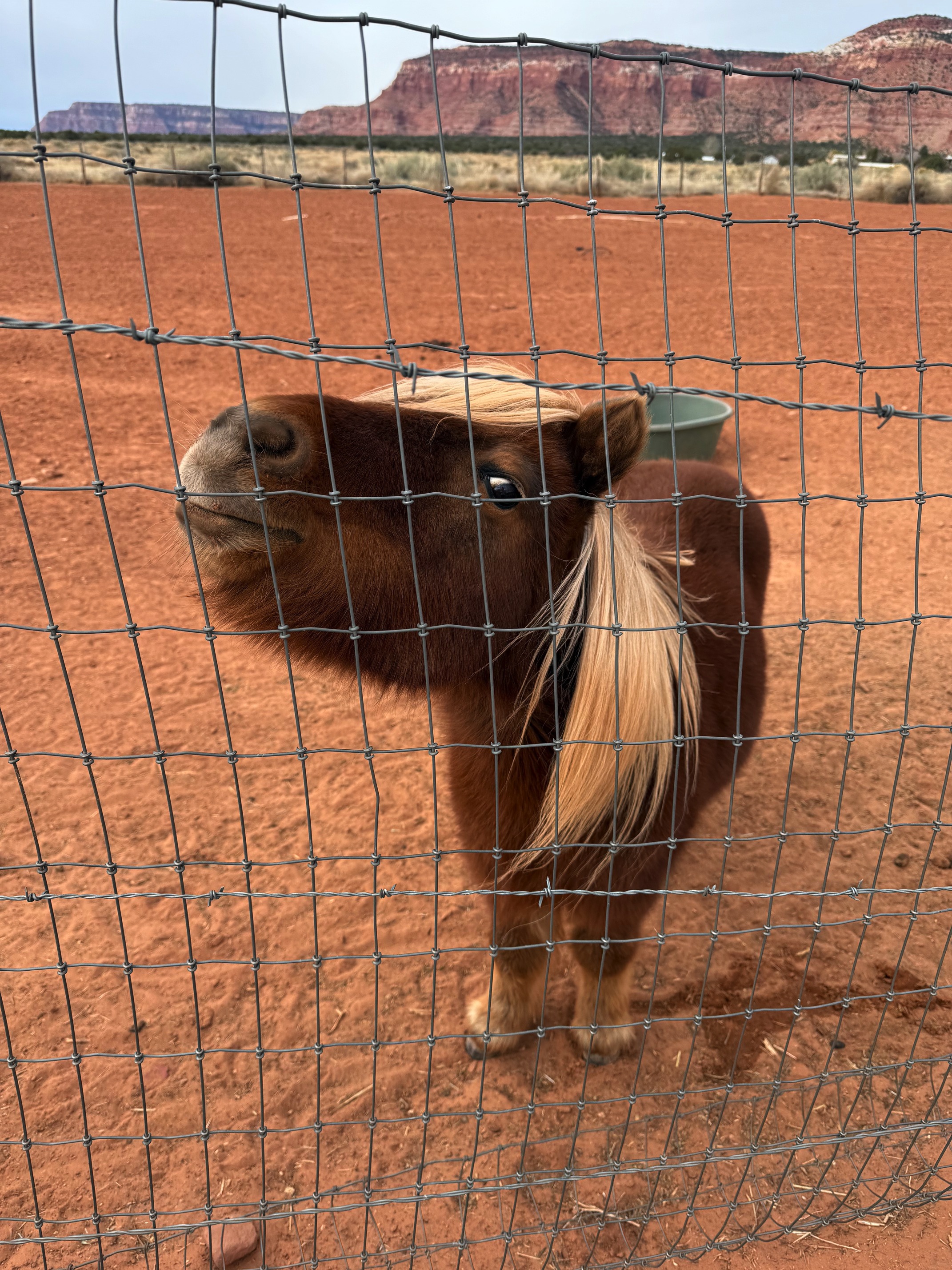
They were very welcoming and curious about me, or maybe they were just hungry. I’m not sure.
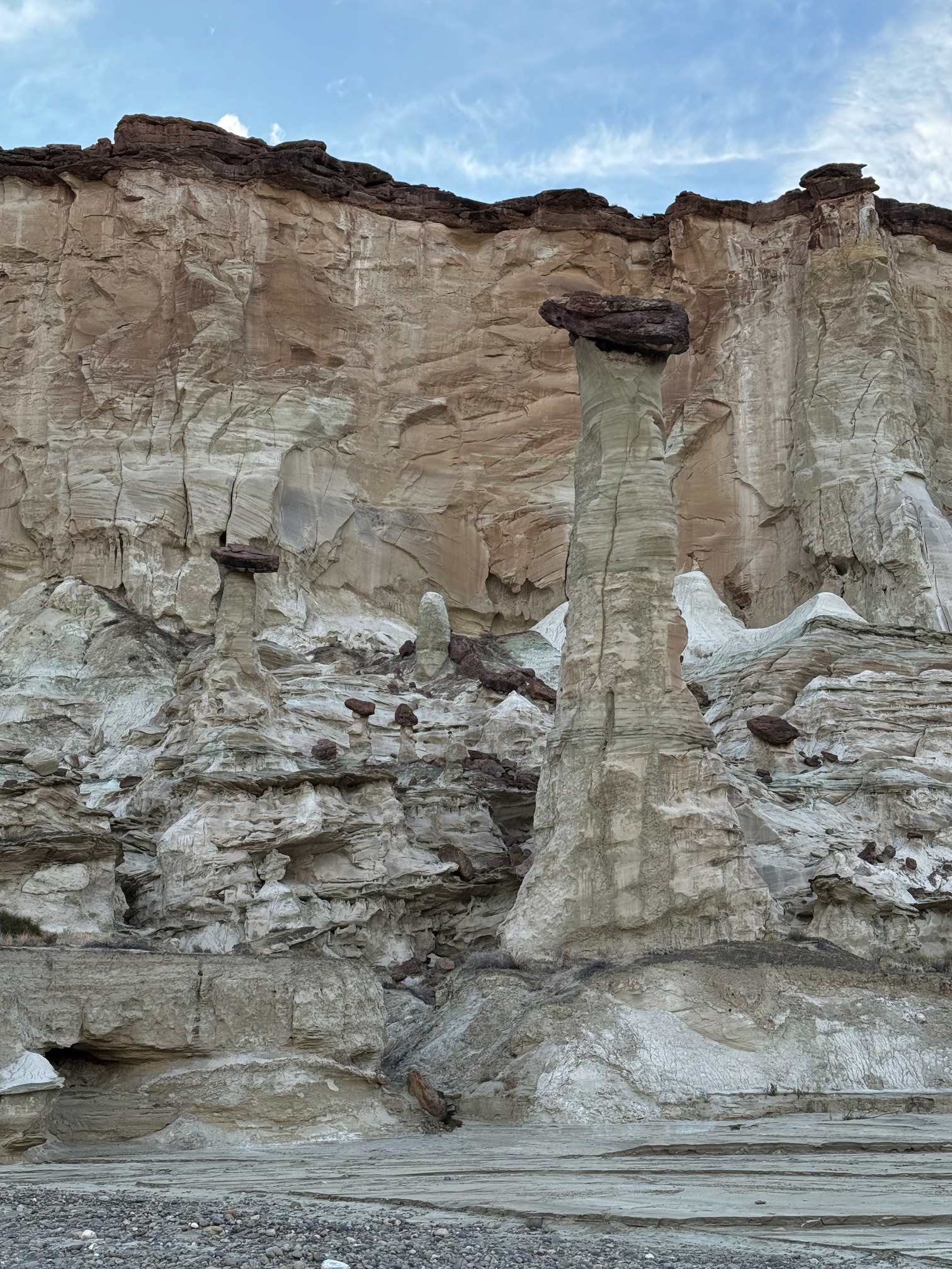
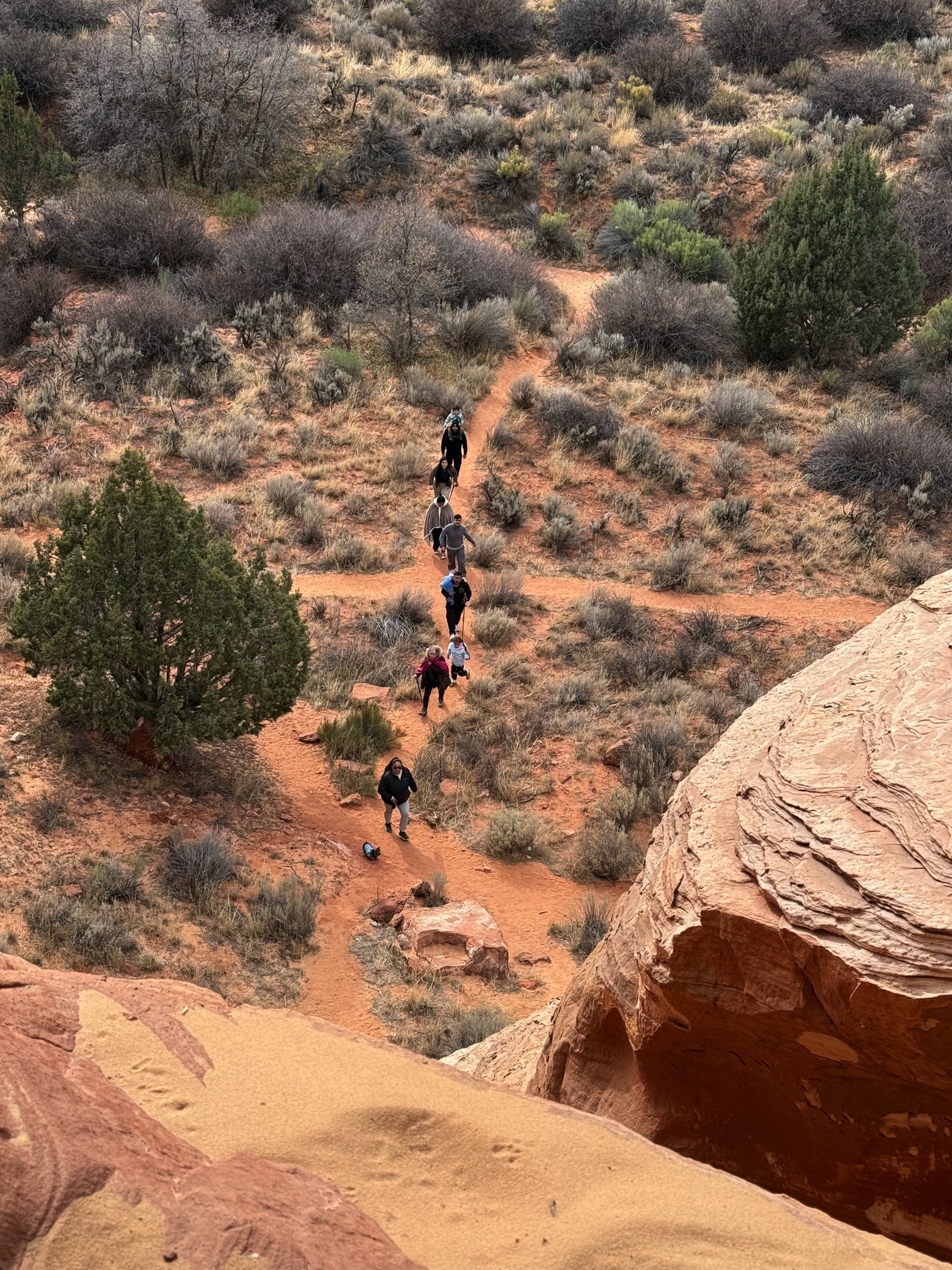
First stop: Sand Cave. Nicholas told me it was an easy short hike. Everything felt peaceful and fun until I realized I needed to climb a steep slope to reach the caves.
 Really can't see how steep it is from the picture
This was the place where the lie of "this is an easy hike" in Utah began. It’s such a lie that sometimes when I’m climbing up and down the rocks, I laugh at myself. So this is easy, huh? This trail where I could easily slip fall and die is easy, huh?
The view was totally worth it if you don’t think about how you’re going to get down from that place.
When I was standing on the edge of the cave, I looked down and saw someone hiking toward the caves. A man down there said she could fall and die. Yes, I’m deeply aware of that. Thanks for the heads up.
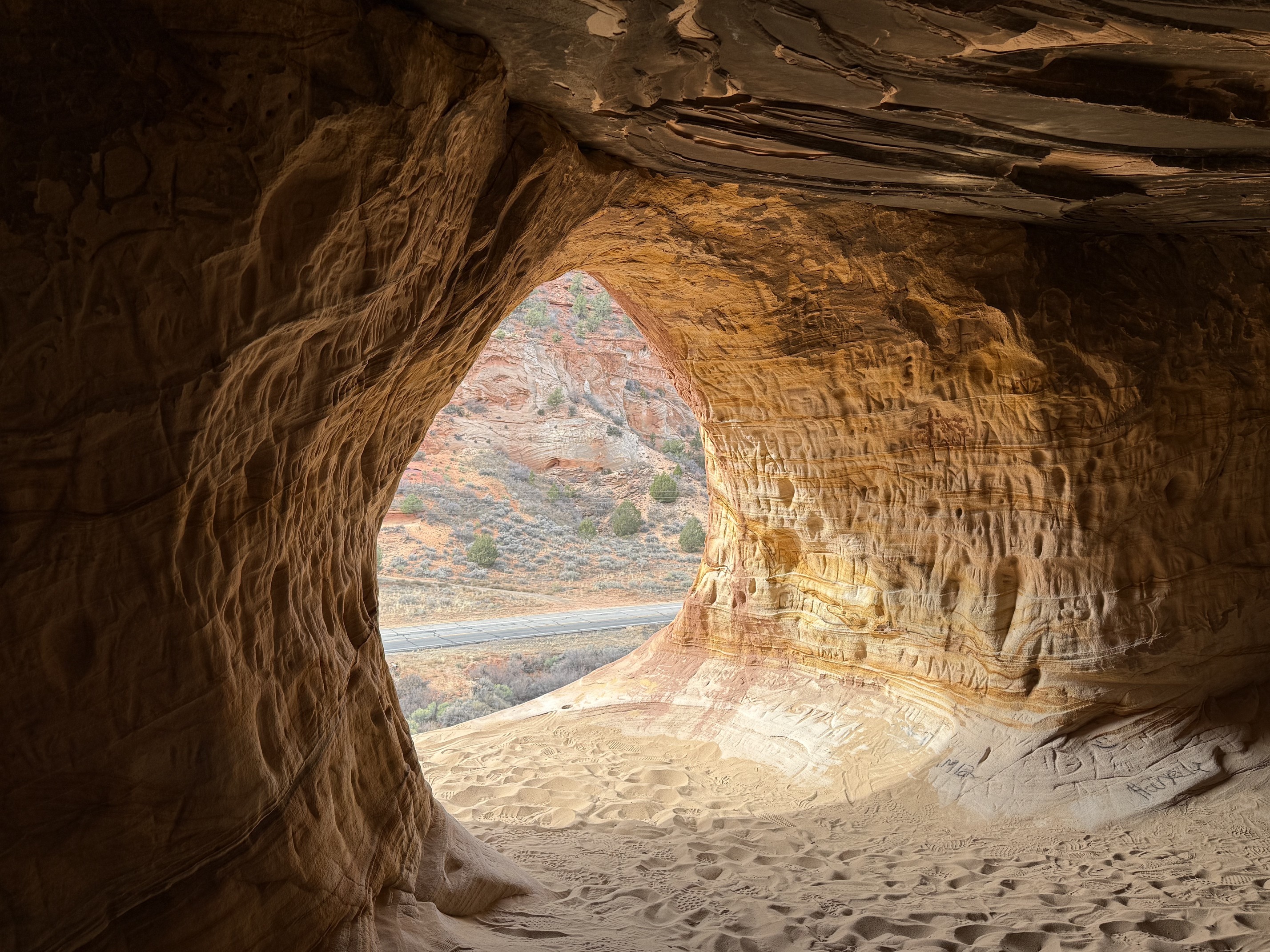
 Someone down there was reminding me
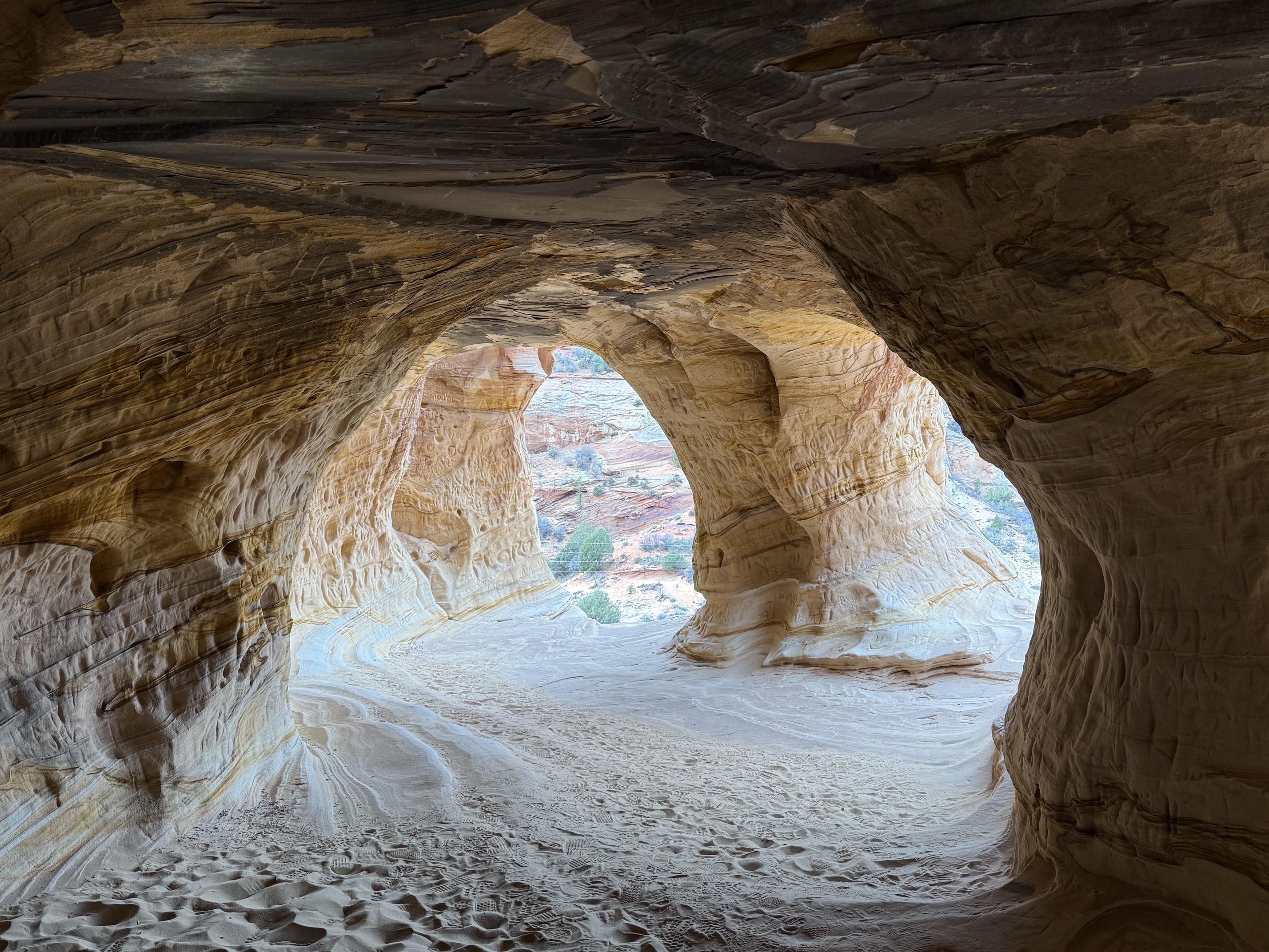
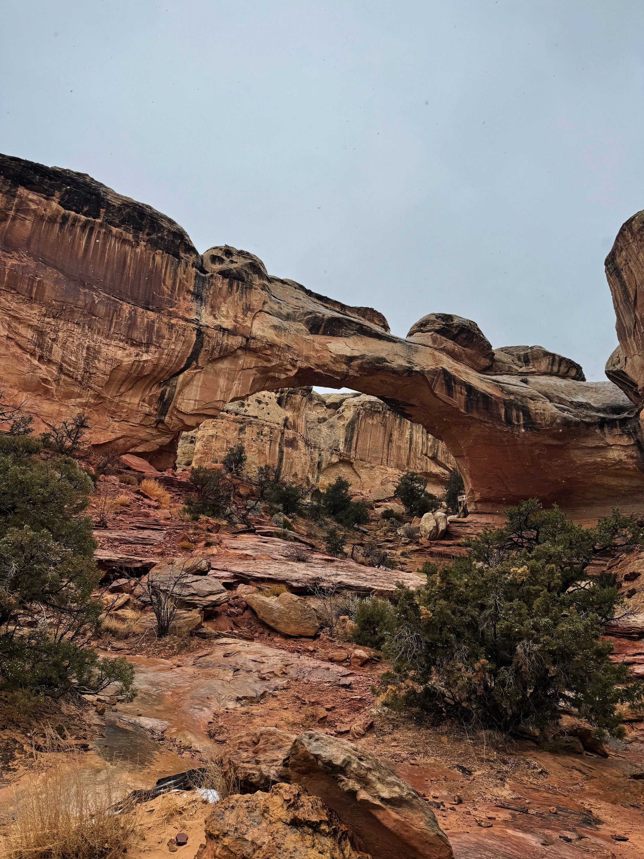
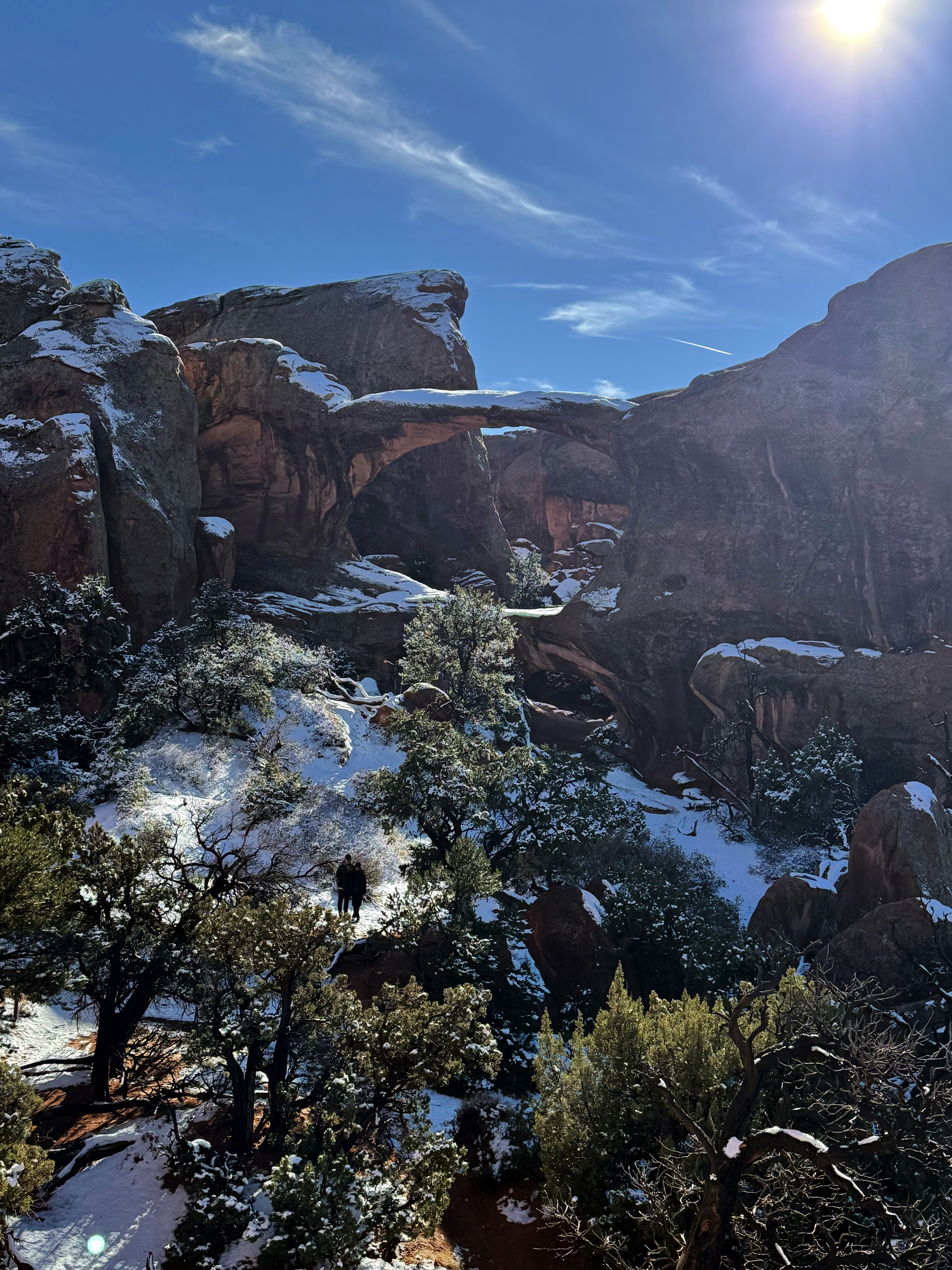
Next stop: The Belly of the Dragon. Not much to say, it’s a tunnel near the parking lot. It’s beautiful.
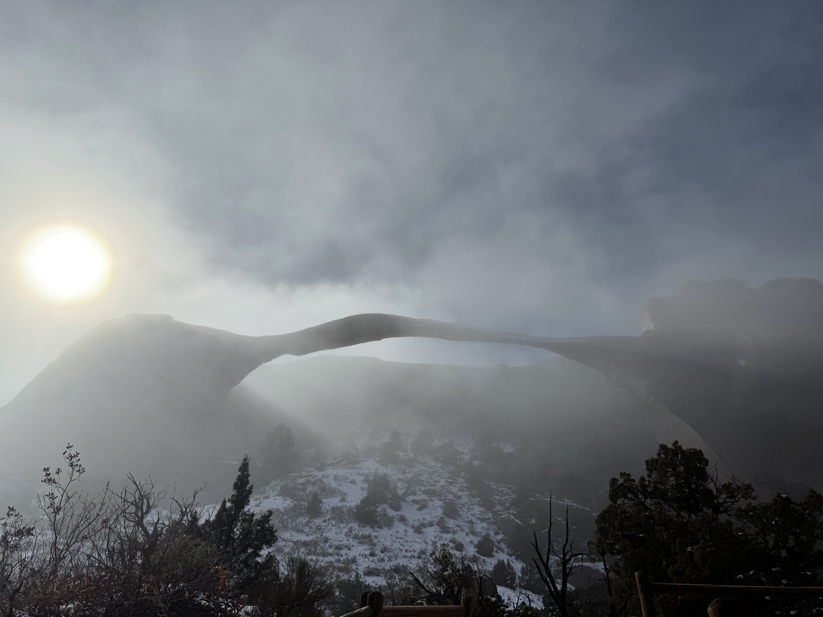
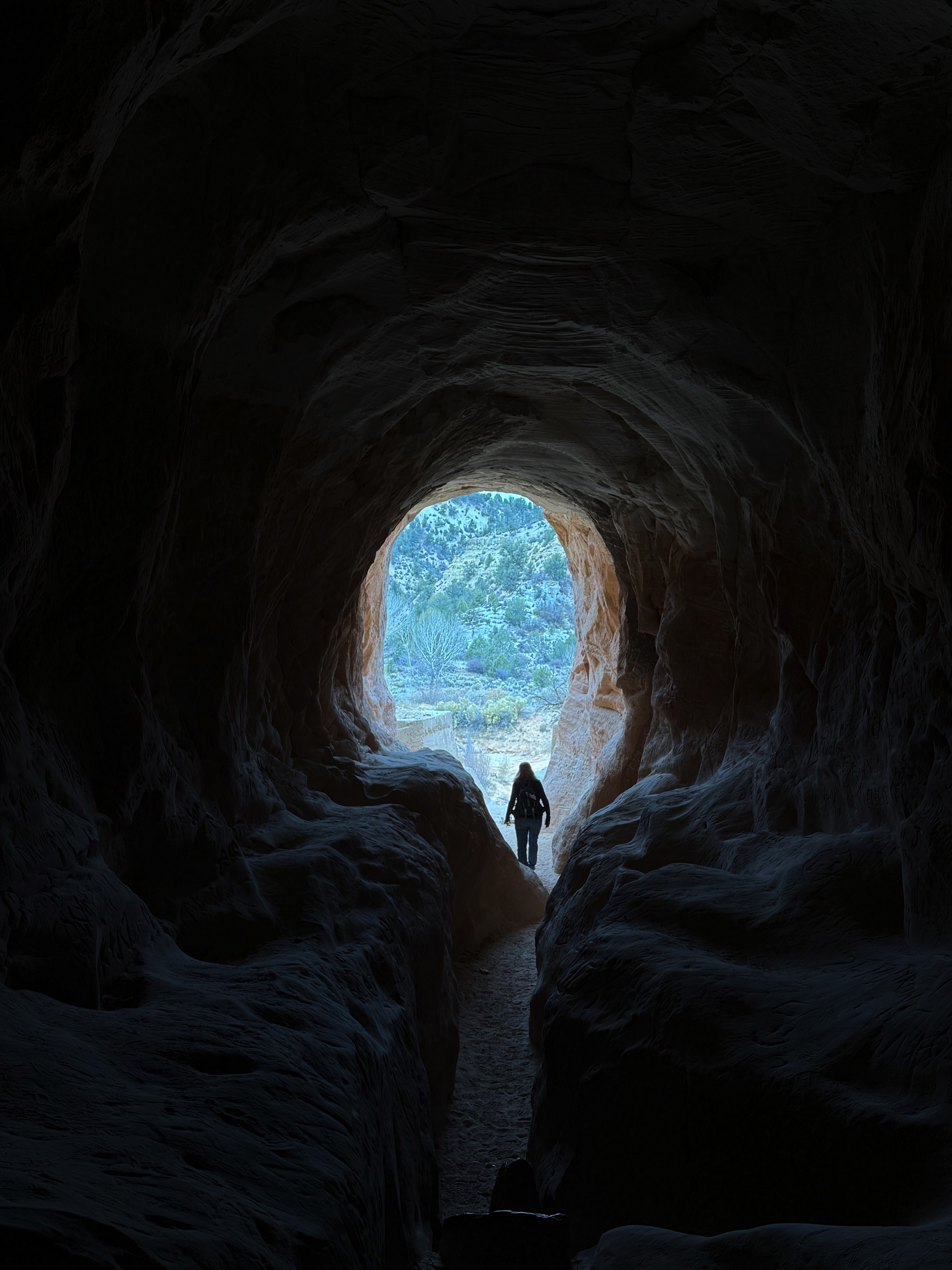 The tunnel you see with bare eyes is more golden
The weather worsened as I drove north. It started snowing. I decided to make a stop at Bryce Canyon National Park since there weren’t many options to choose from in that weather. I had been here before, and I still remembered everything when I came back. I’m not sure if this sign was here last time, but I love this pun.
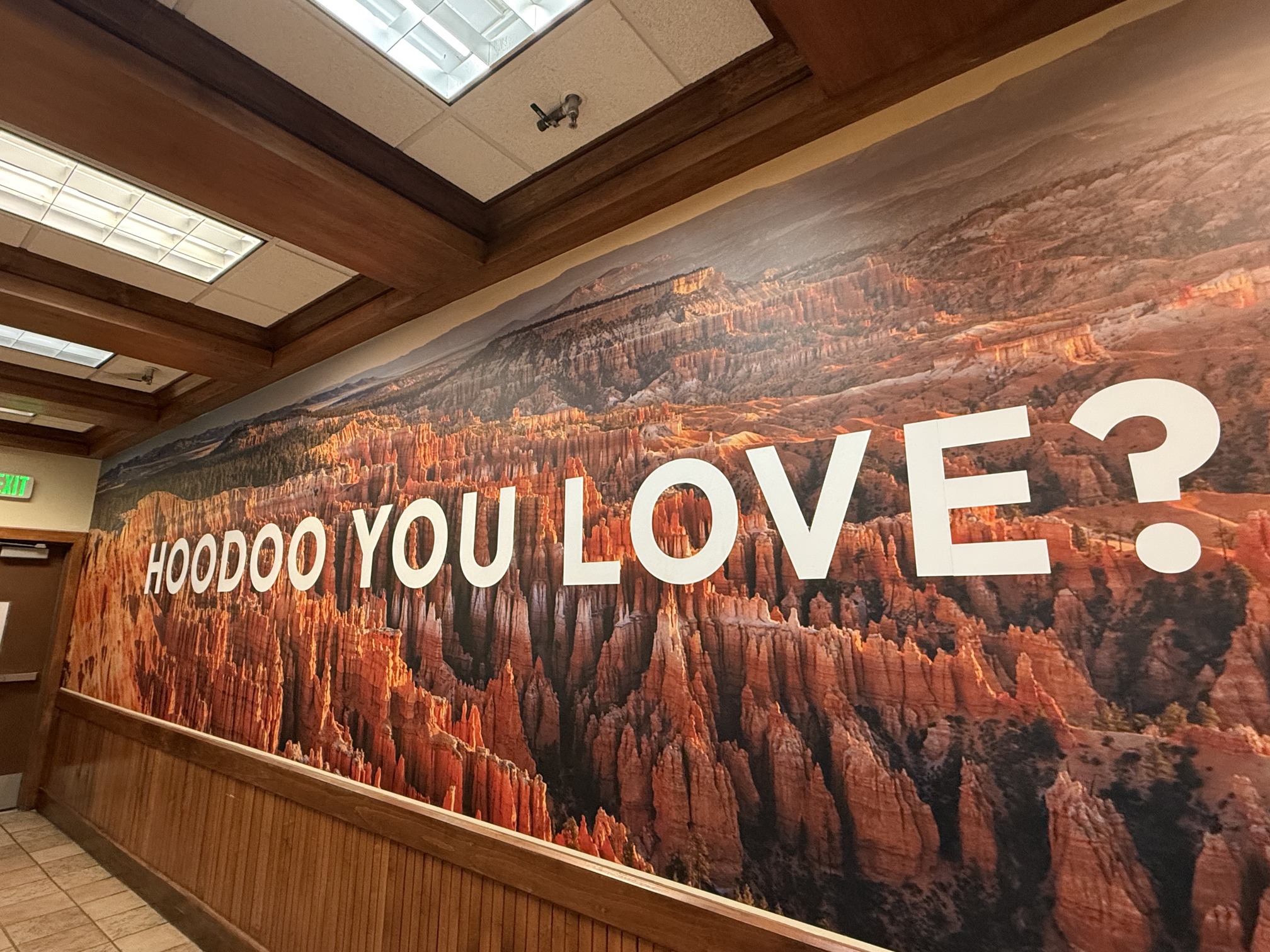 I love hoodoos
It’s beautiful when the weather is nice at Bryce Canyon, but it wasn’t so bad when it was snowing and foggy. I was so excited when I saw the snow. I’m always excited for snow. I really love when people use "crispy" to describe the weather, such an accurate word. The air was crispy, exactly how I like it.
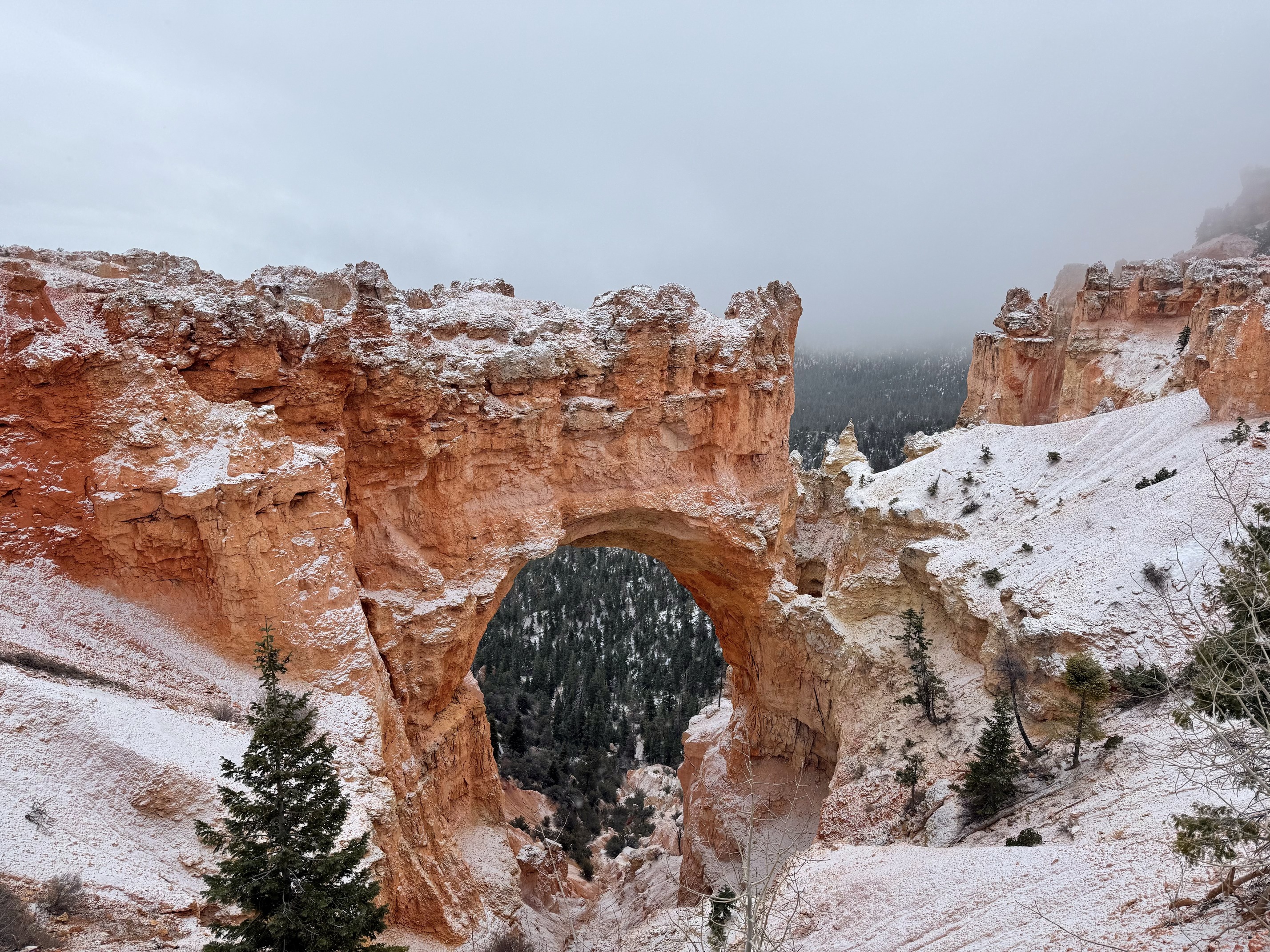 Natural Bridge in the snow
I wanted to go for the Mossy Cave Trail, but I was not in the mood because of the weather.
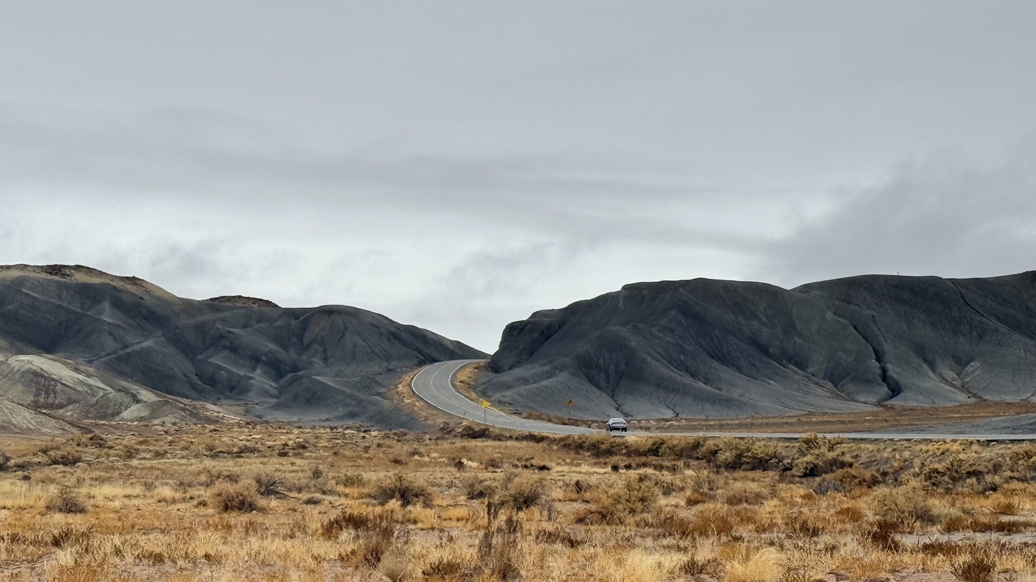
I made a quick stop at Escalante Petrified Forest State Park because I thought it might be similar to Petrified Forest National Park. It is not. There was no one at the park when I arrived. I think it’s more of a spot for picnics and water activities. The lake was half frozen, the weather was gloomy, and there was no point in waiting for the sunset.
Now I was ready for dinner. I was staying in Loa for the night, which is a small town. It was a Tuesday, so I figured I’d have more choices in Torrey. I picked a place from the map and started driving along Highway 12. This is a scenic drive, but the view after Escalante wasn’t very surprising, and it was getting dark. The drive after Escalante became more difficult, with more turns as I drove through the mountains. Especially when I was climbing up, the altitude gain caused snow to accumulate and form a layer of thin ice on the road. That was tricky to deal with.
 Giving way to my friends in the forest
The dinner place I went to was closed. It was in a campground, and I think the campground had closed for the season. Then I tried a Mexican restaurant, but that was closed too. I learned my lesson and started calling them before I went anywhere. Finally I was able to find a place.
There was only one waitress working, and it was rush hour. She was working nonstop, but since this seemed to be the only place open in town besides fast food, I couldn’t complain. A white, middle-aged man gave her a hard time, even though his wife tried to stop him. Afterward, everyone around started talking to the waitress, thanking her for her hard work and consoling her. I made sure to say thank you too. On a Tuesday during Thanksgiving week in a small town, I was very grateful to have a decent meal.
It ain’t the end of the day. I made a risky decision to stay in a trailer at an RV park that night. I was just too curious.
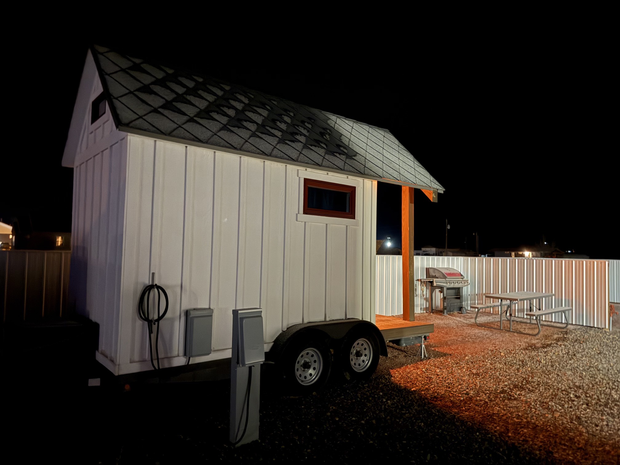
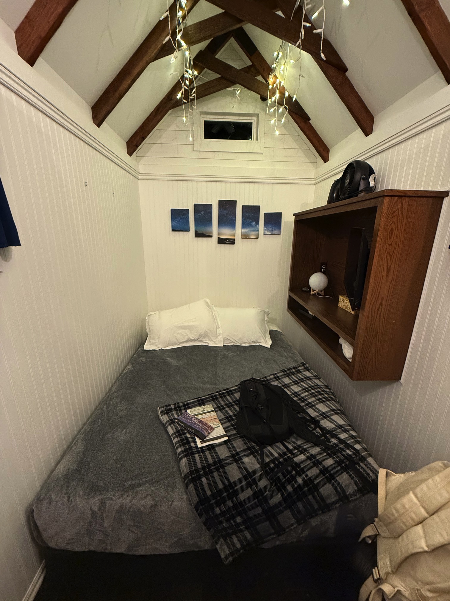
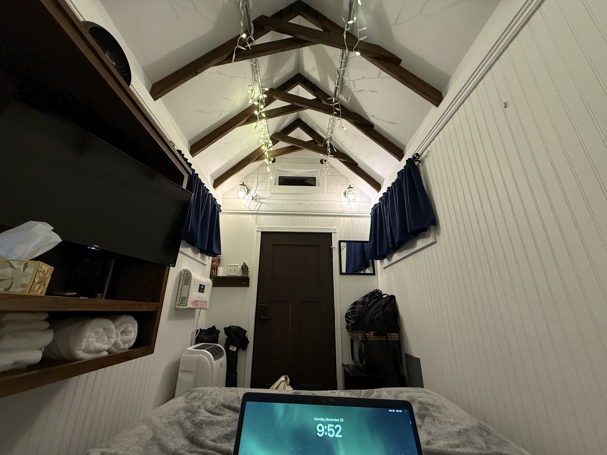
The trailer had everything, very thoughtful. My host even turned on the heater for me ahead of time. The bathrooms and laundry rooms were outside, and they were very clean as well.
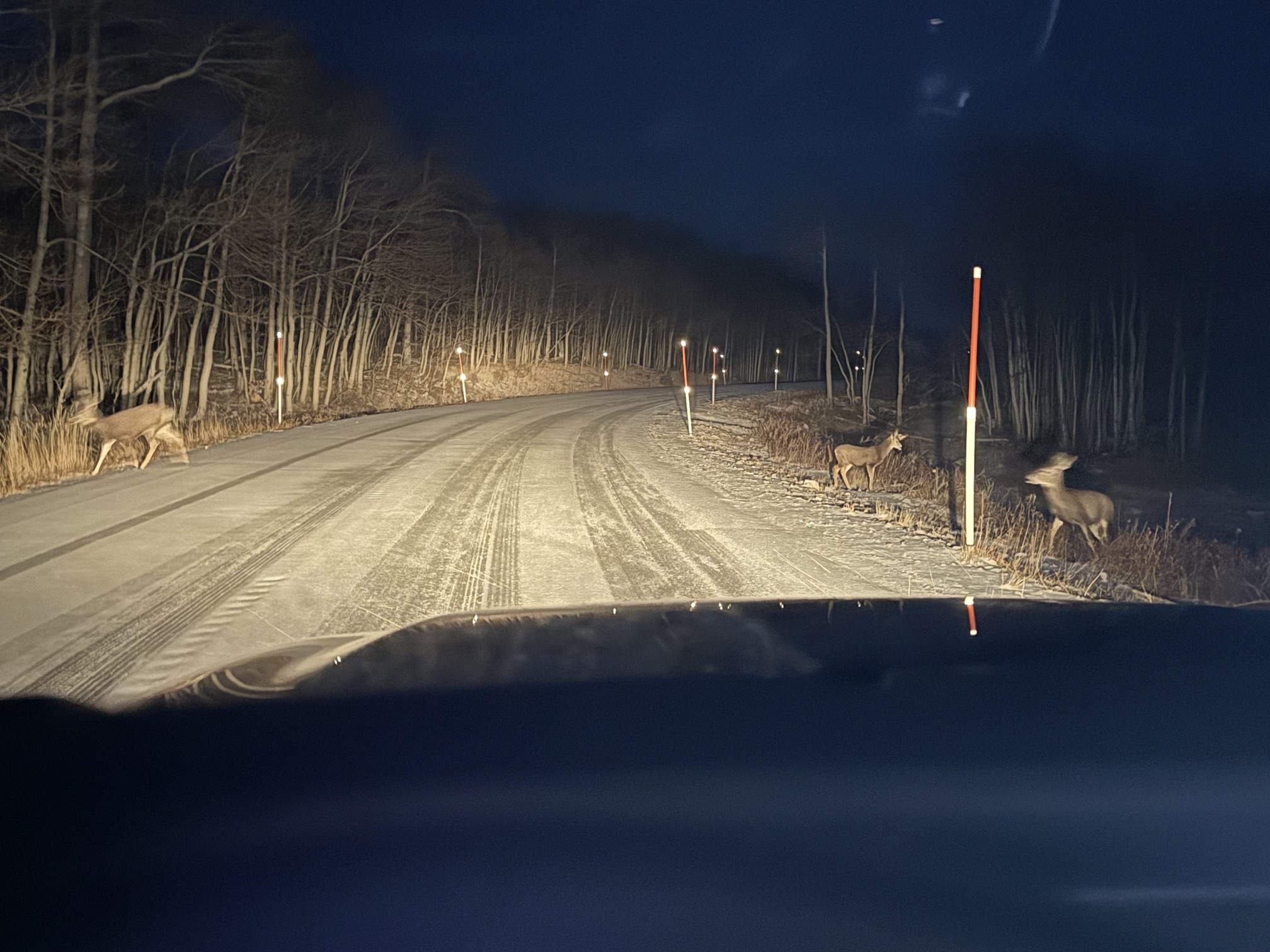
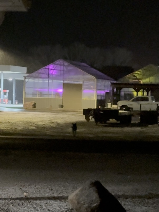
Later I stepped outside to use the bathroom and saw some animal across the street, which I thought was a dog at the time. Now, looking at the picture, I’m pretty sure it was a coyote. I don't know why I just can't stop laughing at myself. Of all the choices I had, I decided to stay in a trailer, step out in freezing weather to brush my teeth while it was snowing, with a coyote staring at me. I don’t regret the decision, but maybe next time, I shouldn’t be as curious.
Day 4 Capitol Reef NP in Snow
 Simple day plan
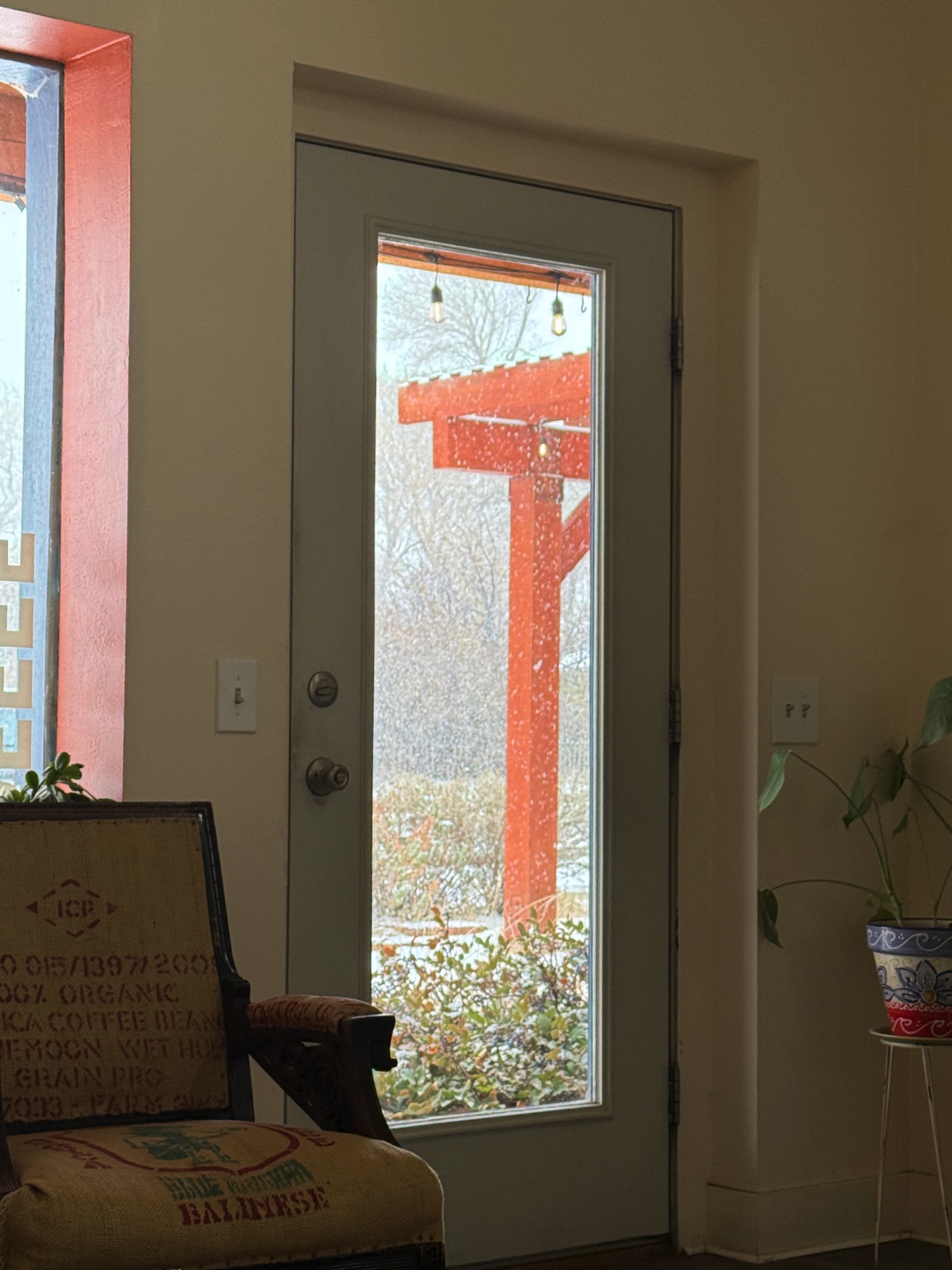
Still snowing. So there went my plan of going off-road. In this awful weather, I desperately needed a cup of hot coffee. I found a spot on the map and called ahead to make sure they were open.
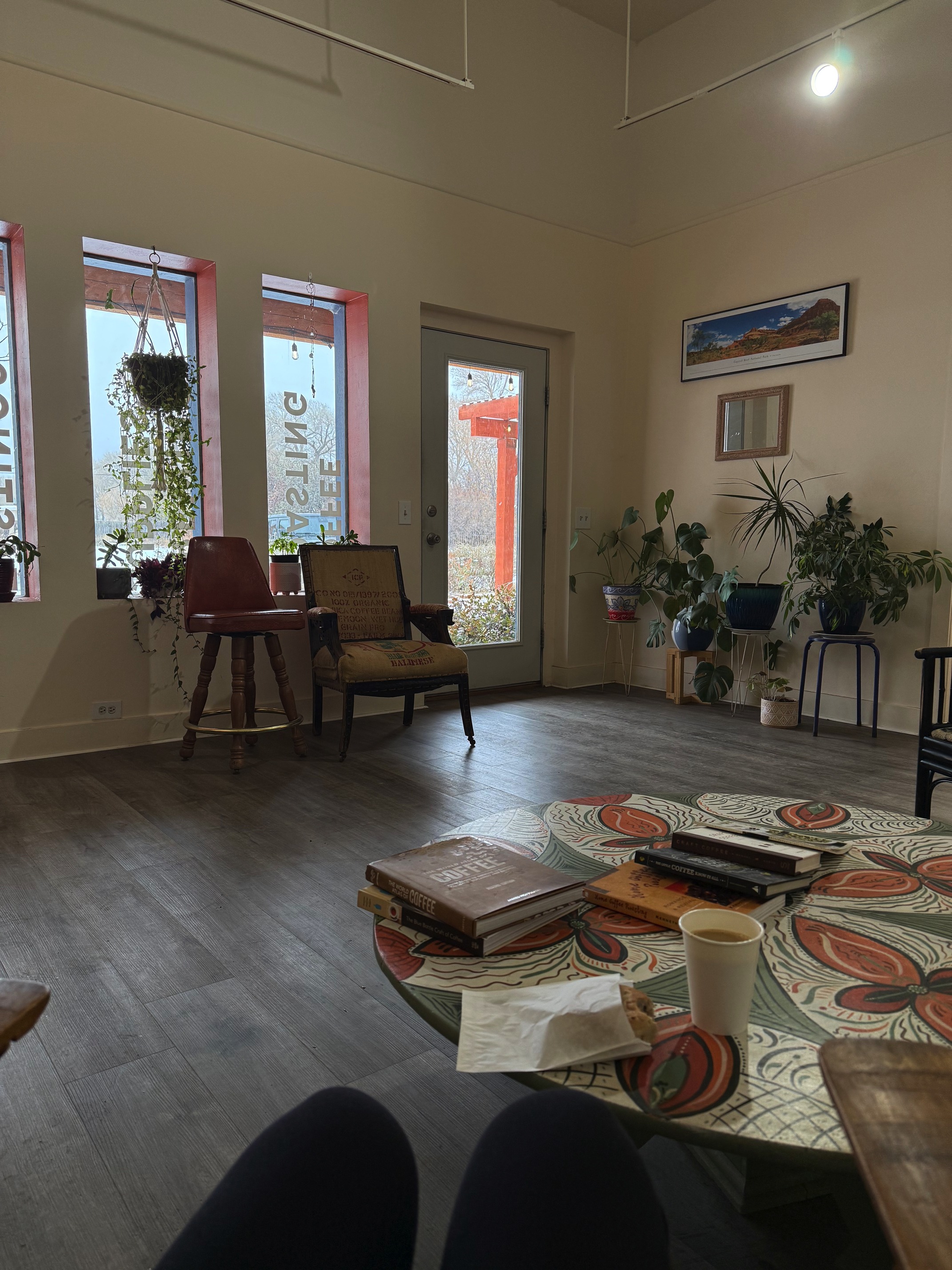 Inside the coffee shop
It was a lovely coffee shop, and while I was there, I met a Korean couple. The owner proudly mentioned that they were the only coffee place open for the season, and they also had an ice cream shop that was still running. I love it that in freezing weather, with all the other shops, restaurants and campgrounds closed for the season, the ice cream shop was still standing strong.
 I think Christmas is here don't you
I met a black stray cat outside the coffee shop. I’m not sure if that’s a sign of luck or not.
Went to fill my tank before hitting the road. I could barely stand outside with my jacket on but look at this guy.
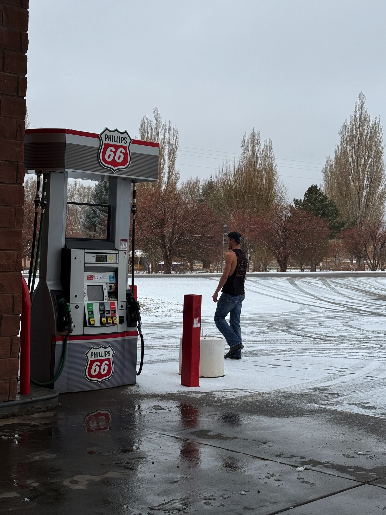 I'd believe you if you say he's from another planet
Given the weather, I had to give up all my other plans, which left me with enough time to explore Capitol Reef National Park.
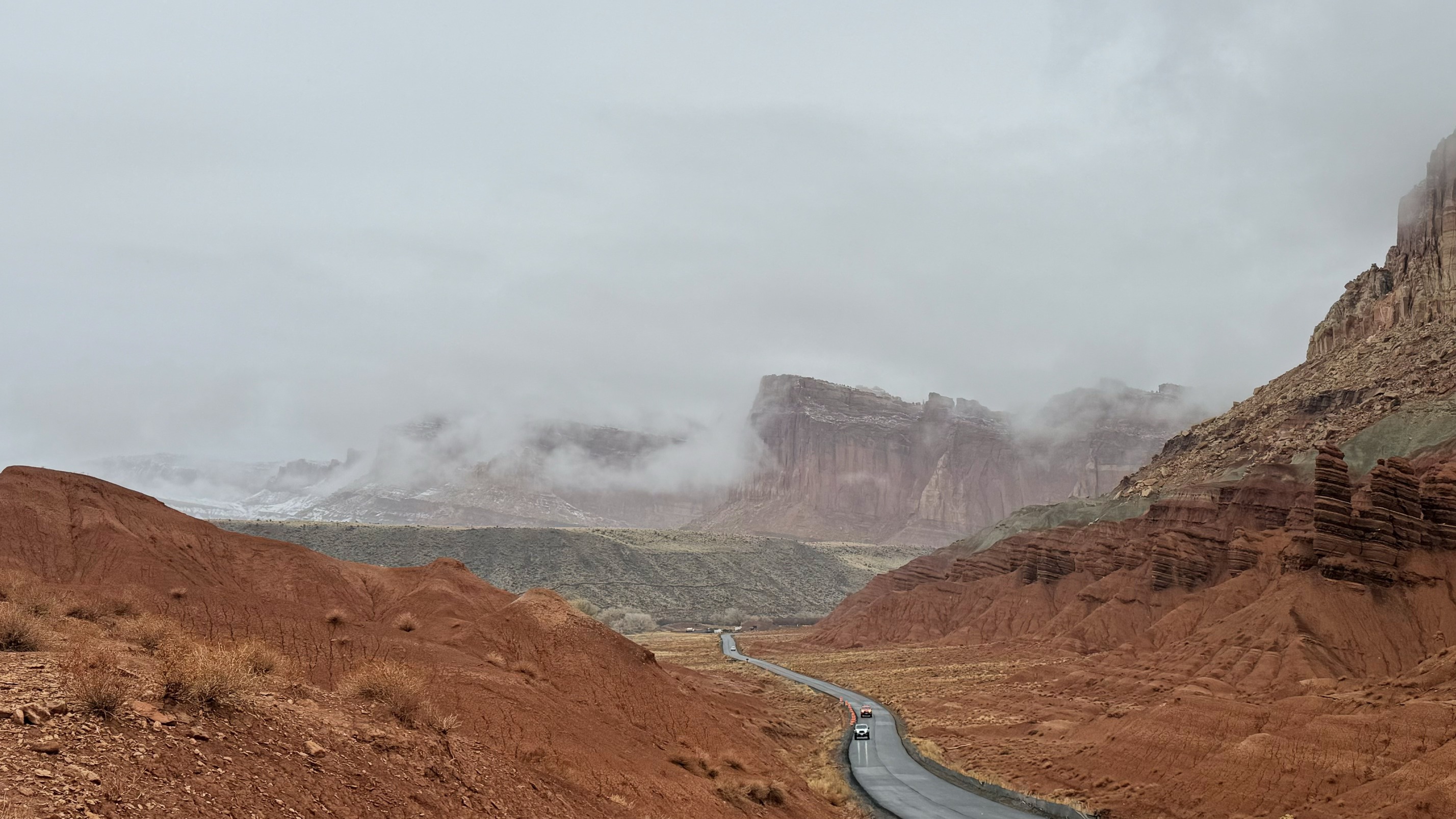
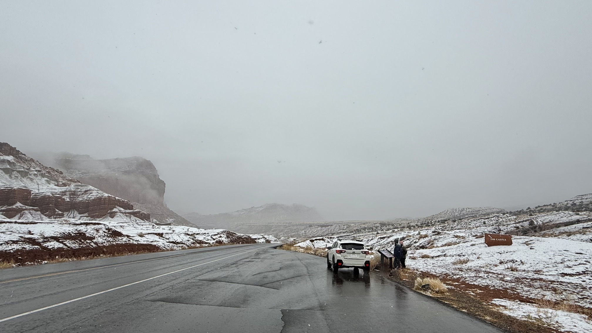 Inside the national park. I don't see the castle
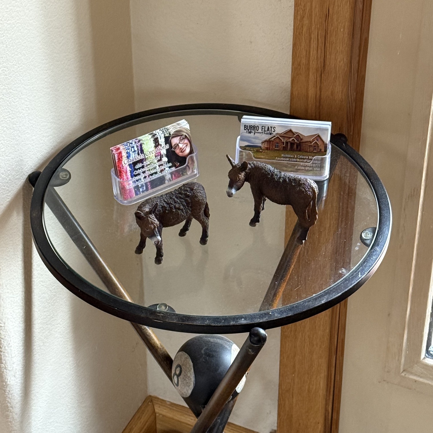
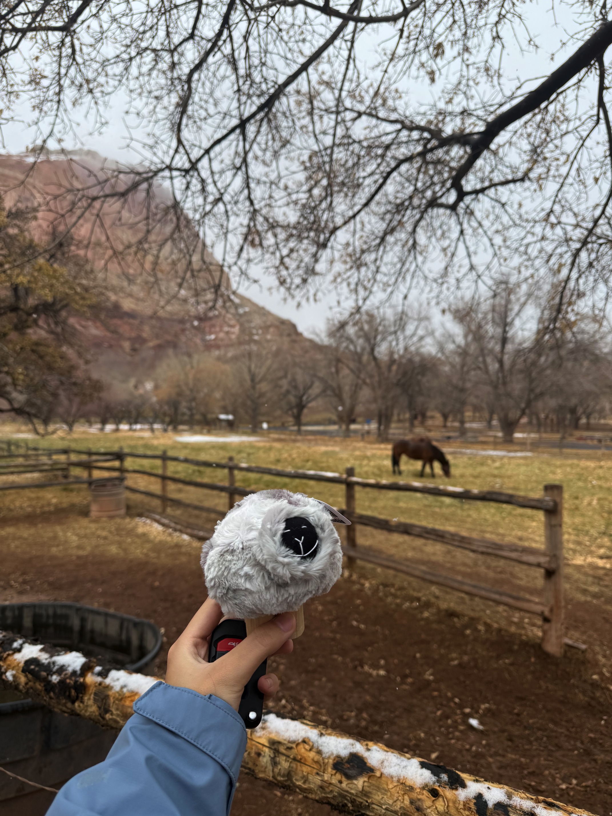 Bought a silly sheep at Gifford Homestead
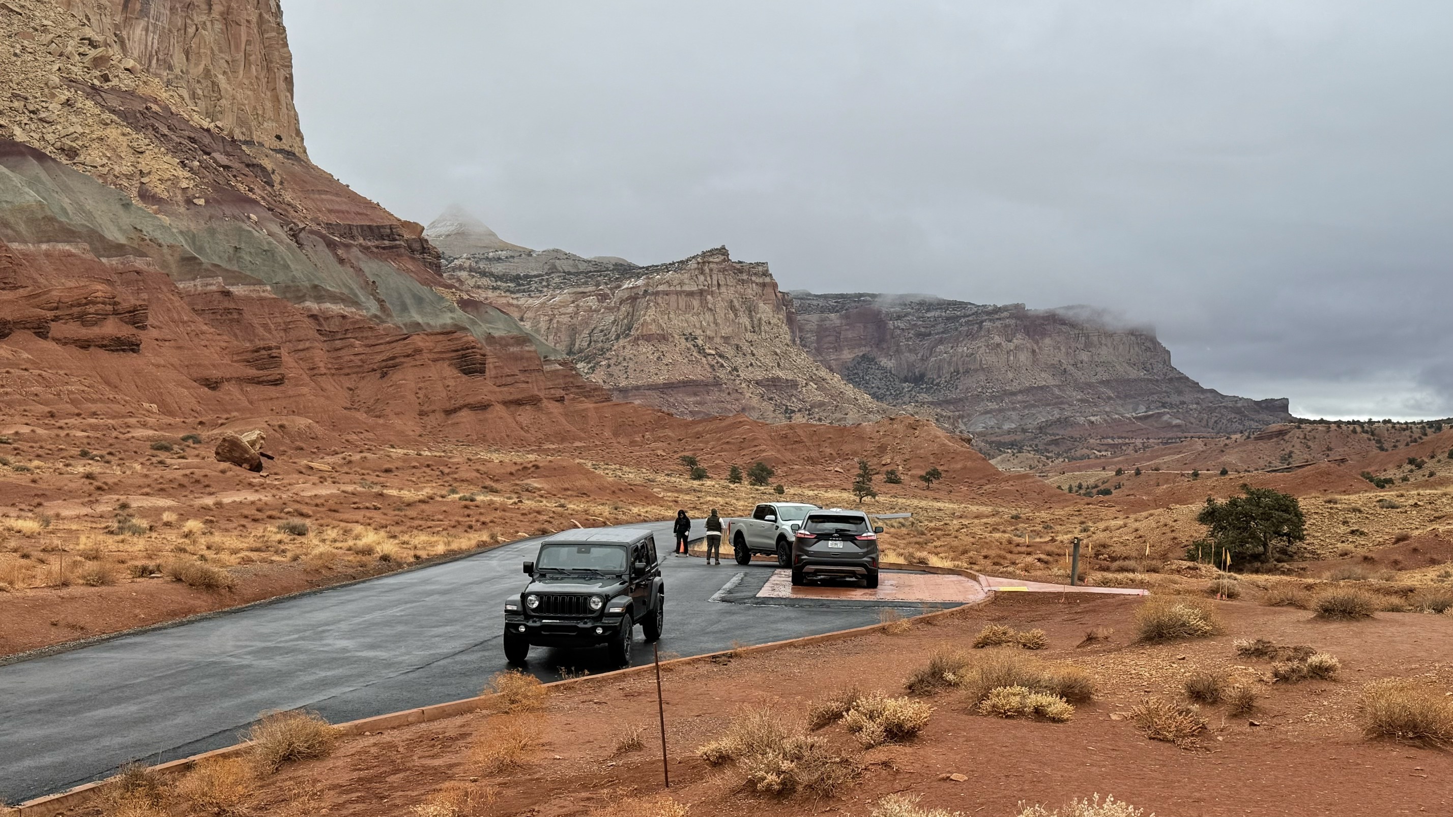
I went for the scenic drive in the park, but you can't really go far since most of the road was closed. So I made a turn at Grand Wash. It couldn’t hurt to drive a little more. On my way back, I saw the red rock slowly unveiling from the fog, stunning.
I also hiked the Hickman Bridge Trail. I have no idea why I thought it would be easy with just a 50m elevation gain. I questioned myself constantly as I climbed over rocks using both hands. There was no trail at all, just rocks, endless rocks. That's how I went the wrong way several times and ended up at a cliff again wondering: where is this bridge?
The hike wasn’t long, but I took at least a one-mile detour to get back on track. Normally, I have a great sense of direction, but I don’t know what Utah did to me. Thankfully Google Maps’ location was pretty accurate so I had some reference. I’m starting to think that a subscription to AllTrails might be worth it.
 Hickman Bridge
The first thing I did when I got back to my car was check the national park map to see how they described this trail. They called it moderate. Okay, so they are not completely insane.
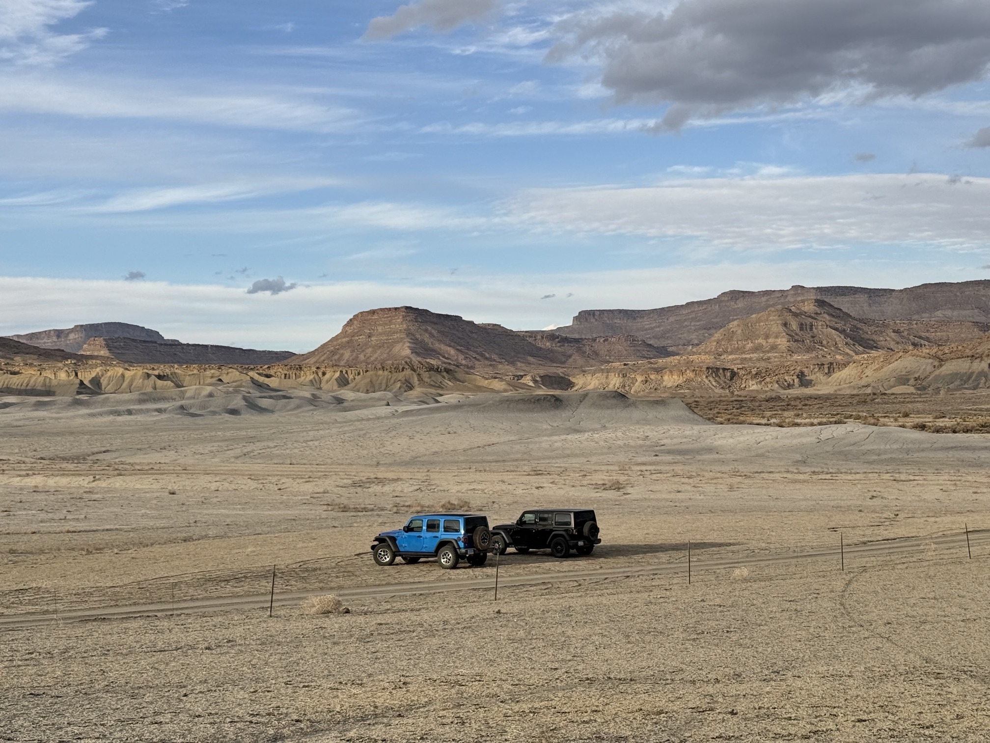
My original plan was to check out Factory Butte, Moon Overlook Point, and Long Dong Silver, all of which require off-road driving. I felt bad about having to skip them, but it was the right thing to do. As I was driving out of Capitol Reef National Park, I took a sharp turn and saw this moon-like terrain stretching in front of me. I noticed a cameraman pulling over and hiking uphill with his gear to find the perfect angle. I joined him. I stopped to snap a quick picture. I didn’t dare to go too far.
 A random pull out point
Moon Overlook Point feels like the standard spot for a classic shot—an easy, expected view anyone can capture. But this, this is what you see while driving, a complete surprise. Views like this are everywhere, you just need to see it with your eyes. I know Moon Overlook is beautiful, but now I don’t feel the need to go there. The shock of this kind of view, how it suddenly appears, and before you know it, you joined the mountains. I was driving among them, it felt like a dream. A single well-staged photo means nothing. This feeling means everything.
I made a few more stops at random pull-out points. They weren’t really pull-out points, just tire marks left by other cars by the side of the road. It was a very risky move because the roads were muddy, soft, and slippery. At one point, I almost got trapped. Don’t copy this! I would love to admire the mountains and rocks, go off-road as much as I can, and explore everywhere on a sunny day. But you don’t meet a snowy day with black mountains covered in snow, stripes of smoke hanging halfway up the mountain every day. Different weather has its own beauty.
Factory Butte can be seen not far from the main road. When I was there, I noticed the dirt road was mostly covered in gravel. I thought going a little further wouldn’t hurt.
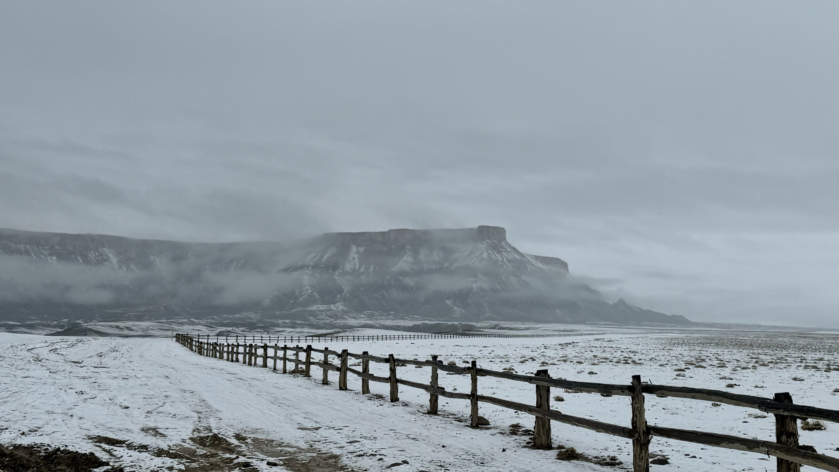
The road condition was pretty bad. I could feel it the moment I stepped out of the car. I couldn’t stay much longer or drive any further, as it would only get worse. Time to head to my stay for the night in Moab.
The drive there was awful. I had to drive through heavy snow for the first half, then heavy rain as I headed south. It was only around 3:30 pm when I arrived at my inn, but I was already exhausted.
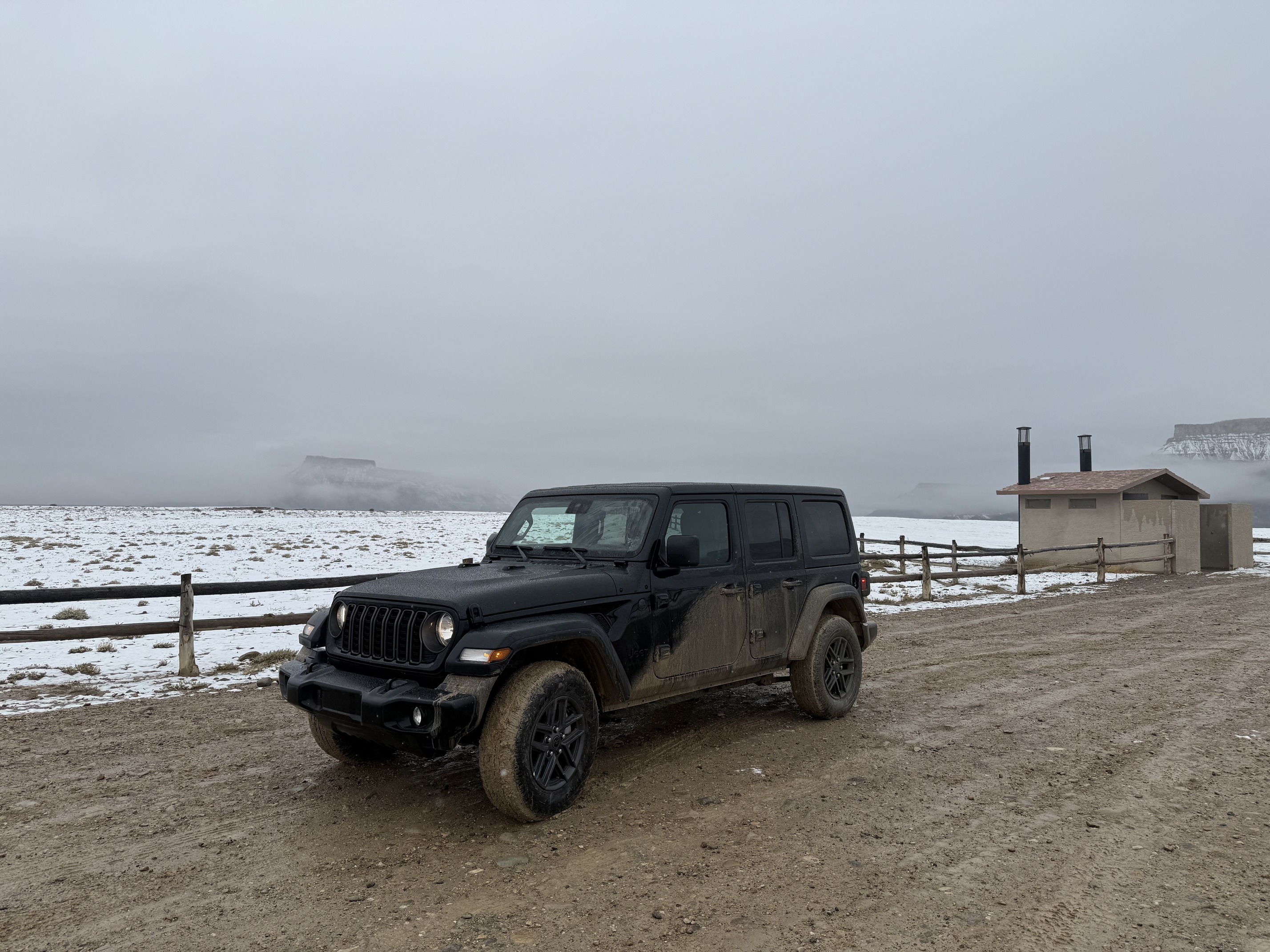
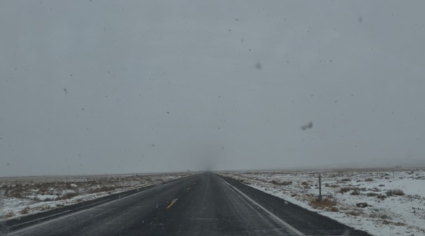 Drove in this condition for at least an hour
The inn was super nice. I love Moab. Moab feels like a utopia for outdoorsy people. I went to a Mediterranean place for dinner, and OH MY GOD, their food was amazing. Or maybe it was just me starving. Everything I had reminded me of my days in Turkey. And their baklava is everything!
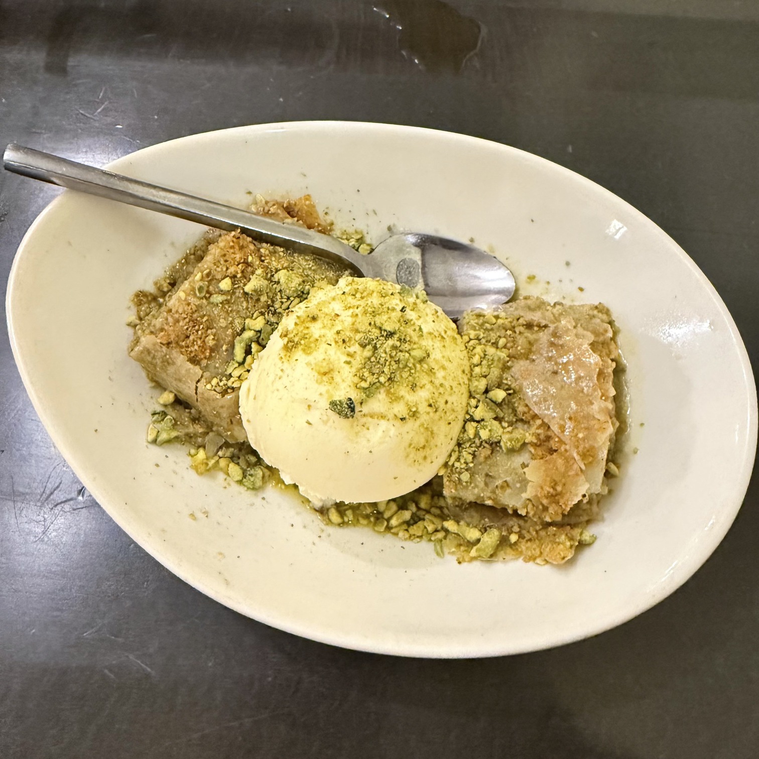 THE baklava
Day 5 Arches National Park
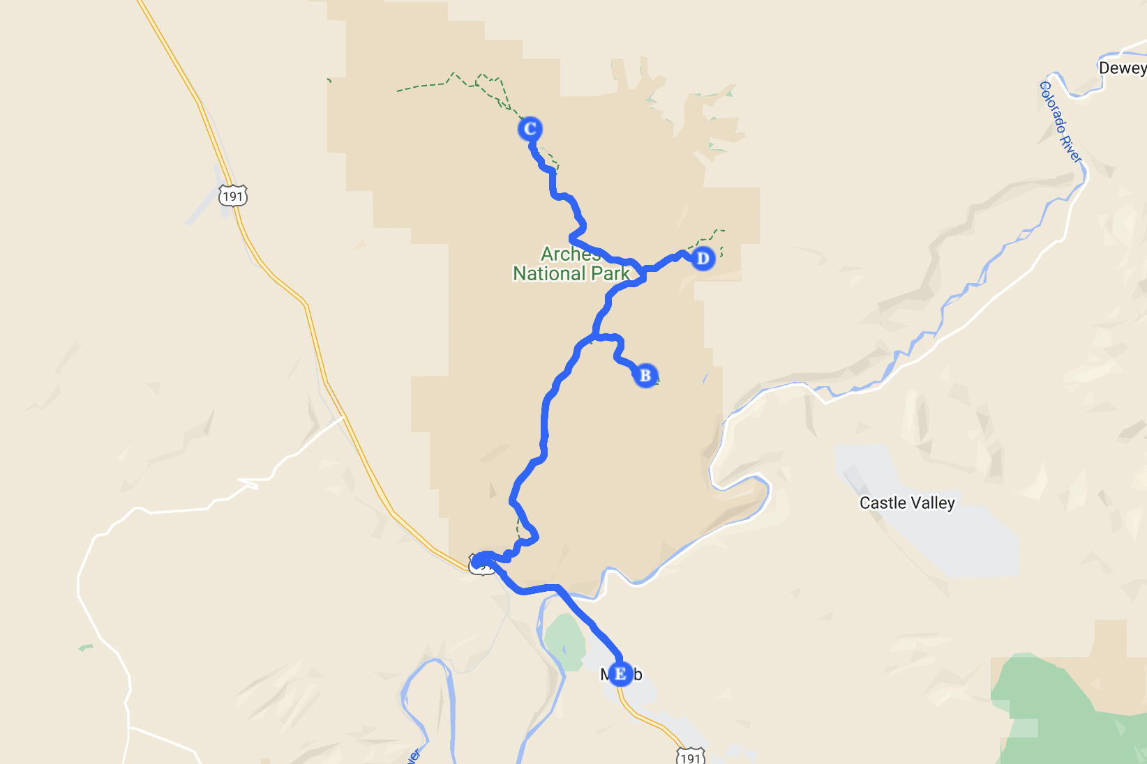 Arches NP day
I'm back on the trails! Spent the whole day at Arches National Park, no need to drive far. Started my day with coffee and breakfast at a local café.
 I don't know what they put in this sandwich but it was too good to be true
Started with the Double Arch Trail. It was a flat, easy hike. Double Arch gave me vibes of Yellowstone, with so many people there just for the picture.
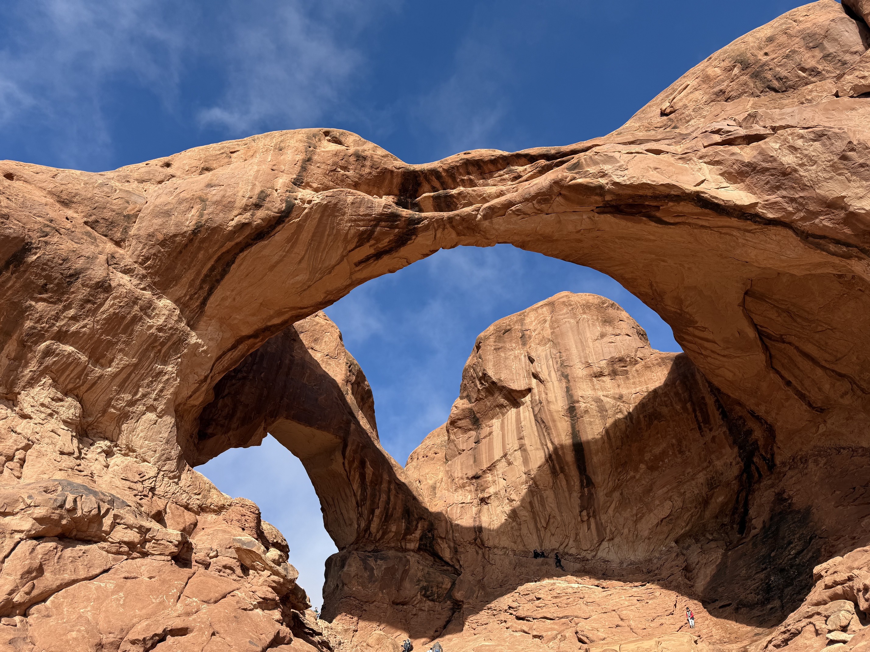 Double arch
I ran into the Korean couple again at Turret Arch. They had been at Capitol Reef the day before, stayed in Moab, and were visiting Arches that day. It felt nice to see familiar faces in a place that was completely unfamiliar to me. And we happened to share the same itinerary!
I had only planned to visit Landscape Arch and wasn’t planning to go any further. However, when I saw the recommended hiking time and realized the distance wasn’t too long, I decided to go for Double O Arch as well. I figured I could still make it back to Delicate Arch in time for sunset.
It was foggy when I started the hike. The trail to Landscape Arch was flat and easy. While I was taking pictures with my film camera, a family was standing next to me. Their young son tried to say something, but his mom gently shushed him saying, "She’s doing her thing."
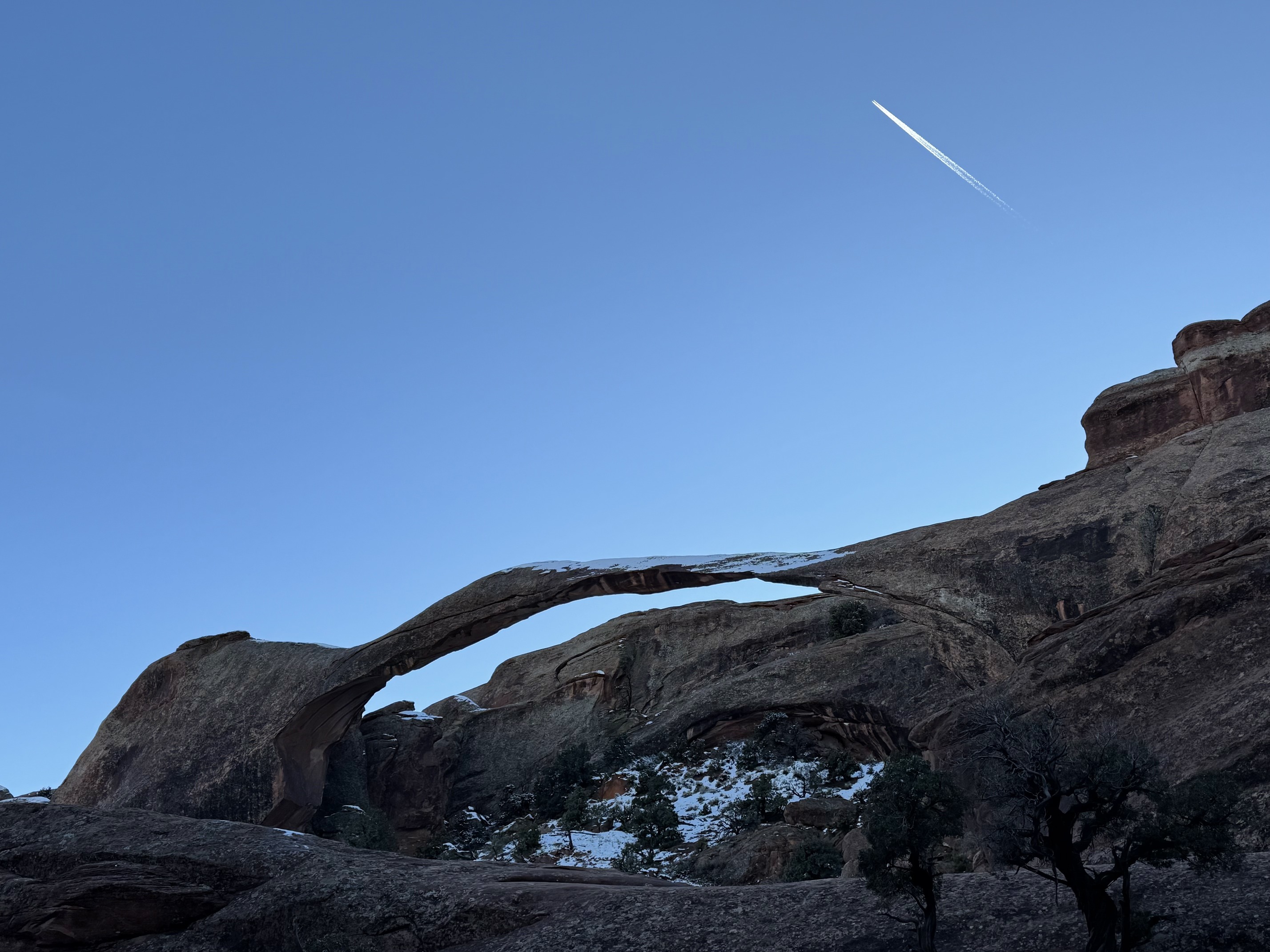
 Landscape Arch
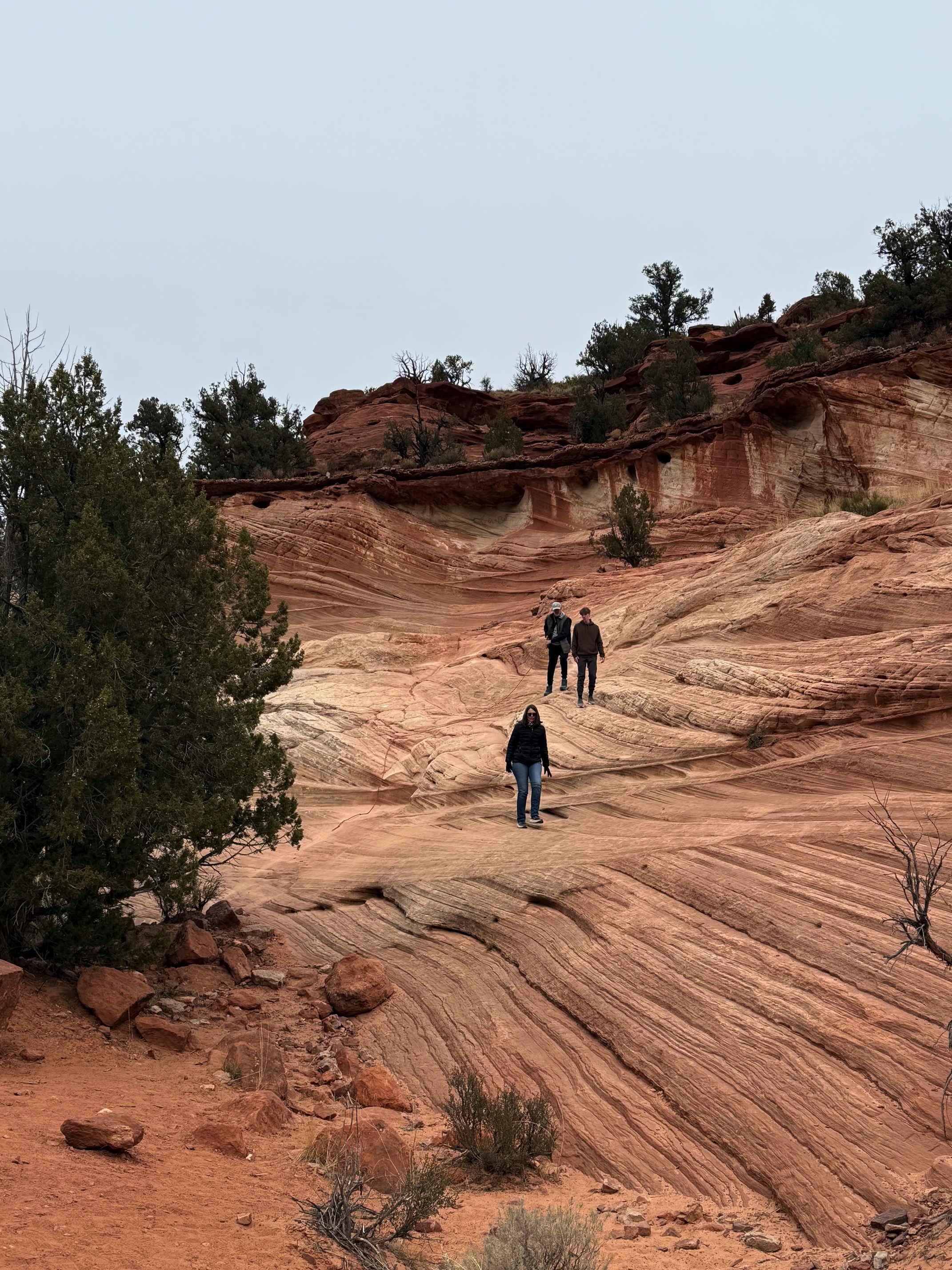
The hike to Double O Arch from there was 1.1 miles one way. However, the first challenge I faced was a massive rock I had to climb. It wasn’t until I heard kids laughing from the top that I thought to myself, If kids can do it, I can too.
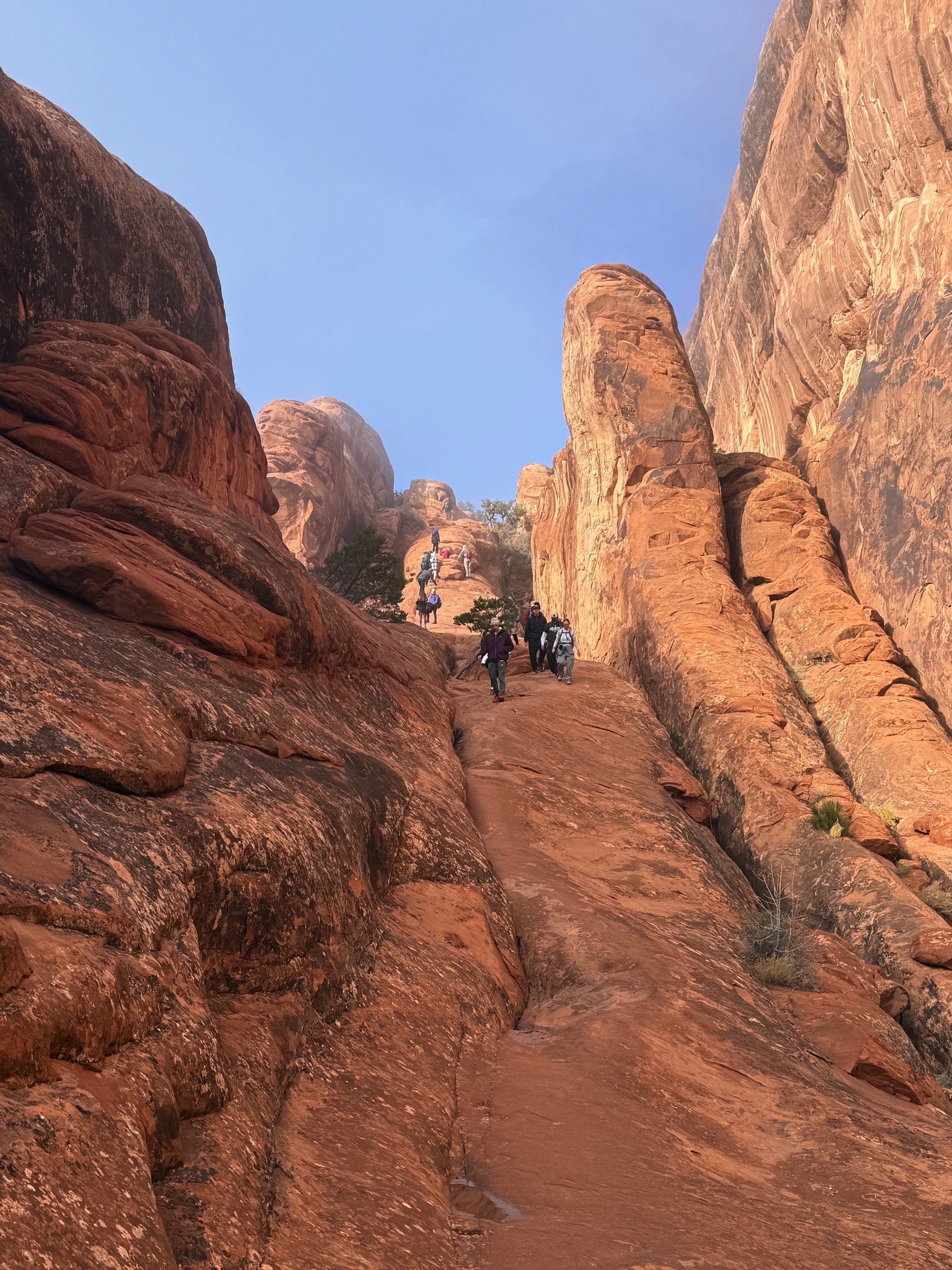 The rock I had to climb
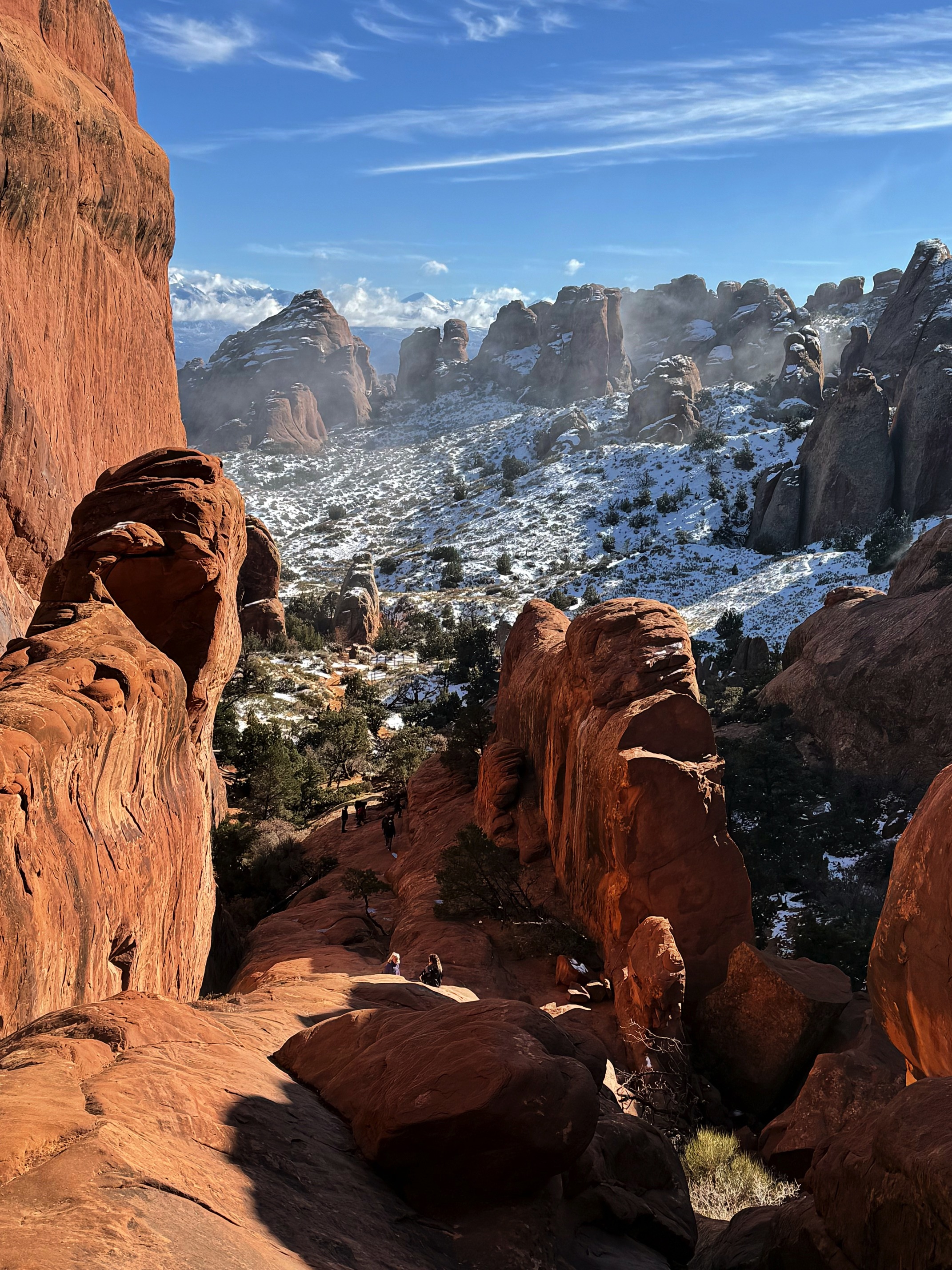 Looking down from the top of that rock
On my way to Double O Arch, I stepped aside to let a few guys pass who were heading in the opposite direction. Since we were walking on rocks with no clear trail, they found a way around where I was standing. I commented: I see no trails here, and they burst out laughing. Honestly, it wasn’t that funny considering we were the ones struggling through it. I’ve learned I should never take the "1.1 miles" as if it were the same as 1.1 miles on other hikes. I’ve never felt more like a goat, jumping between steep rocks.
I lost my way countless times. To be fair, there weren’t any real paths, just rocks, some easier to climb than others. I must defend myself, it was so easy to get lost hiking in Utah. I went the wrong way on the last huge rock I needed to climb over to see the arches. The previous day’s snow made the rocks icy and slippery. I had to slide down a steep slope to be back on track, only to discover that the rock I had just slid from was actually the correct path.
While stuck with that rock, I met a kind couple. The girl was exploring ways to go while her partner stayed below, watching out for her. She managed to find a way and helped me as I climbed up. Her partner stayed behind me to ensure I didn’t slip. They asked if I was hiking alone. When I said yes, the girl called me brave. Honestly, I hadn’t known what I was getting into before coming here. The couple continued hiking under the arch to complete the primitive loop. I wasn’t planning to go that far. I took a few quick pictures and prepared to head back.
That’s when I met Chris, just as I was putting away my GoPro. “Team GoPro!” he said. He was doing the primitive loop and happened to be heading the same way as me. I joined him for the rest of the hike.
He is in the Navy. His wife had hurt her ankle before, so she wasn’t able to do a strenuous hike like this. She stayed in Moab for the day while he left early that morning to complete the loop.
The fog lifted and the sky cleared as we made our way back.
 Still Landscape Arch
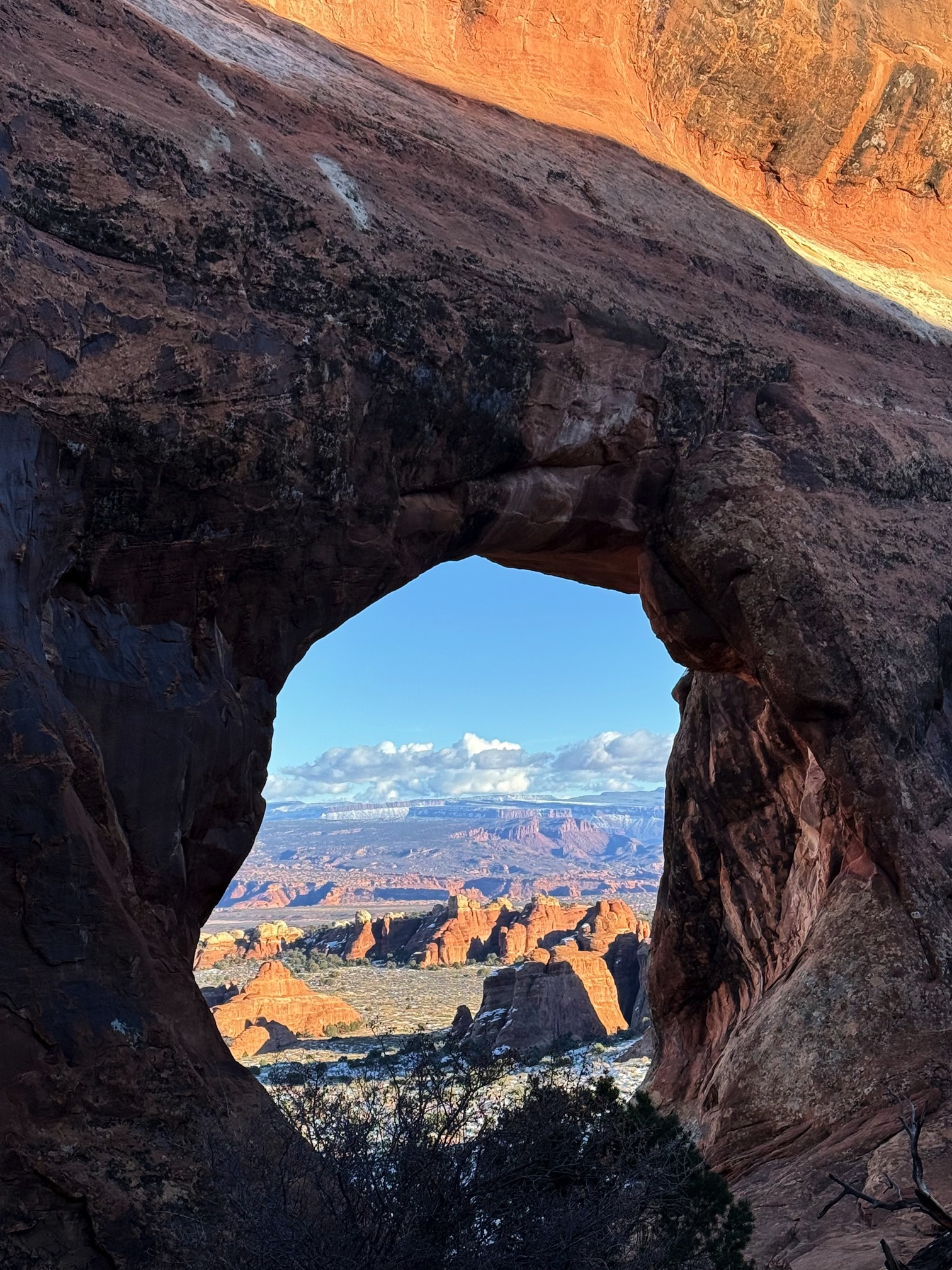
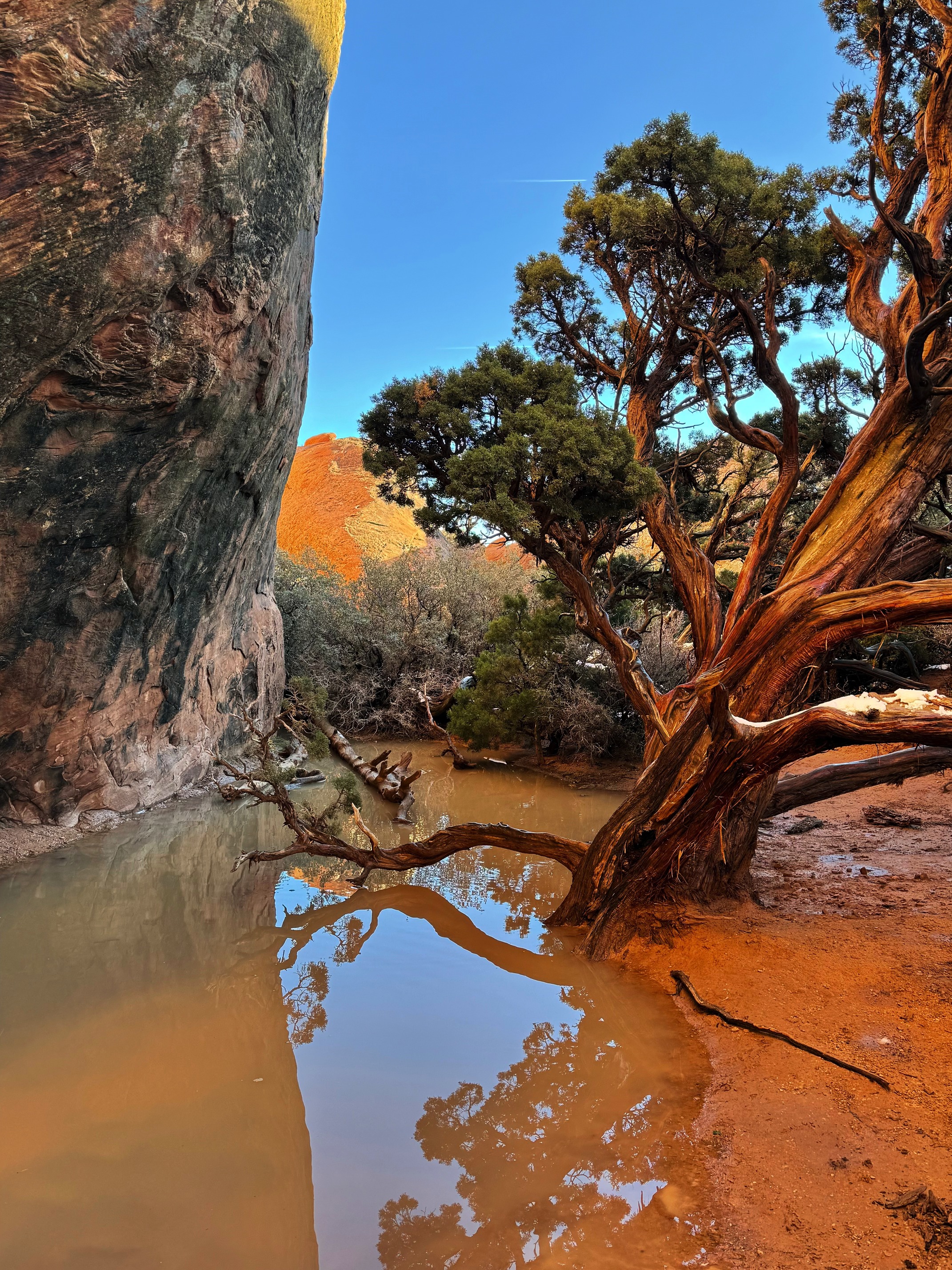
He pointed at a branch and asked me, "Do you see the steam rising from the snow? That's beautiful." At that moment, I realized he was a really great hiking buddy.
 You can't see the steam that clearly since this is not a gif. But you get the idea
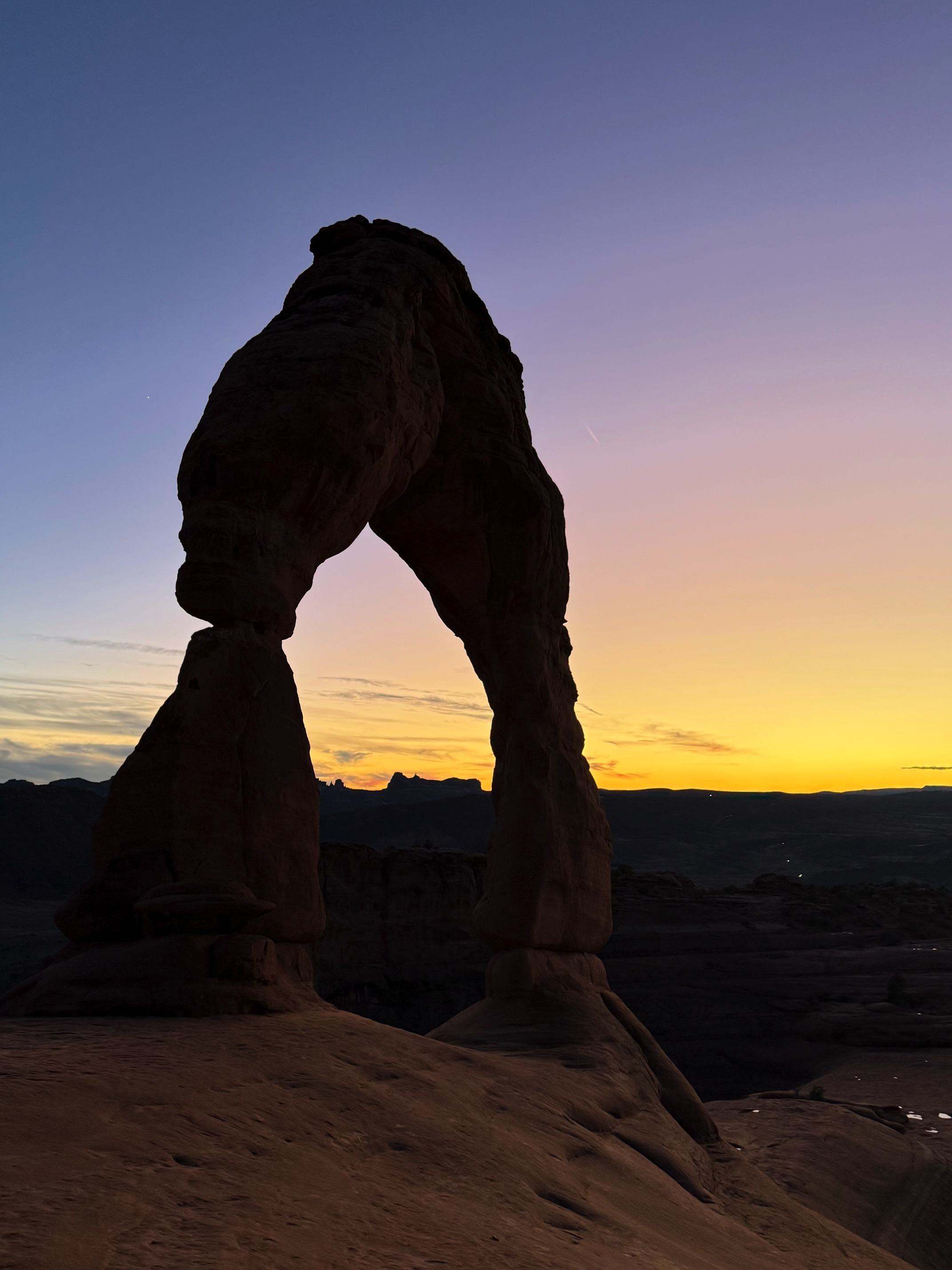
It wasn't in his plan, but he spontaneously decided to join me for the Delicate Arch sunset hike. We arrived just in time. As we made our way around the mountains and stepped up onto the rocks, we were greeted by the golden arch, with the pink La Sal mountains in the distance.
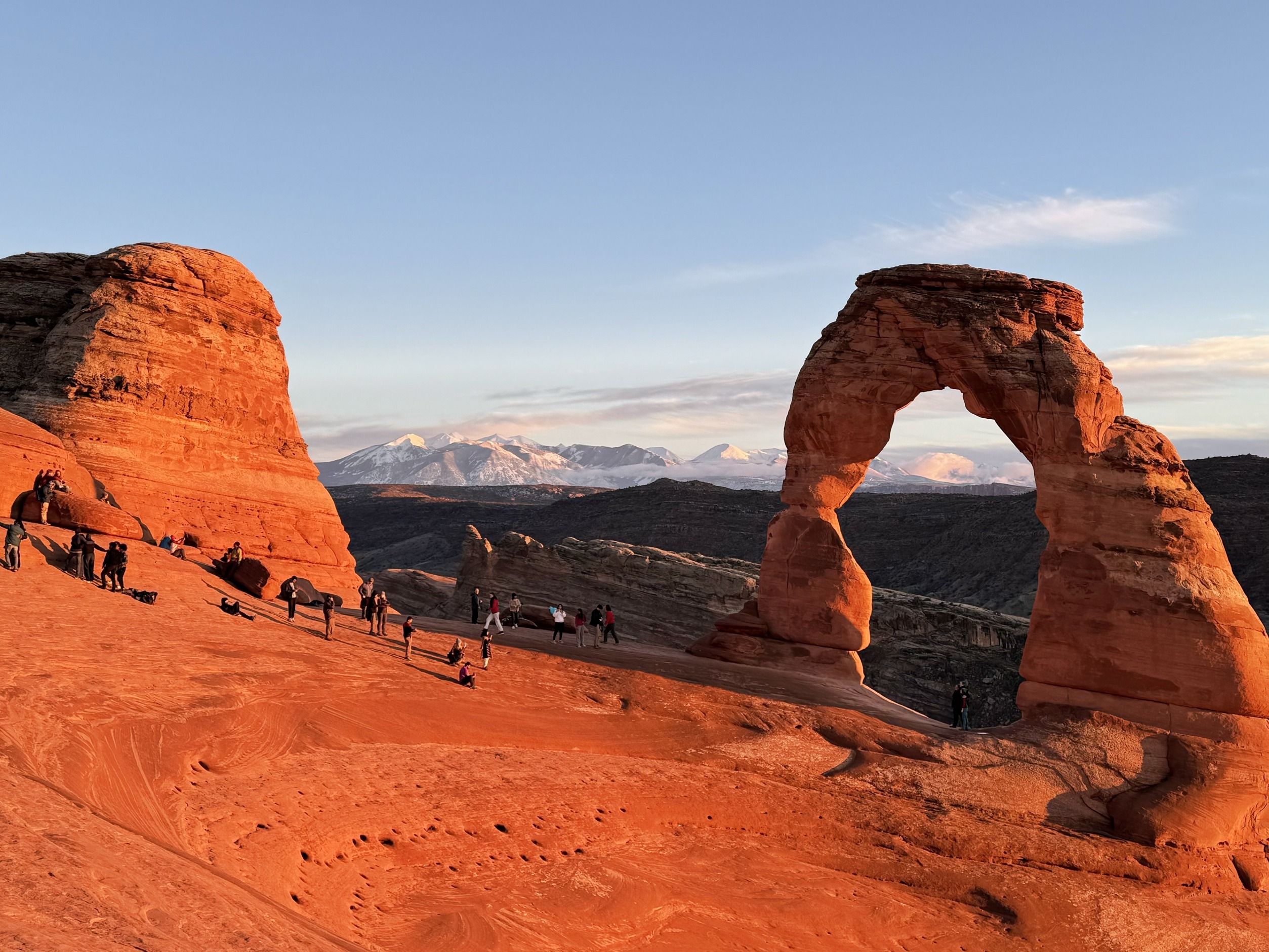 Golden hour at Delicate Arch
Compared to the Double O Arch Trail, the Delicate Arch Trail felt like paradise.
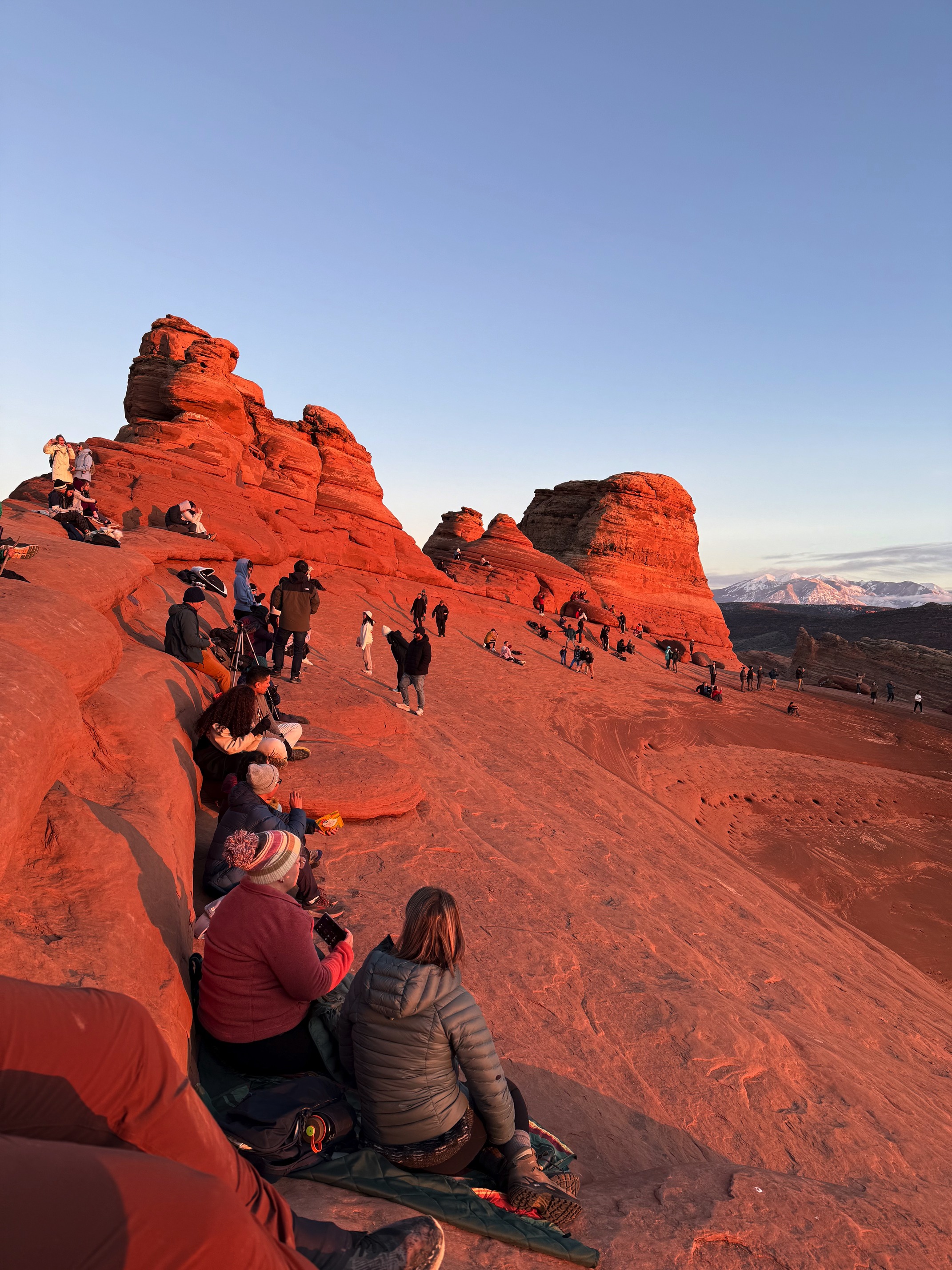
We joined everyone else, sitting down to rest and worship the sunset.
I helped Chris take a lot of pictures but ended up with none of myself. He offered to take a few for me, but I didn't feel like it. Then he stood behind me, suddenly called my name, and snapped a quick picture.
It was completely dark when we headed back to the parking lot. Watching the stars isn’t a luxury in this national park or the surrounding town, but what was lucky for me was seeing Starlink satellites.
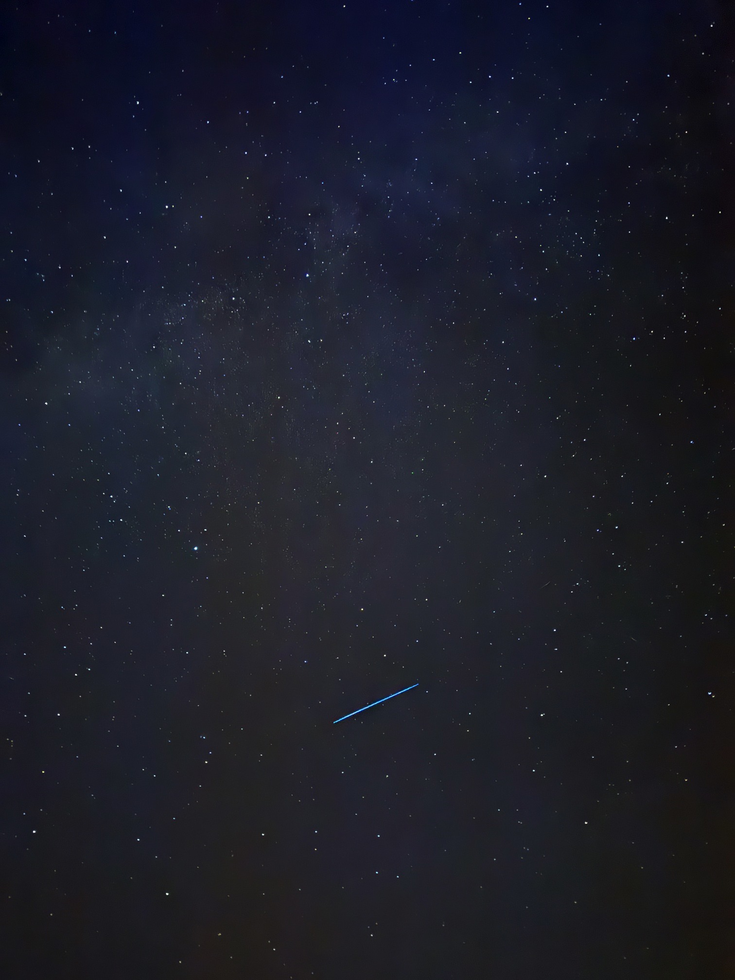 Starlink shot with my iPhone
Oh I was so done with hiking.
Day 6 Canyonlands National Park
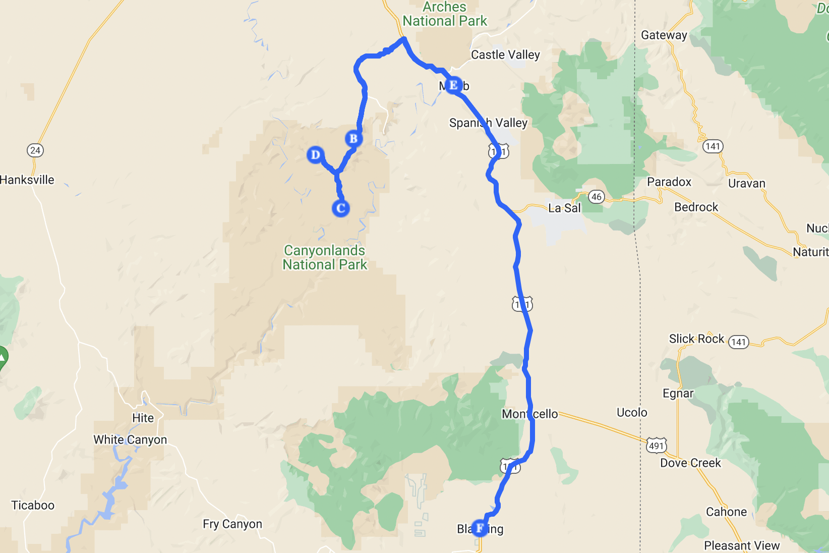 Canyonlands NP day
I went to the same café for breakfast simply because it’s so good. While I was there, I overheard someone mentioning chances to see the northern lights that night. I immediately joined the conversation. I was thrilled! I know there have been several spectacular northern light this year, and I’ve seen people posting pictures of them from Moab. The Kp index was indeed high, but I hadn’t checked any other details. I also didn’t recall hearing about strong solar activity in the past few days.
Anyway, I ended up chatting with a guy named Nathan. He’s from Australia and calls himself half Chinese. He lived in China for a few years and knows a lot of “deep secrets” that only locals do. Nathan was planning to visit Canyonlands that day too.
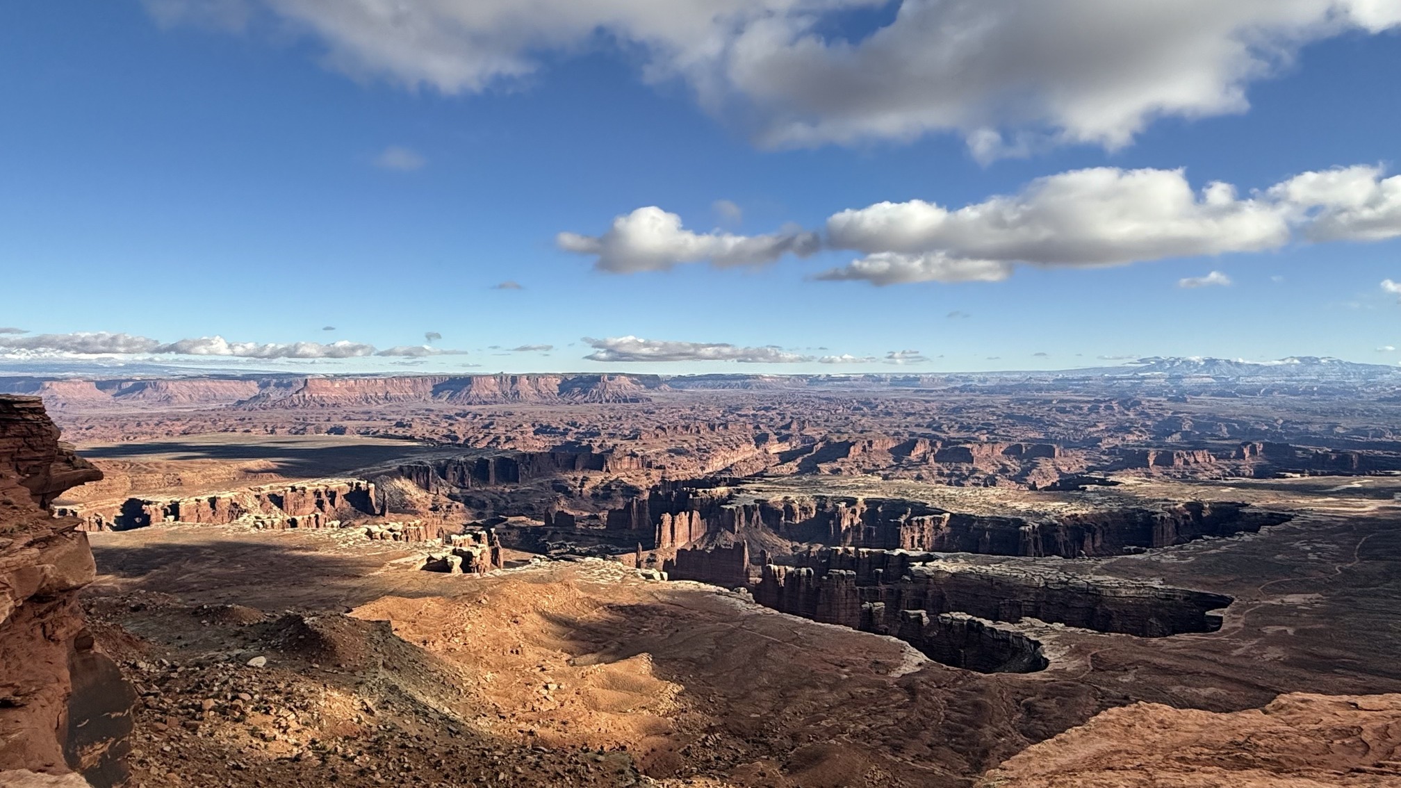
We didn’t leave together though. I wanted to explore the Needles section, but the ranger told me it wasn’t worth it unless I planned to hike. So I decided to stick to the Island in the Sky section, the most popular area with lots of viewpoints and minimal hiking.
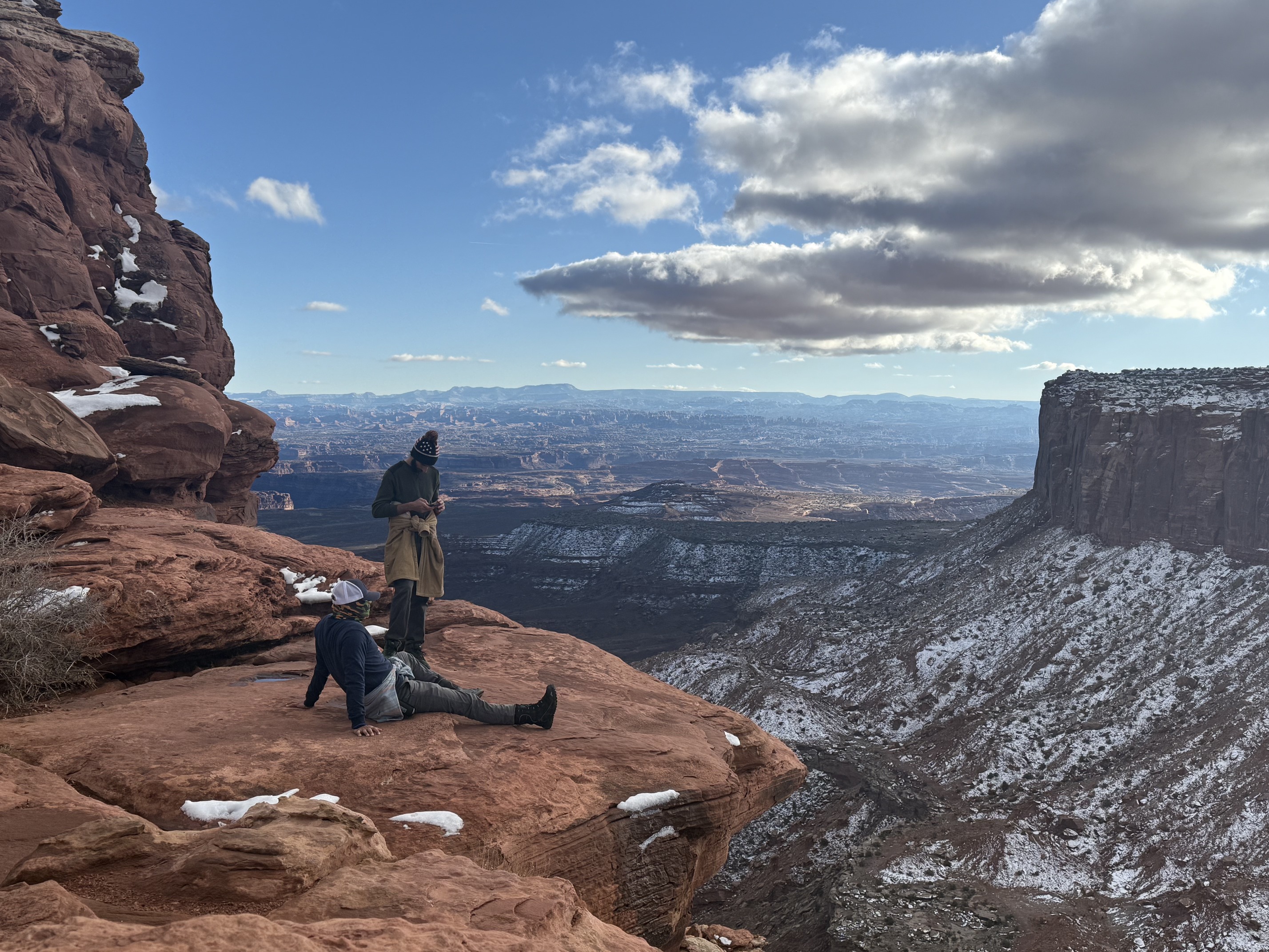
It was such a coincidence that I ran into Nathan again at Shafer Canyon Overlook.
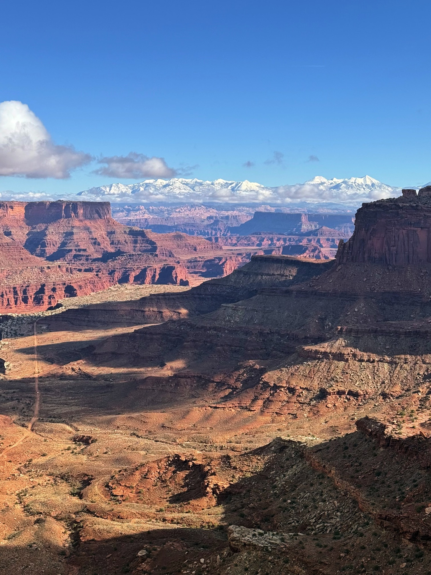 Shafer Canyon Overlook
There was an off-road drive I could go for, through which you can drive from the national park back to Moab. The problem was, it had just snowed a few days ago, the road was icy. And the road was narrow, once you go for it, there’s no turning back. I wanted to try it but it felt too risky. We saw someone attempt it. They were driving down the hill slowly, moving forward inch by inch with extreme caution. We stood on the cliff watching, wondering how much they were regretting it and how many cars had probably lost control and gone over that edge.
 Part of the drive. You can see a green car there
Nathan insisted that, after all the pictures I’d taken of the scenery, I needed one with myself in it. So, he took this photo. He said, "I’ve been into photography for over 20 years. Trust me."
 Me cause I didn't want to show my face
Went through the viewpoints and did two short hikes: Grand View Point Overlook and Upheaval Dome Overlook.
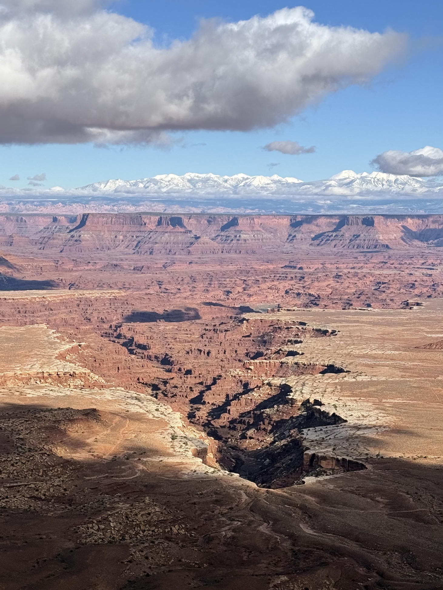
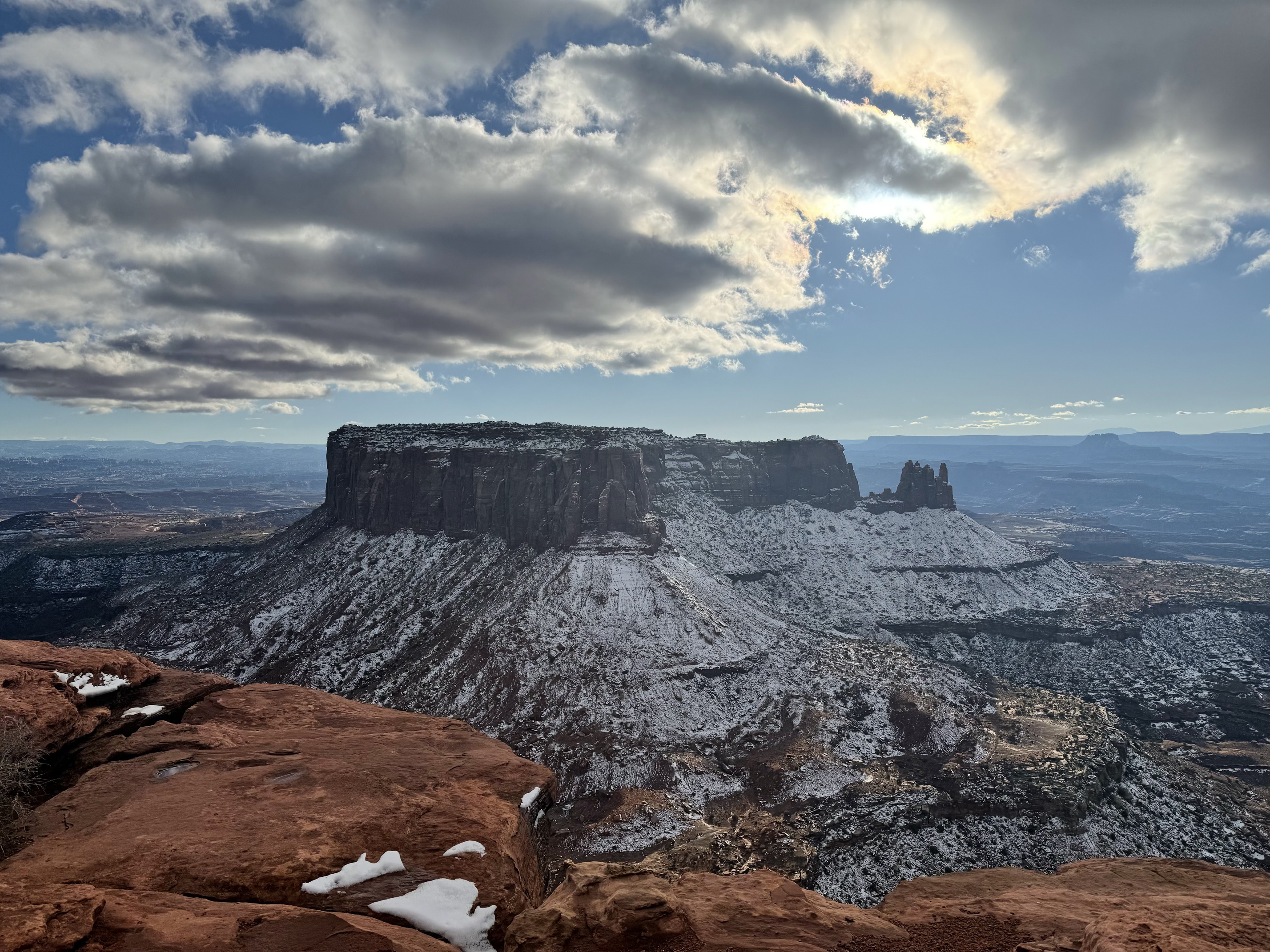
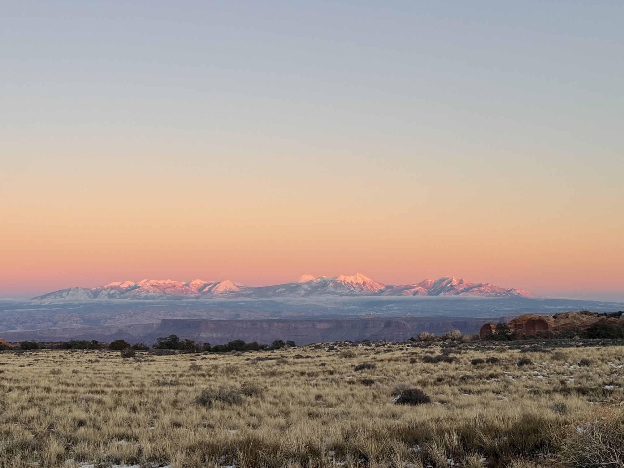
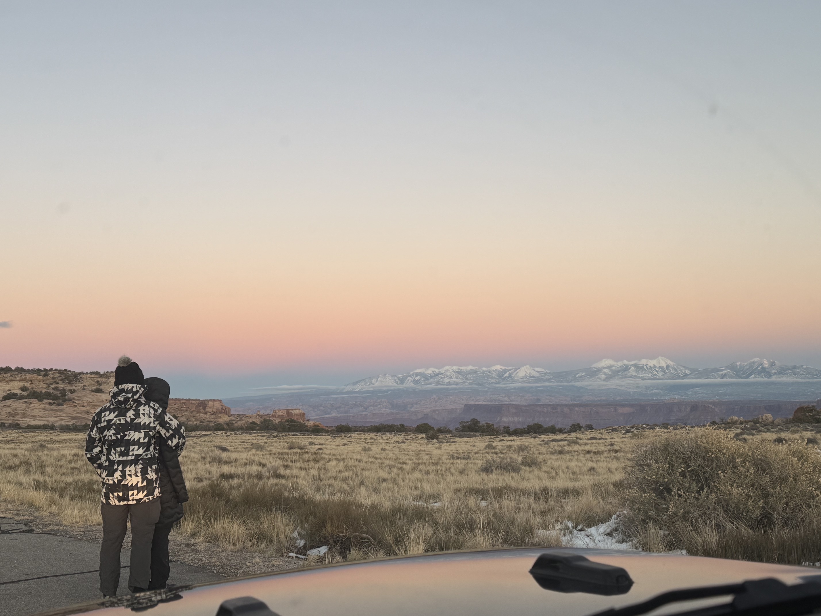
After visiting all the viewpoints, I decided to return to Shafer Canyon Overlook for sunset. It has view of both the canyon and the snowy La Sal Mountains. By the time I finished the hike to Upheaval Dome, golden hour was already underway. I rushed to get there before the pink glow on the snow-covered mountains disappeared. On my way, at a random pullout point that’s not even on the map, I got the best view.
That day was Thanksgiving. Moab is a relatively bigger town with more options, so I stayed for dinner before heading to Blanding to spend the night. After calling tons of restaurants, I finally found one that was open. Later, Nathan joined me and showed me pictures of the chipmunks he'd spotted earlier. He’s obsessed with them.
No luck with the northern lights, or maybe I should say it was as I expected. Seeing them here is extremely rare.
I really don’t think Blanding is a very friendly town, though it’s bigger than the others I passed through. Both the city and my inn creep me out.
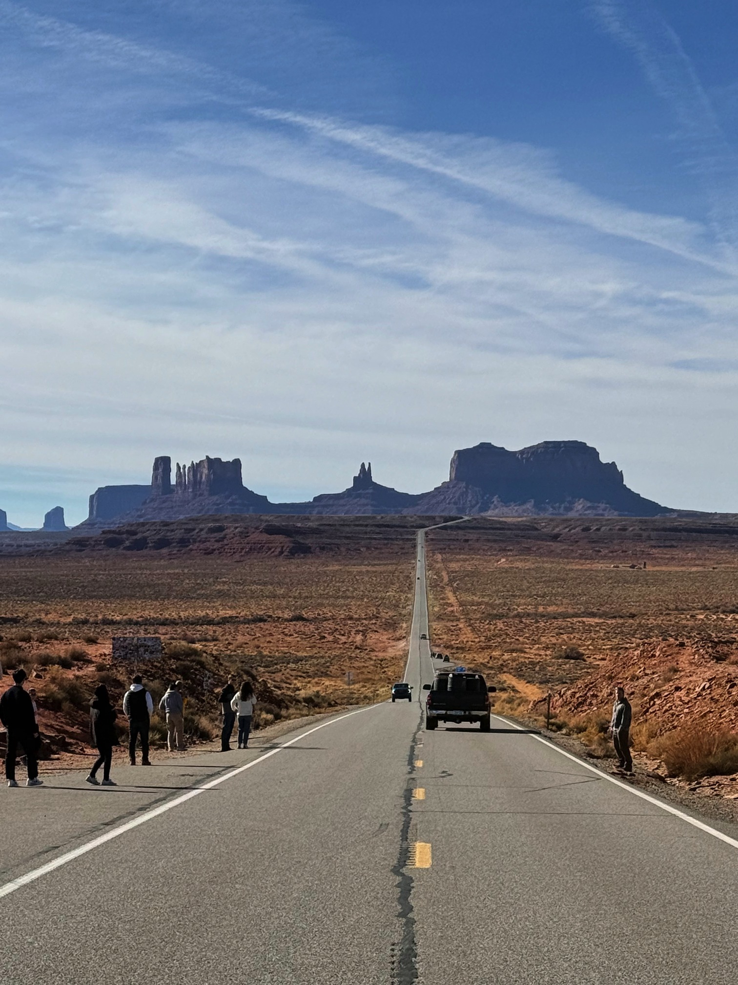
Day 7 Monument Valley and Shiprock
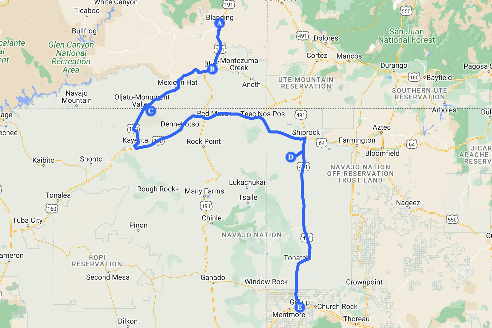 Quite-some-drive day
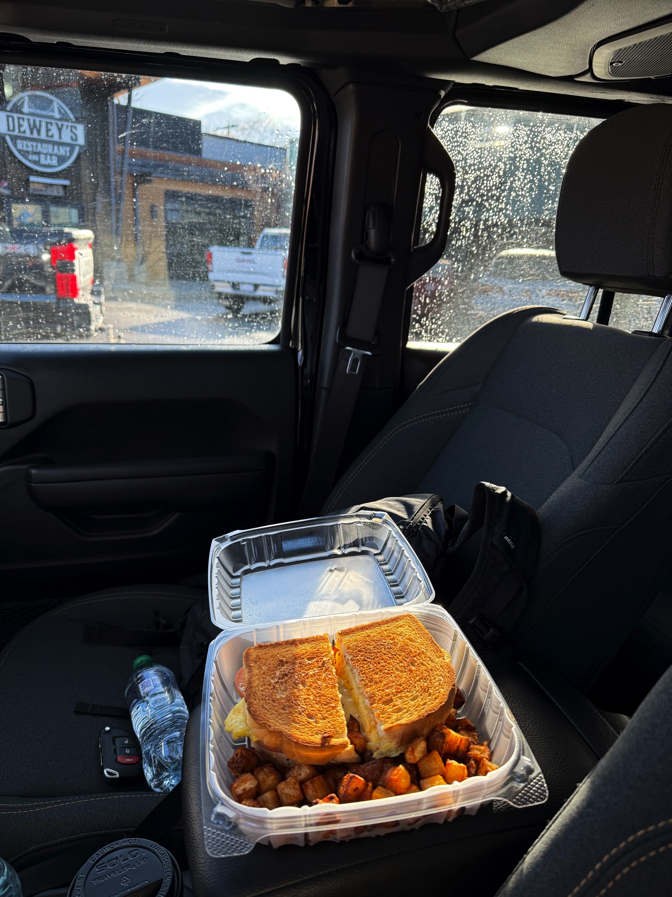
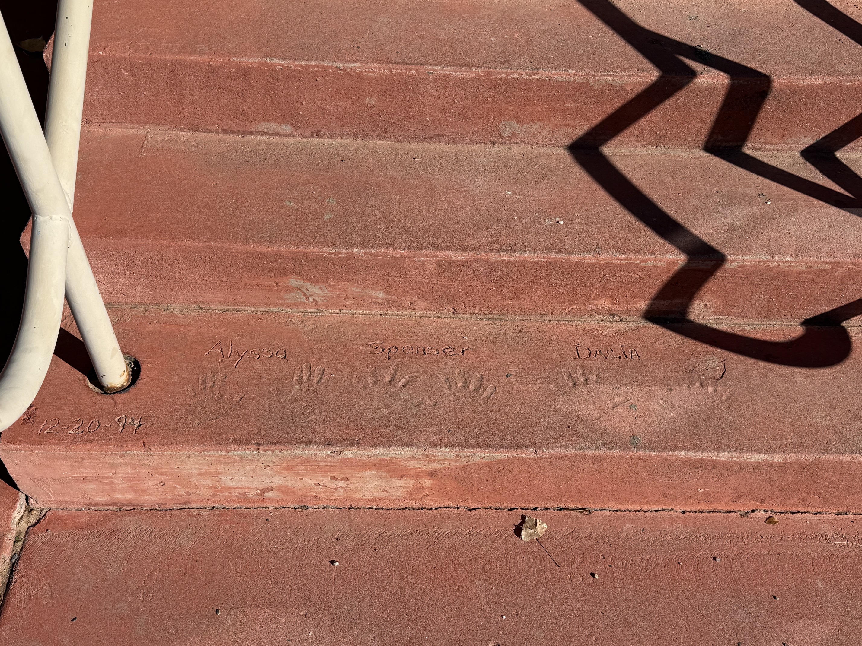
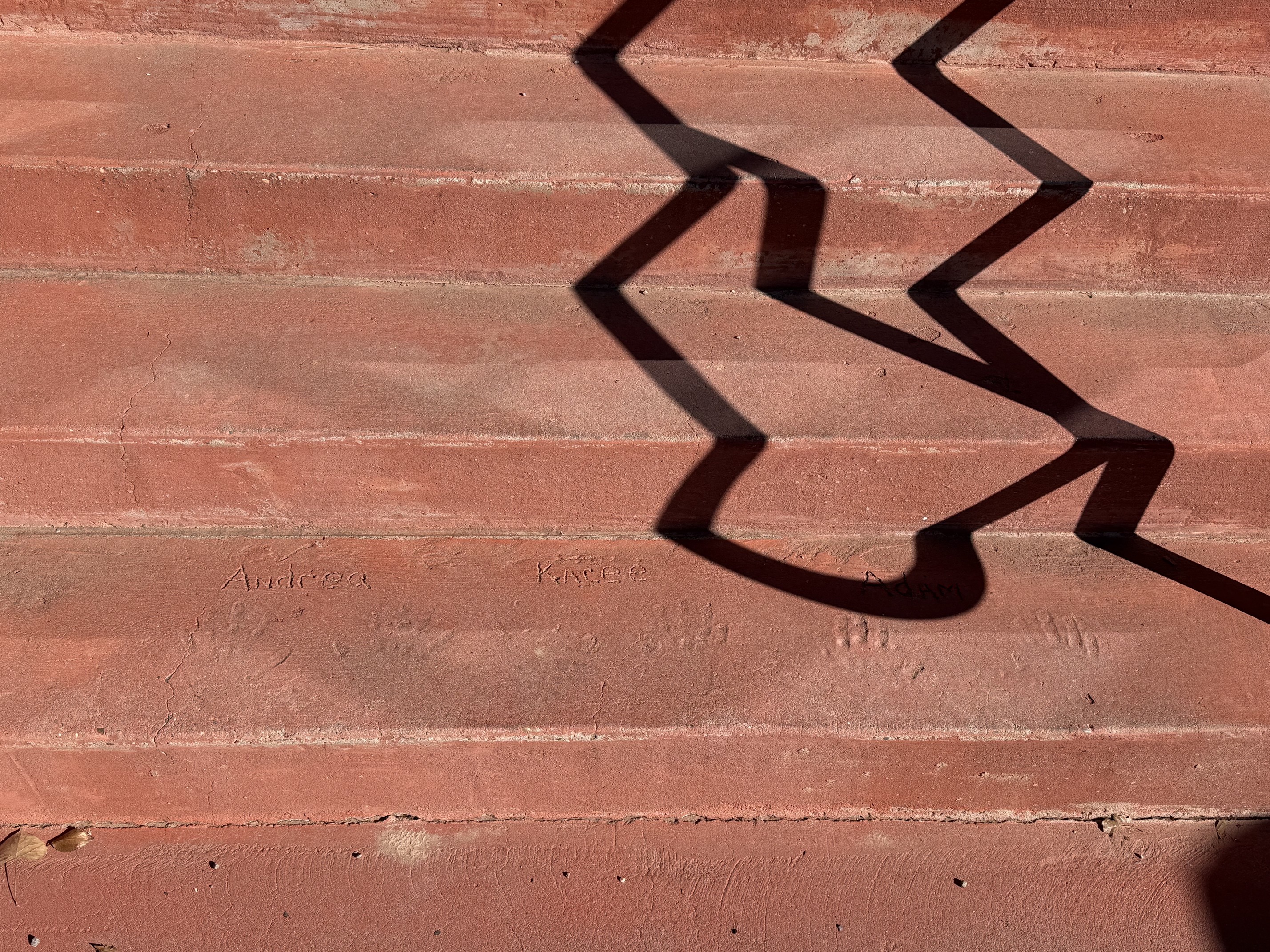
Breakfast! Nothing was open in my town. It gave me the vibe that zombies had destroyed it, eating everyone, tearing down the buildings, and leaving behind an empty ghost town. I escaped as fast as I could. I found a place nearby called Twin Rocks Café. Thank you for being open. THANK YOU!!! I was completely over fast food.
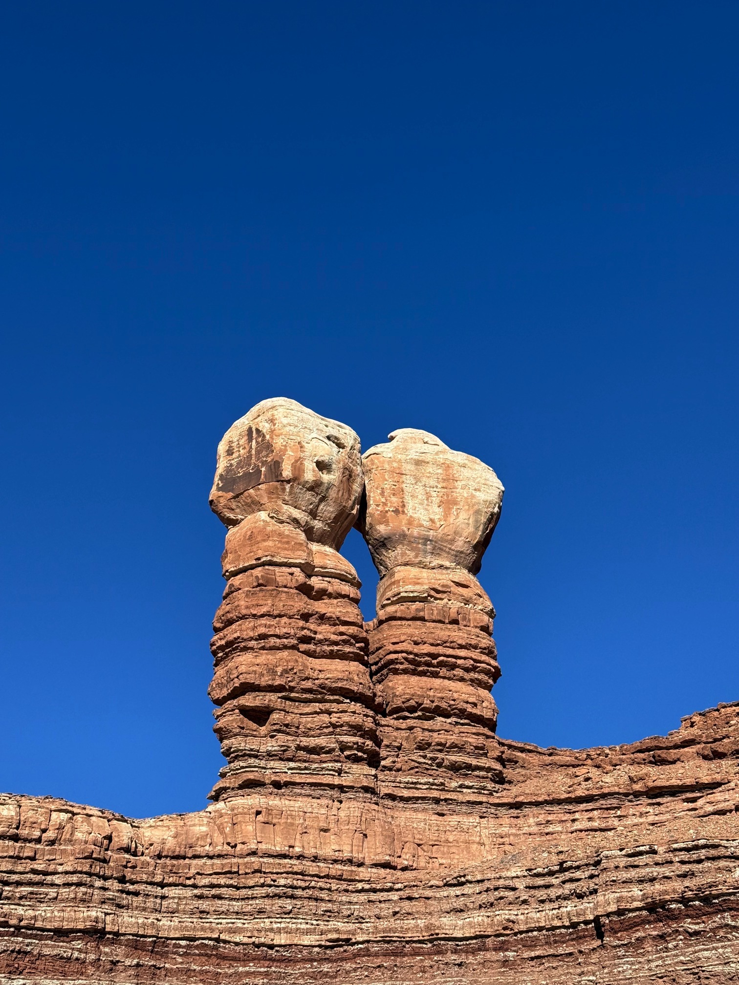 I guess this is why it's called Twin Rocks Café
The food was amazing, but that's not the point I'm trying to make. In front of the cafe's stairs, there are handprints with dates next to them. Seems like this is a family-run business. Lovely.
Okay, Monument Valley. I was exhausted at this point. This trip is finally coming to an end.
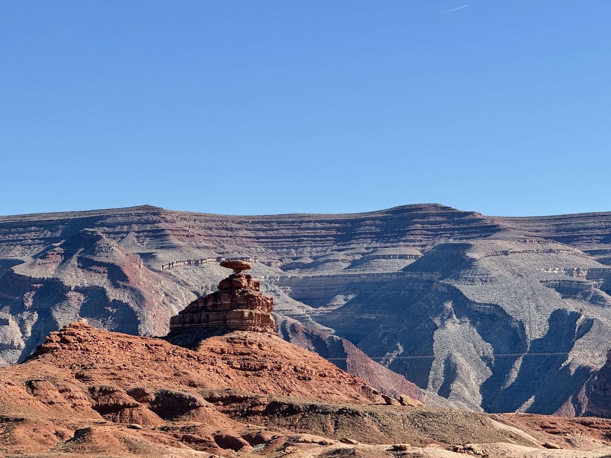 Mexican Hat on my way to Monument Valley
Still one more stop to make: the exact camera location where Forrest Gump ended his run. By the way, Forrest Gump is a fantastic movie, go watch it if you haven’t already. I’ve always loved stories about insignificant people, though I’m not sure if it’s fair to call Forrest "insignificant."
 Yes I didn't wait in line for THE shot. I'm fine with it
Now it’s really Monument Valley time. The plan was simple: drive along the scenic route. The road turned out to be much bumpier than I expected. I truly admire those who drove Tesla here. Monument Valley is undoubtedly breathtaking at sunset. Starting the scenic drive around 2 pm would let you catch it at the perfect moment. But I had something else planned for that day.
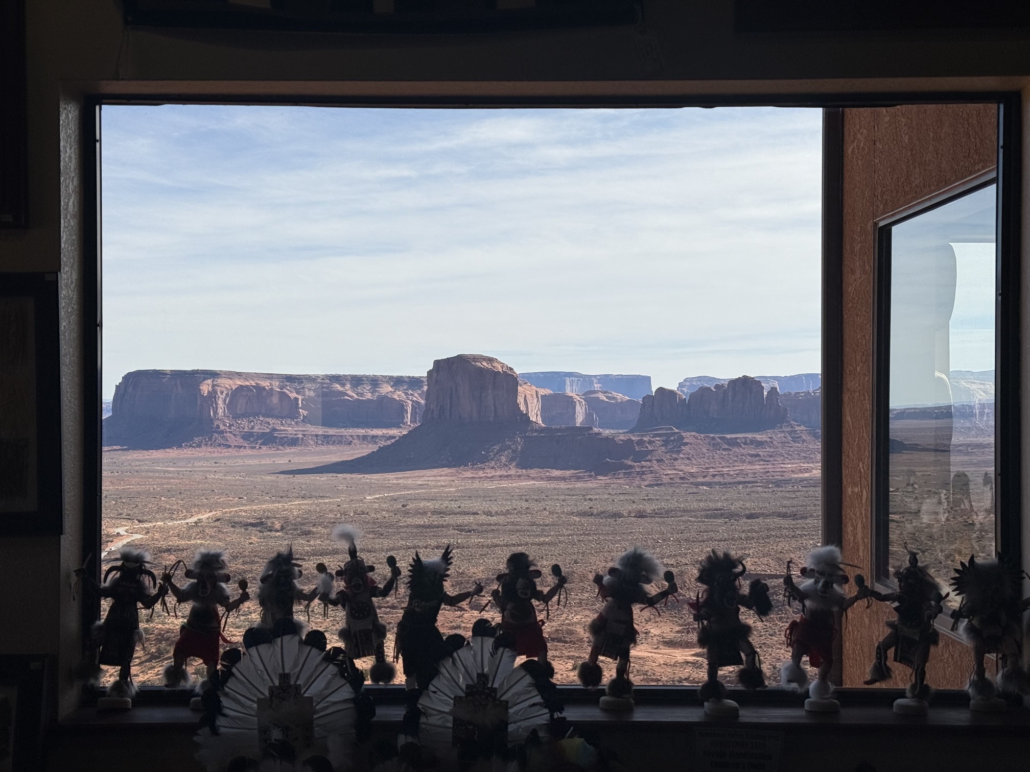

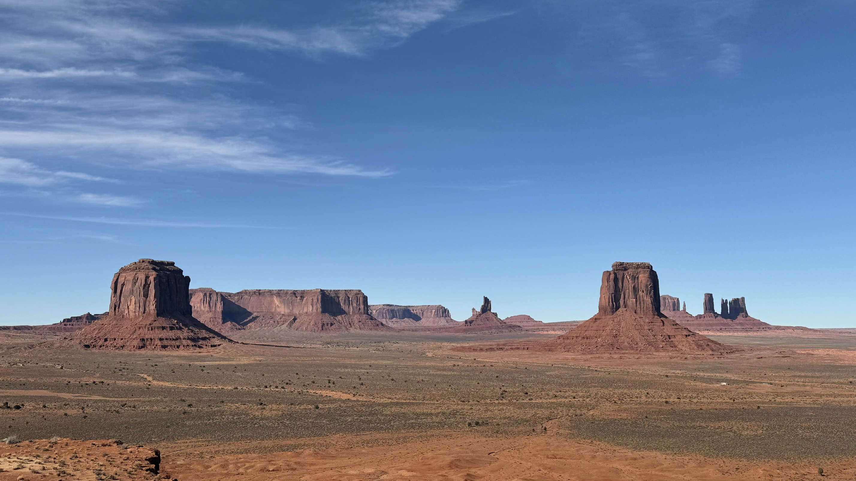 And Monument Valley
I can’t even describe how rough the off-road scenic drive was. Let me put it this way: I was driving a car designed for conditions like this, I got carsick and almost threw up afterward. For those who say White Pocket is tough to drive, hello? Have you ever been to Monument Valley? The view was absolutely worth it though.
The drive took way longer than expected, and I still had to rush to Shiprock for sunset. I needed to arrive 30 mins before sunset for the golden hour. Compared to people in Utah, New Mexico drivers drive like there’s no tomorrow. What’s wrong with you guys? Well I should be used to this since I came from Texas. But what’s wrong with you?
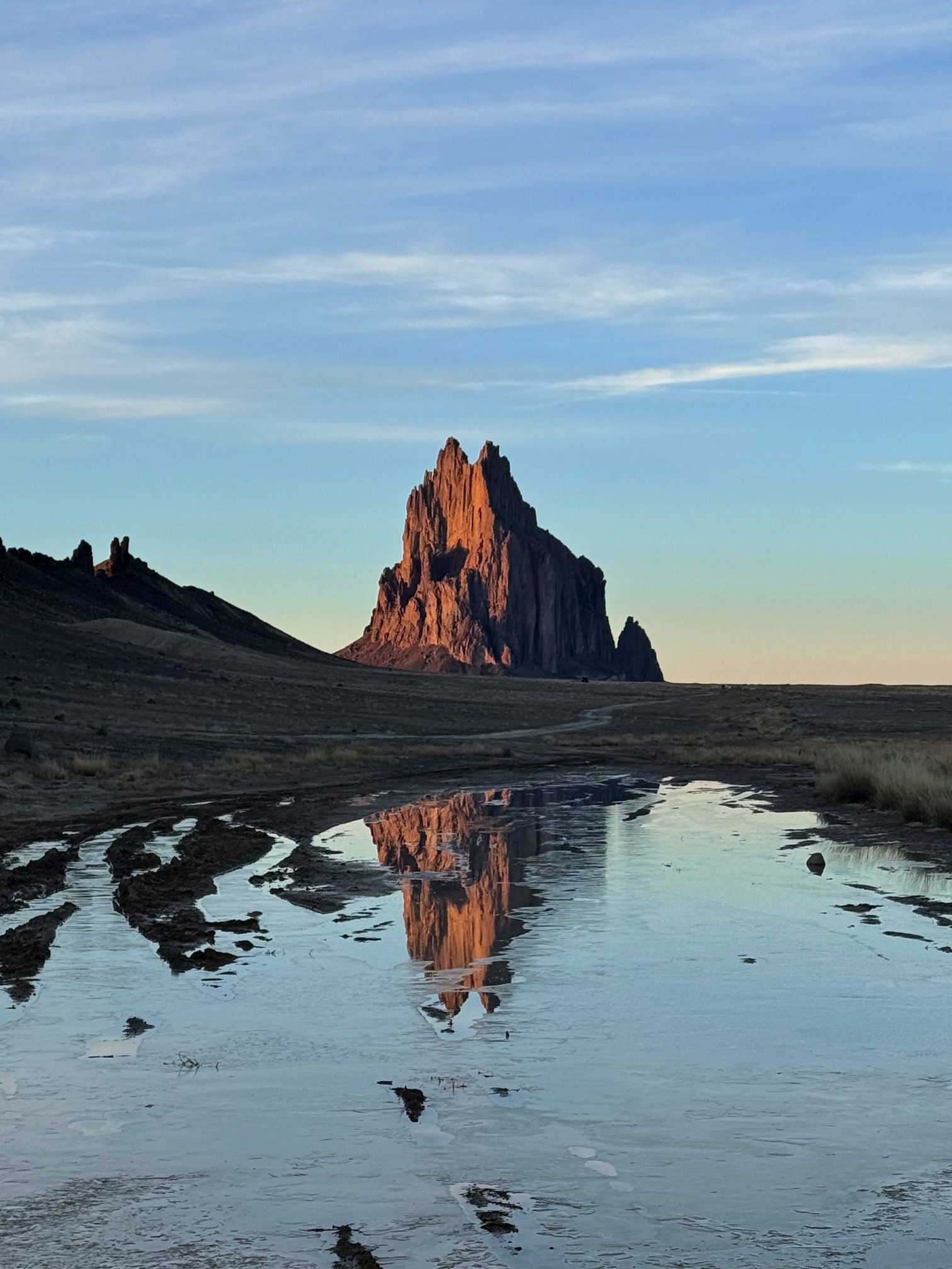
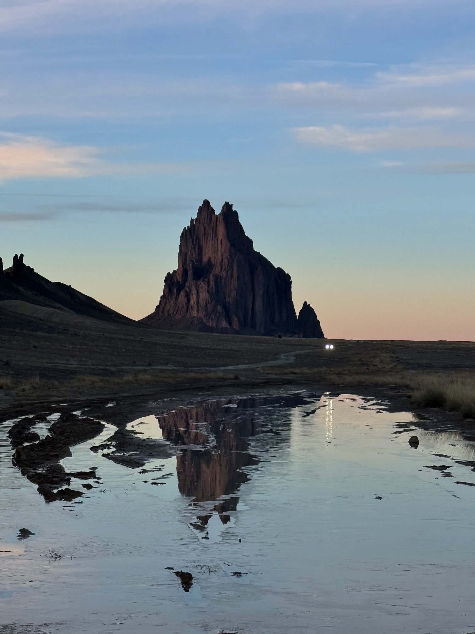
I didn’t have time to see Shiprock last time I was in New Mexico, so this time I made a 300-mile detour for it. Shiprock and the surrounding land hold both religious and historical significance to the Navajo people.
Make a turn onto Indian Service Rte 5010 to get closer to Shiprock. I read that there’s a sign somewhere along the way saying, "Be respectful to local environments and culture, don’t drive closer to the rock." I didn’t see the sign, but I didn’t drive any further. I just parked in the open ground next to the main road.
I think I made it just in time.
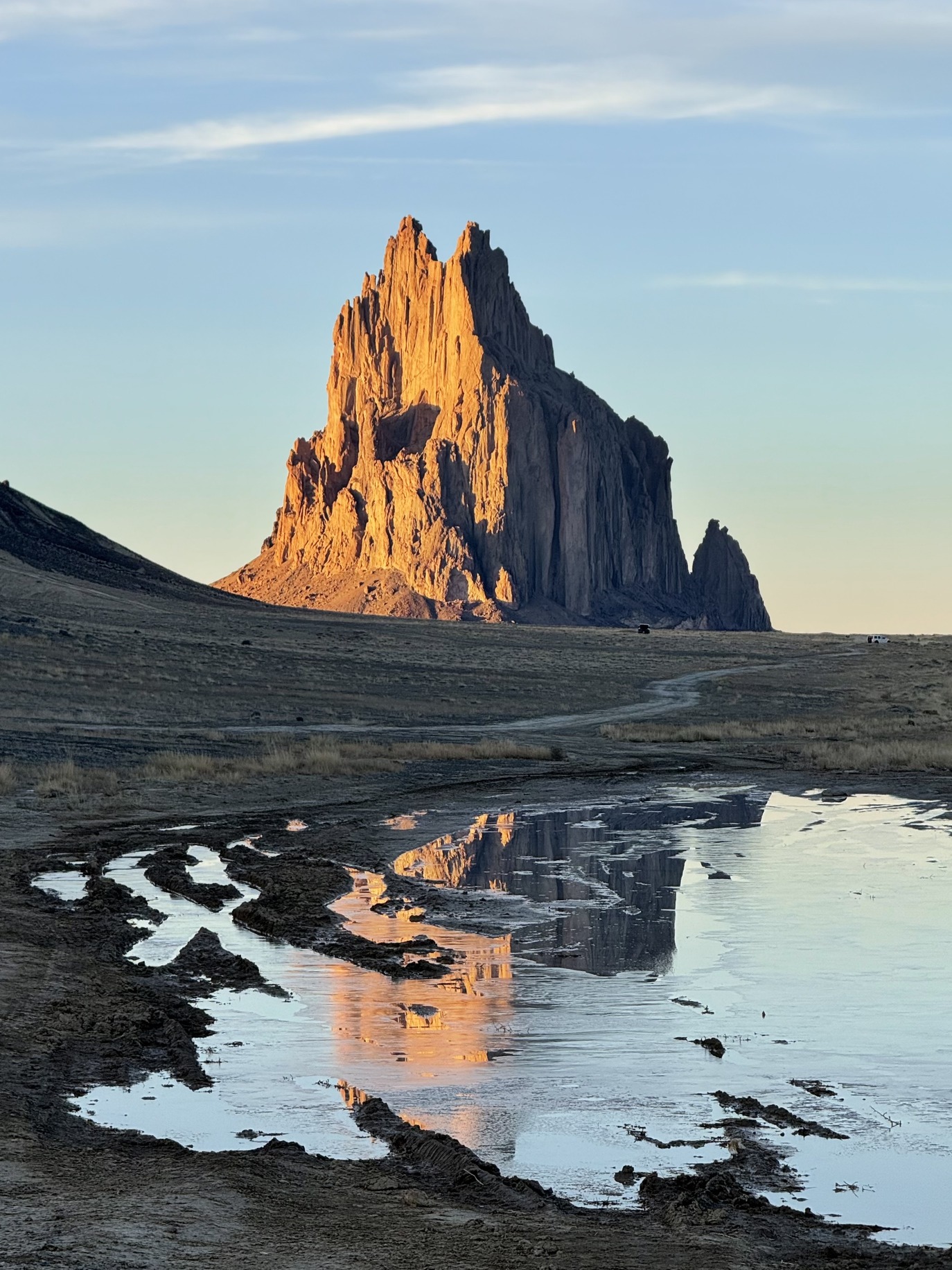 Shiprock at golden hour
My hands were shaking as I parked the car, gathered all my camera gear, and jumped out to take this photo. 300 miles? I'd totally do it again.
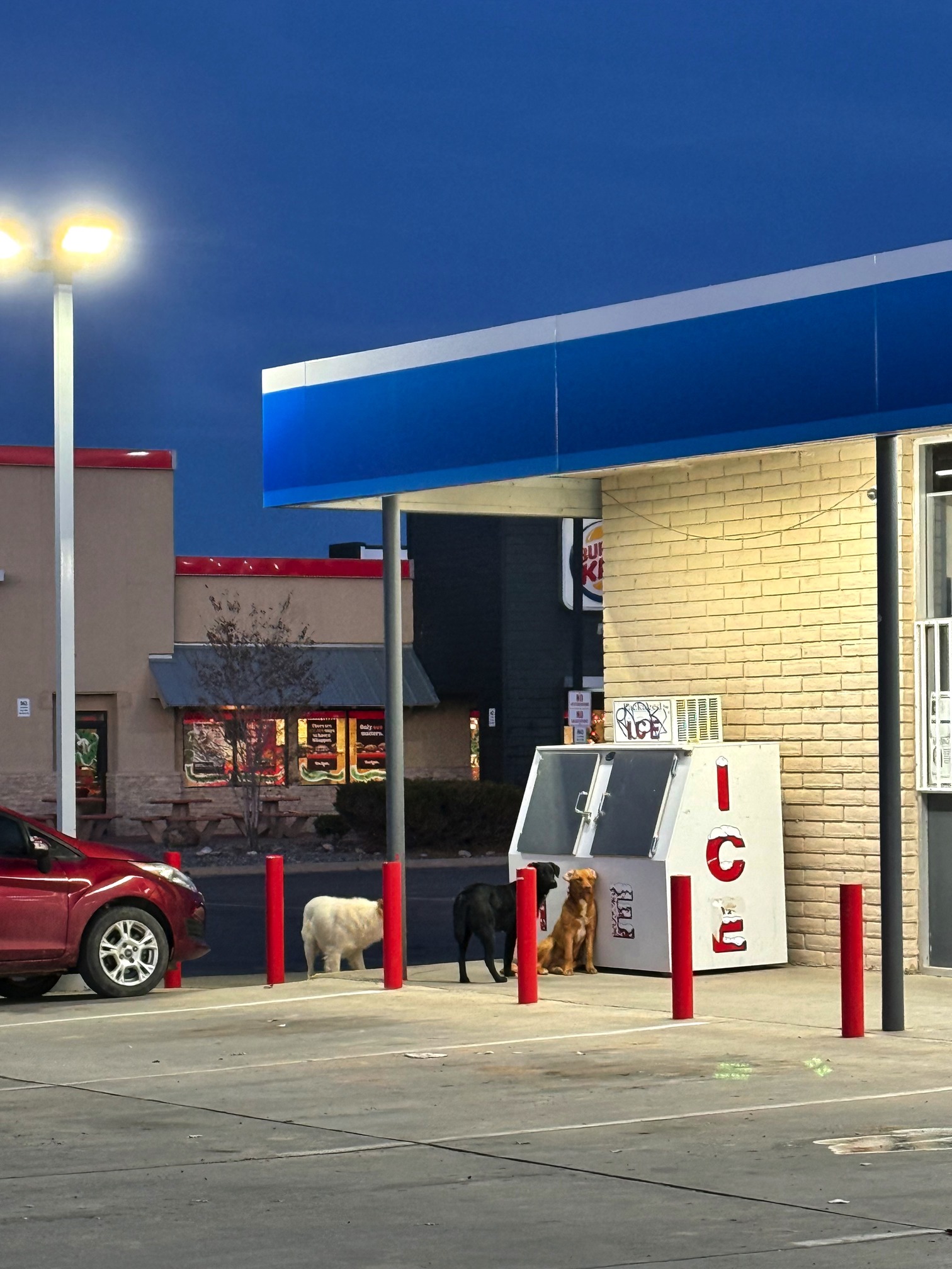
I wanted to have dinner in the town Shiprock, but the gas station I stopped at seemed really sketchy. I escaped after filling up my tank. Later, I found out the energy drink I bought there had expired over six months ago.
I stayed at a motel in Gallup, which was my first time staying at one. I was really worried beforehand since I wasn’t familiar with the city, and it was New Mexico. I did a lot of research and chose the one I ended up staying at. To my surprise, the motel was family-run and super nice.
Day 8 Petrified Forest NP
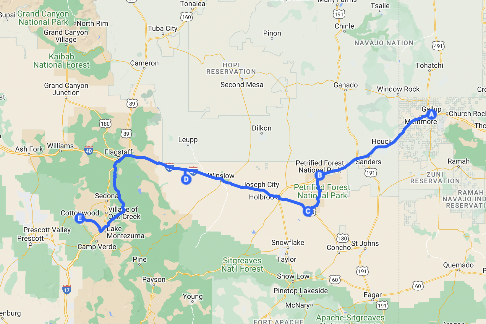 Ready to go back to Phoenix
Petrified Forest is a chill national park, not too big, you can cover most of the scenic views without much hiking. This is Celeste’s favorite place. I’ll let the photos speak.
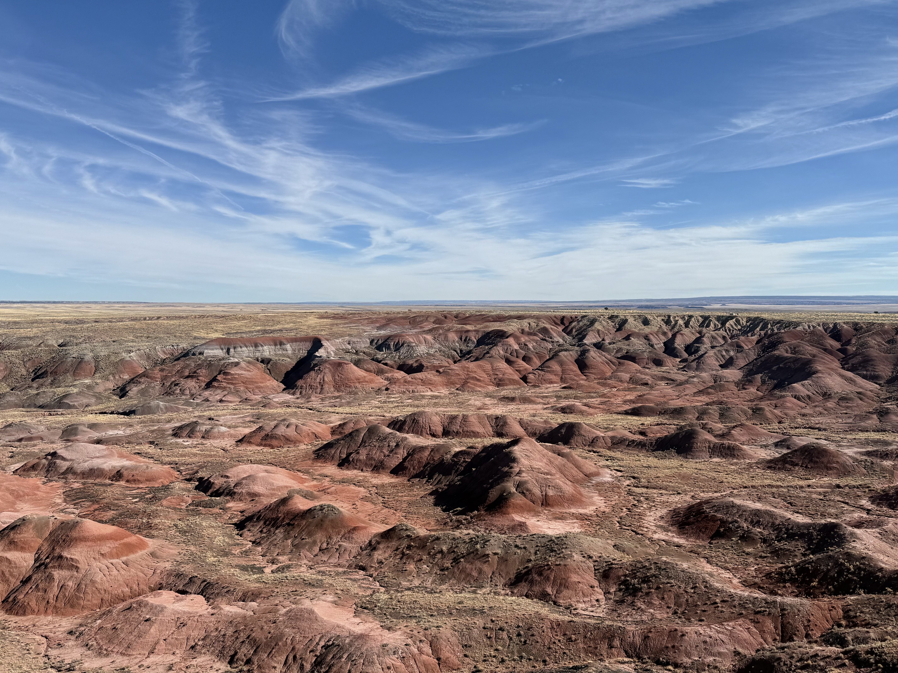
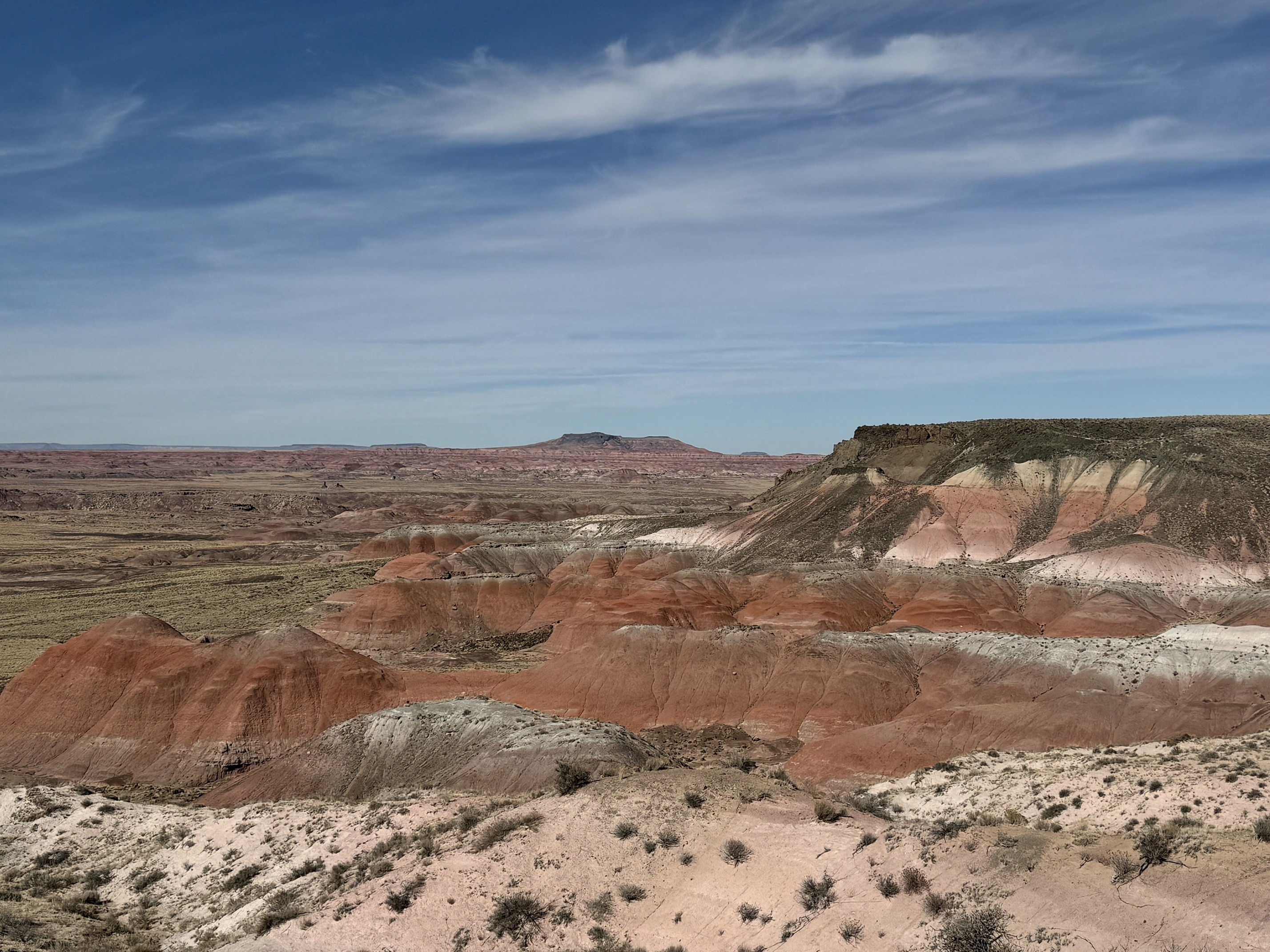
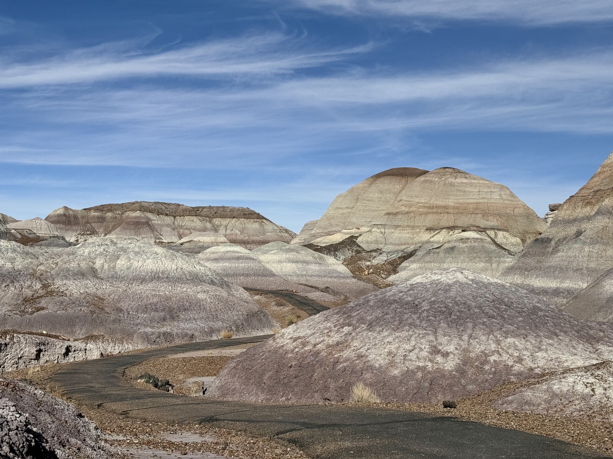 Blue Mesa
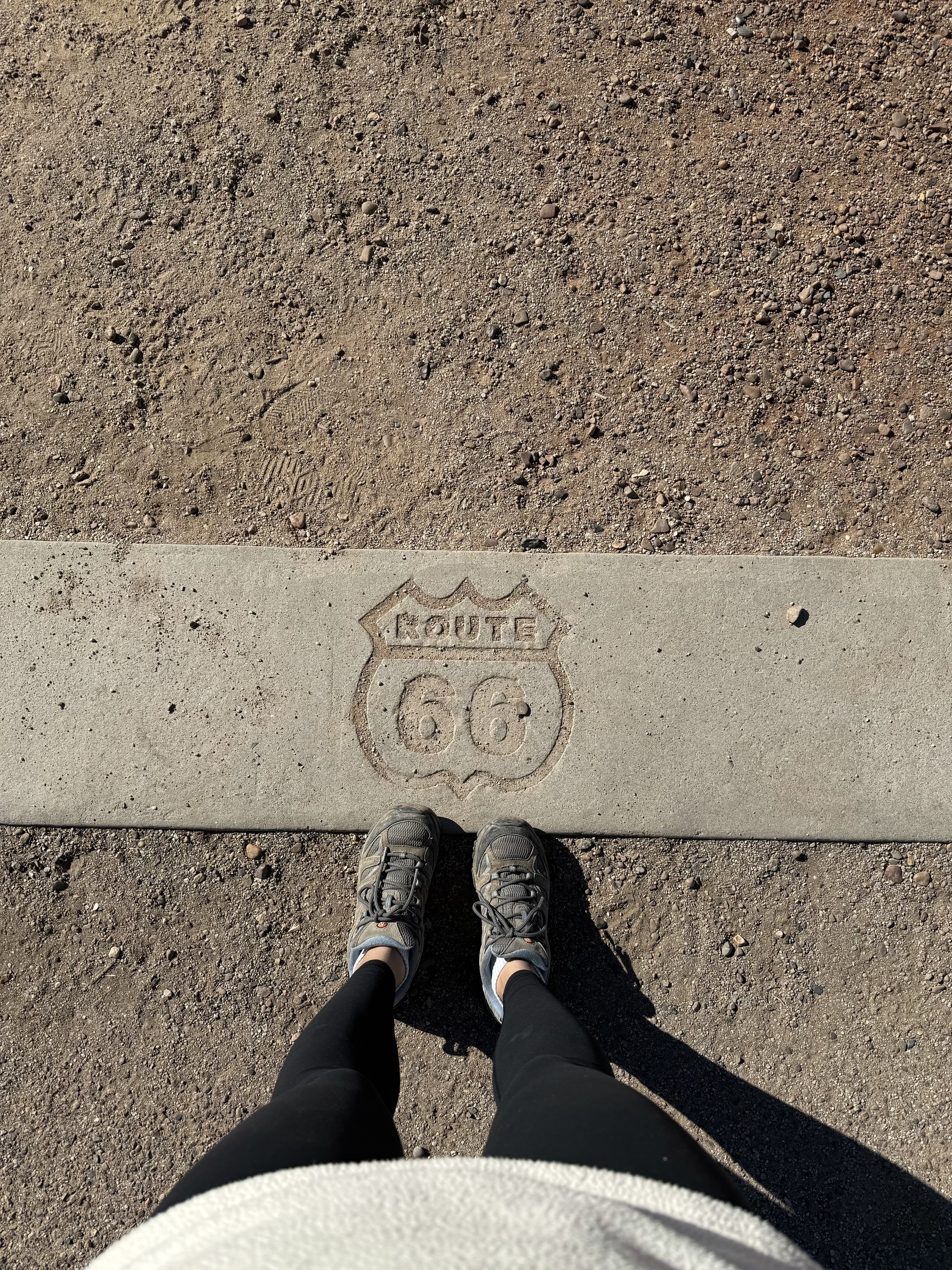 Petrified Forest National Park is the only park in the National Park System containing a section of Historic Route 66
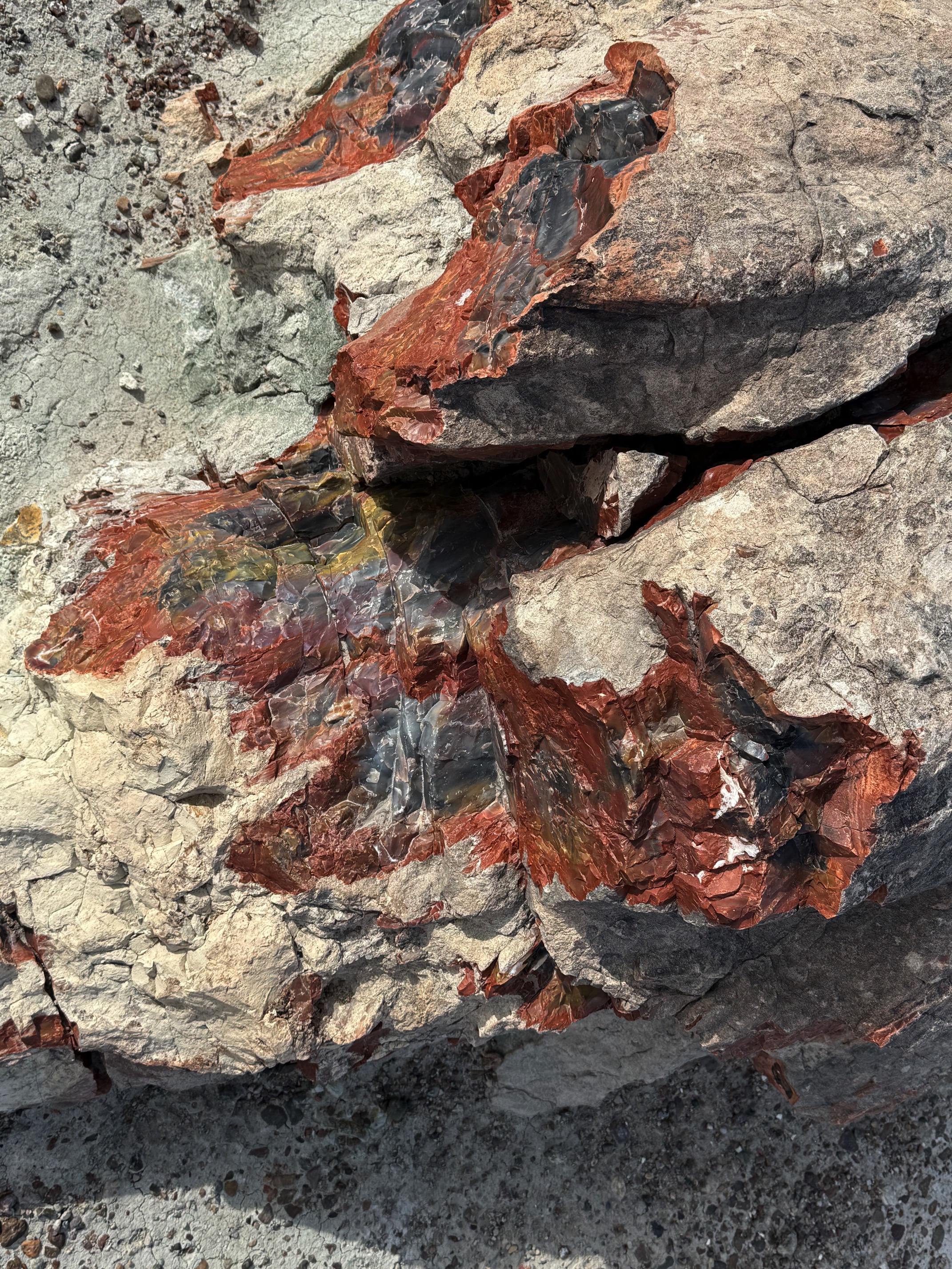
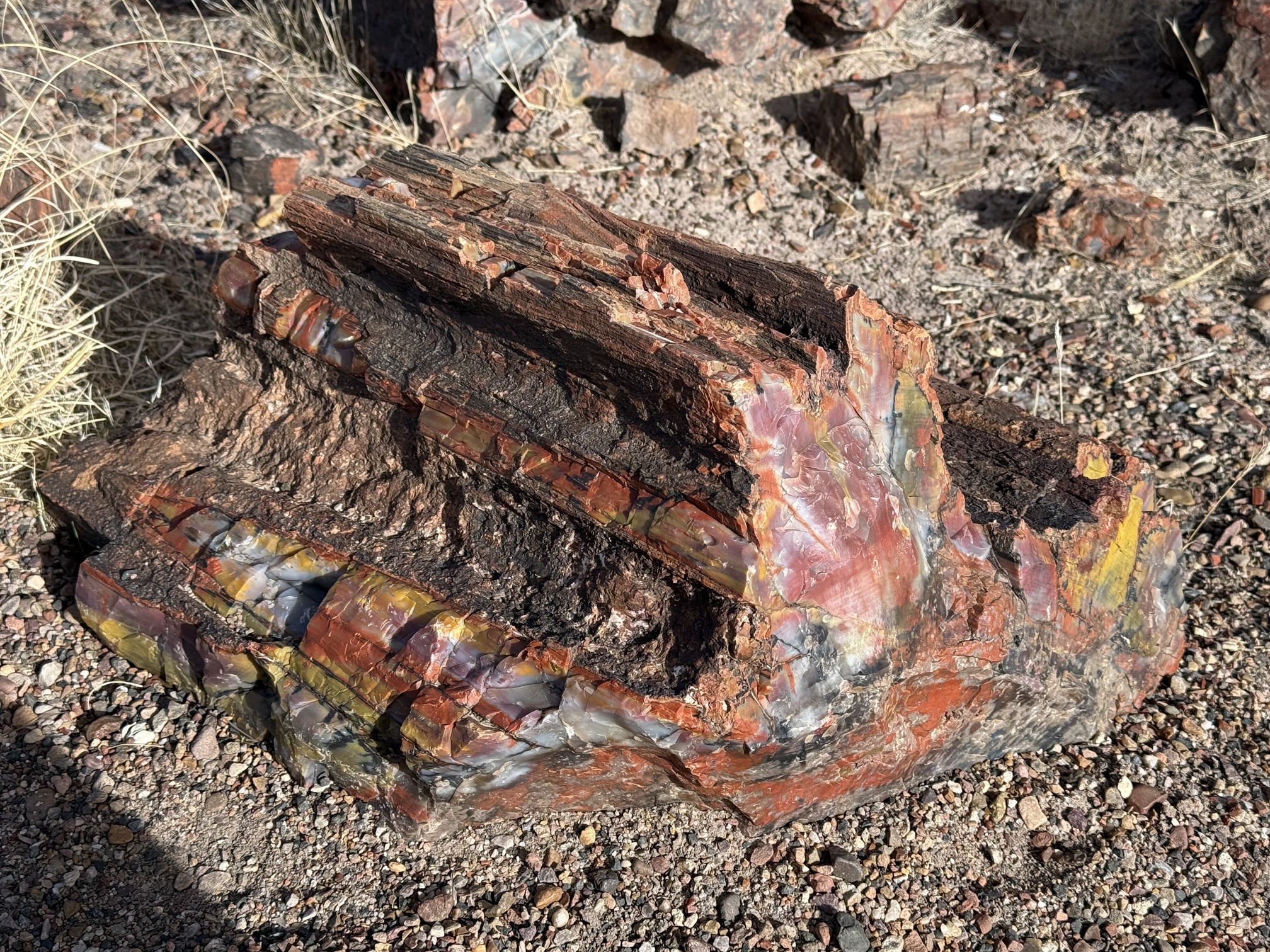
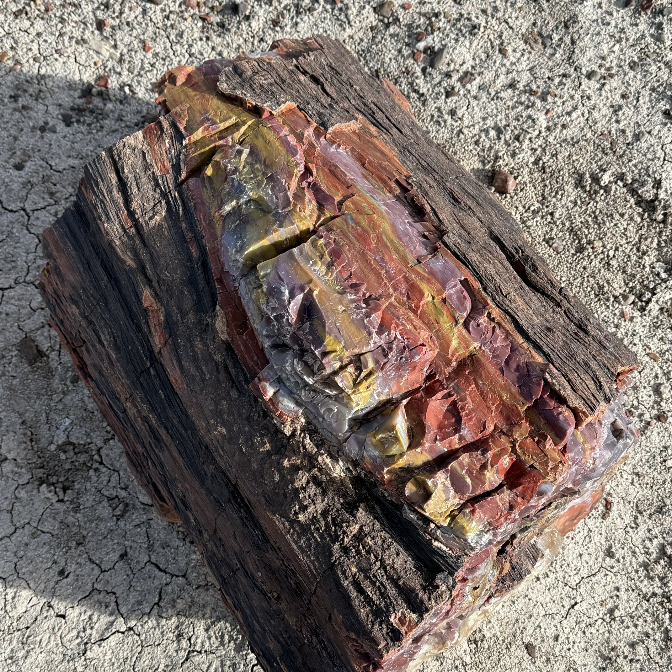
It’s totally illegal to take petrified wood from the park. If you’d like a piece, you can buy one at the gift shop or visitor center.
It was still too early to check in at my Airbnb in Cottonwood when I left the national park. As I looked over the map for things to do on the way, I came across Meteor Crater. Nathan had mentioned it before, and I read some Google reviews saying it wasn’t a tourist trap. Plus, I had never seen a meteor crater before, aside from Upheaval Dome.
I shouldn’t have been so curious. It felt like a tourist trap, and I should have turned around the moment I saw the $29 ticket price. I mean there was an exhibit explaining the basics of meteors and craters, but a national park charges $35 per vehicle, and they’re asking $29 per person here? Plus, you’re not even able to walk around the rim of the crater. I will never forget the number 29. I have hate in my eyes just thinking about it. If I had the chance to choose again, I would spend some time in Holbrook, and waste that $29 on coffee and good food.
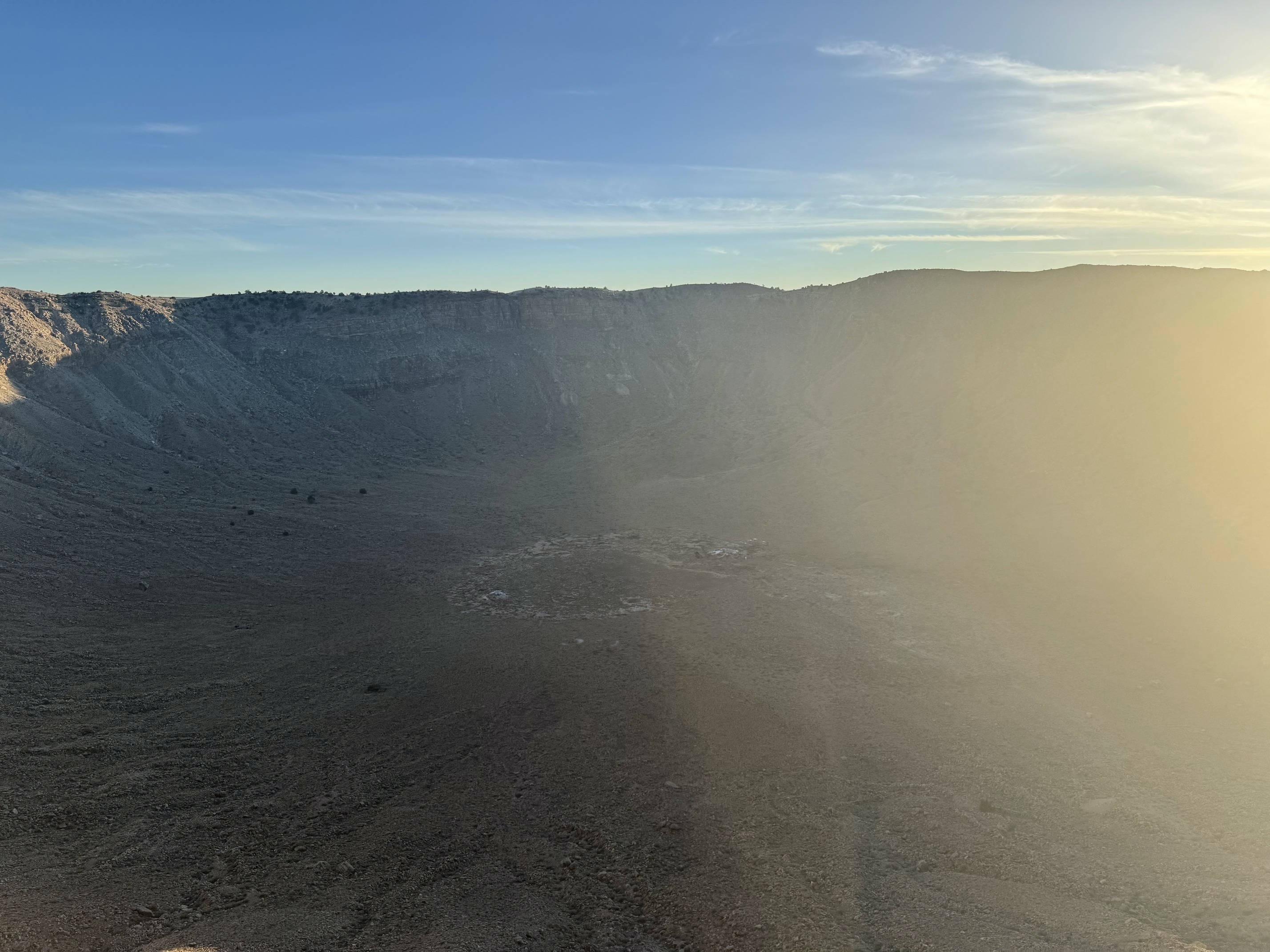 The only picture I have for Meteor Crater
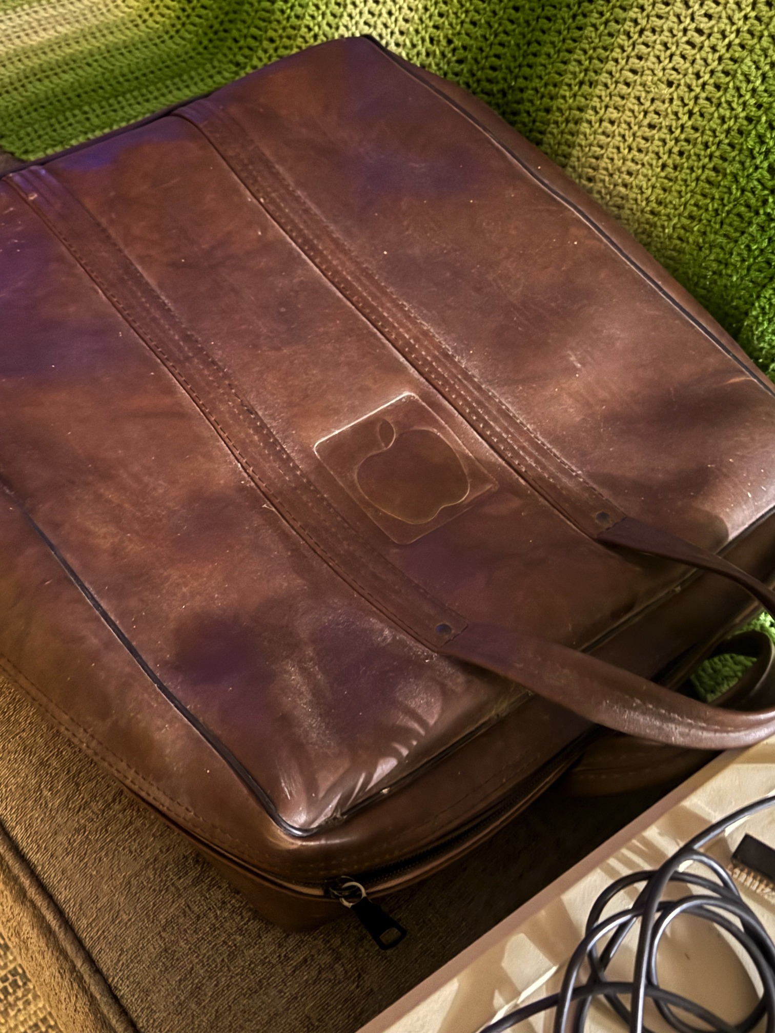
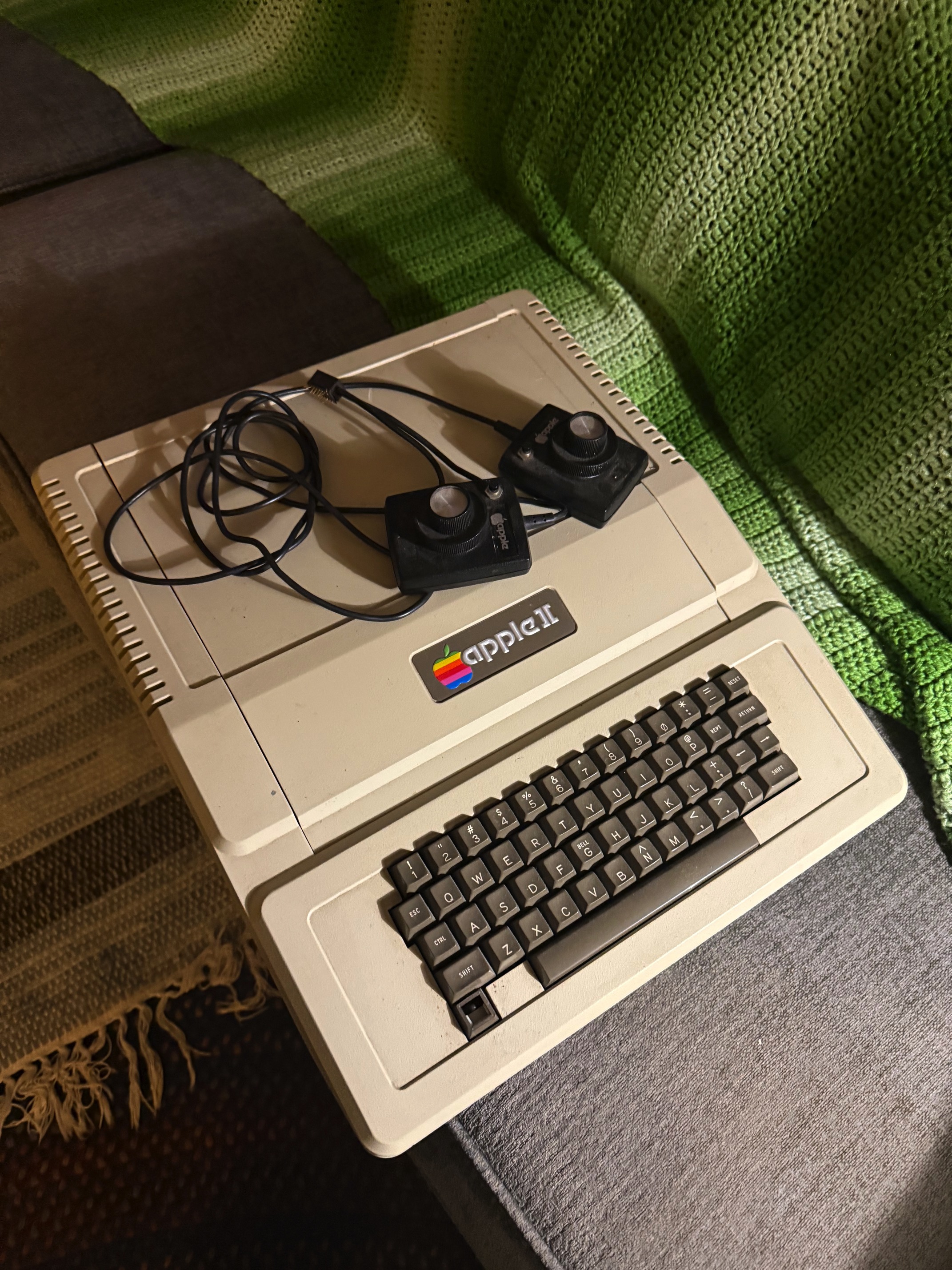
Last night of my trip and the final day of November. Laura, my host, showed me her little 'Apple collection.' She told me that when she used to work for Apple, her manager once asked if anyone wanted this trash, so she took them home.
Went to an Italian restaurant she recommended. She said Cottonwood is a very Western American small town and that I would like it. Old Town Cottonwood was quiet, but the restaurant was packed with people, talking, laughing, cheering.
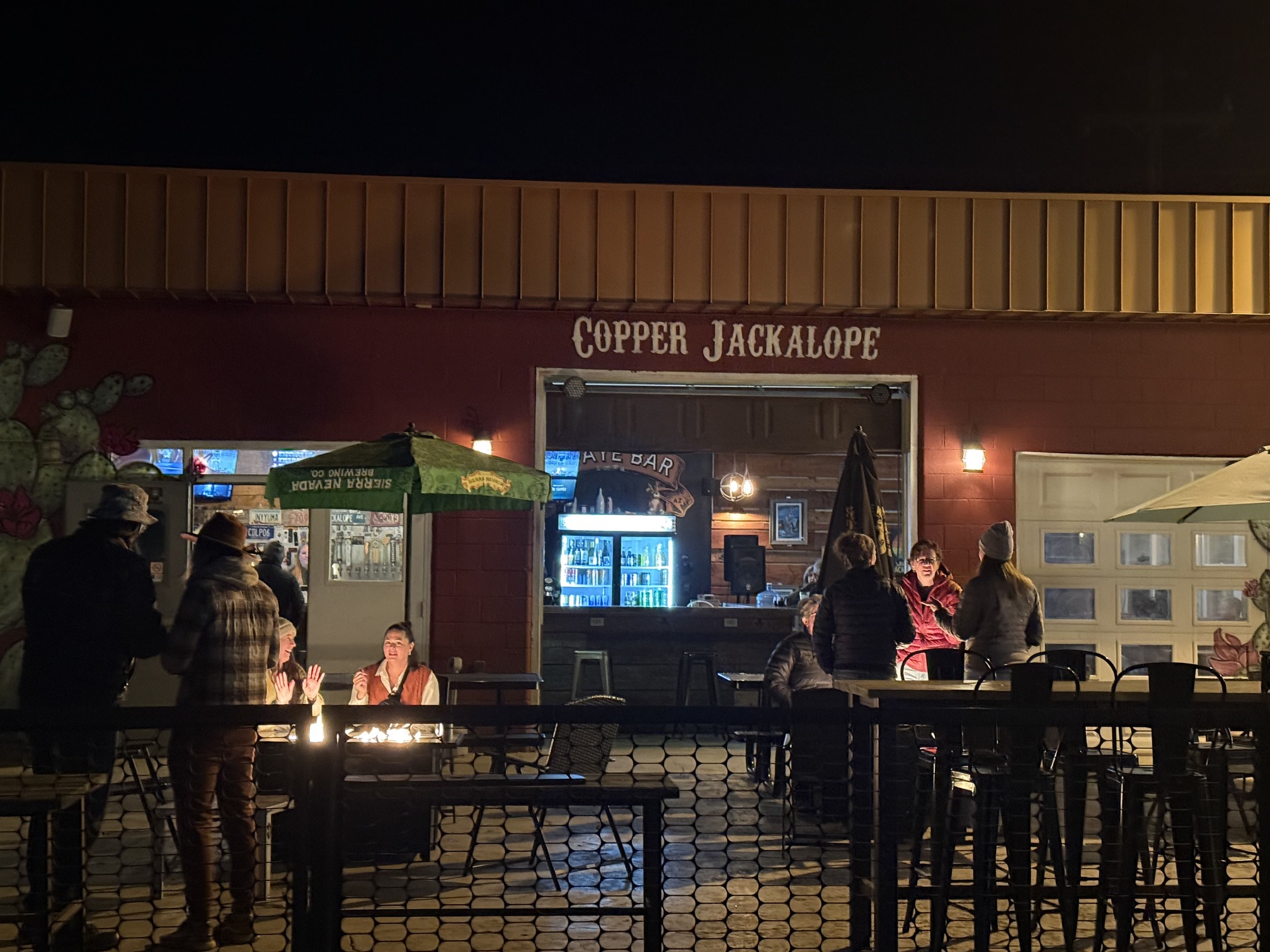 A nearby bar
Day 9 Home
There was a guestbook in my room, apparently provided by Airbnb. I love how they put it: Belong anywhere. I felt it.
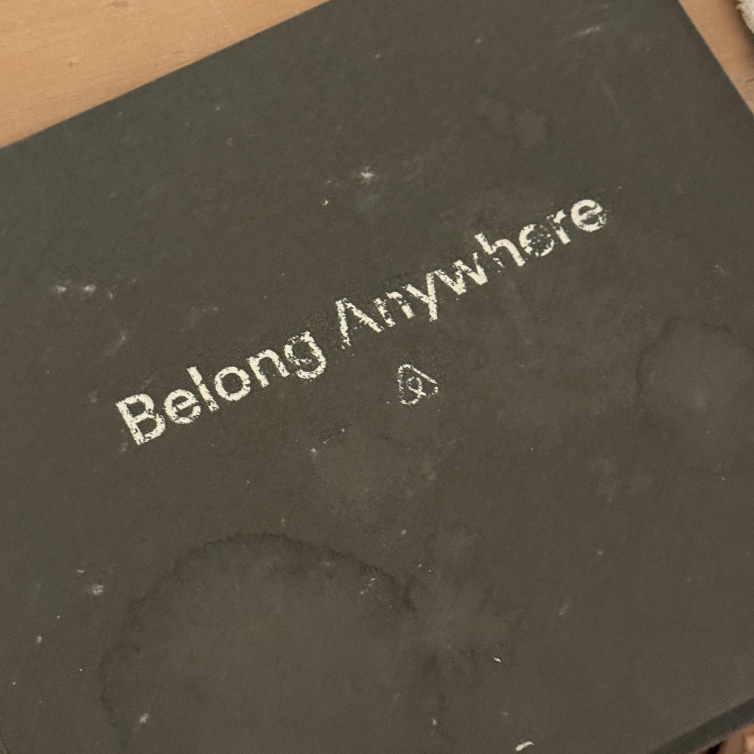 The guestbook
Nothing much to say. Drove back to Phoenix, got a hit-and-run by crazy people, returned my car, and waited for my flight. Sunset that day was beautiful.
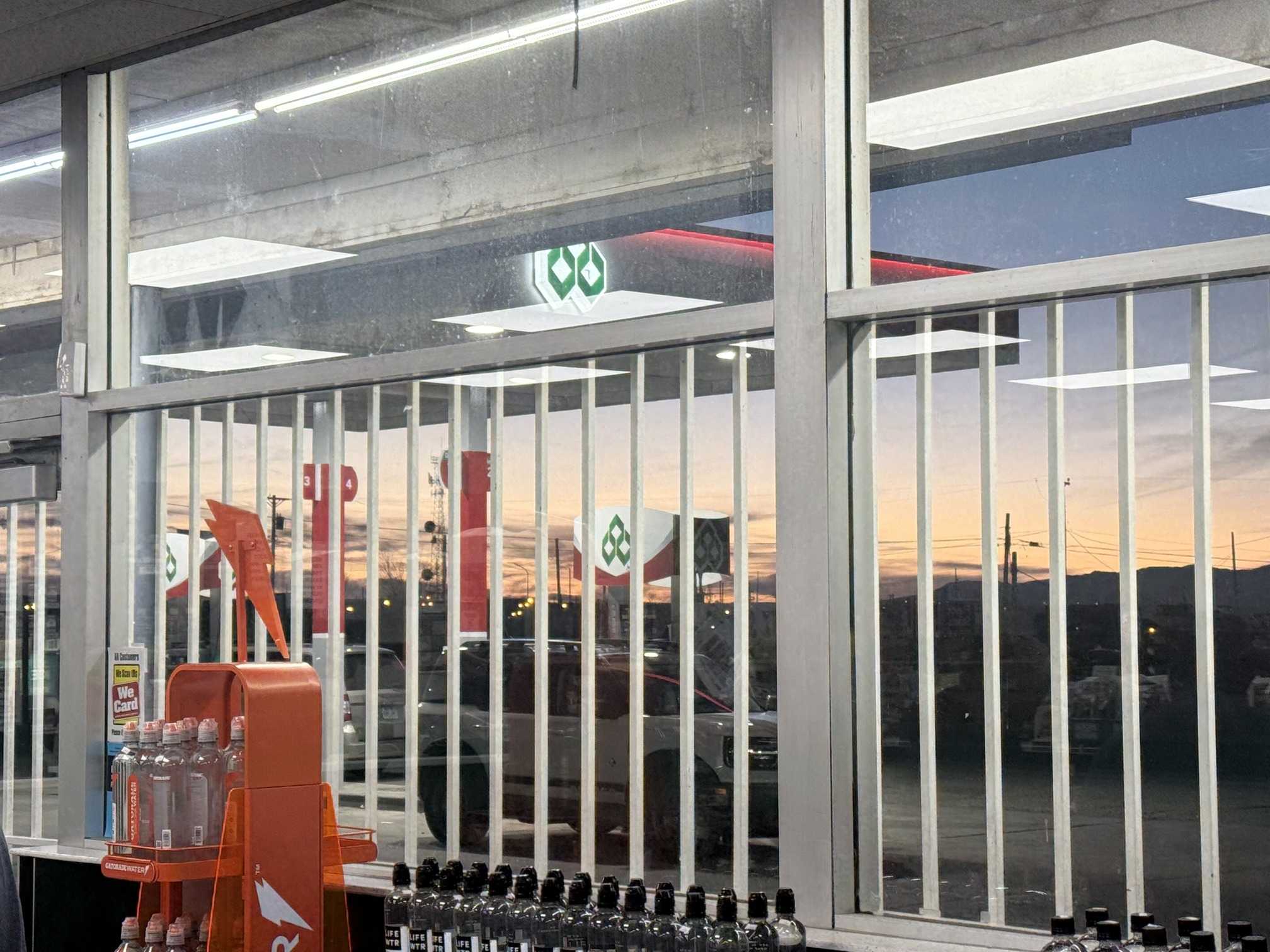
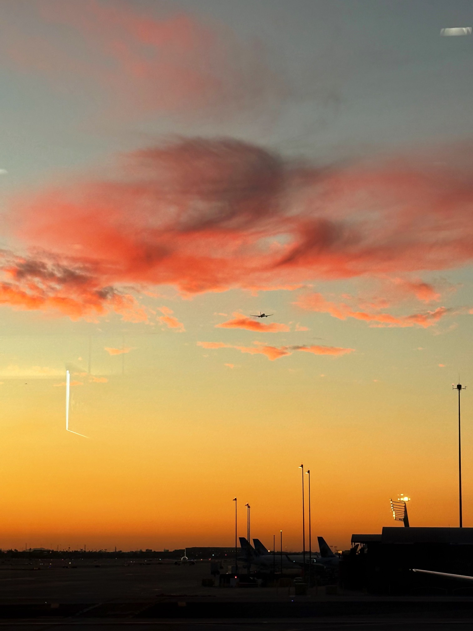 Sunset at the airport
I drove over 2,000 miles in 8 days, it was one hell of a ride. Thanks to RAYE and Tove Lo for hyping up my trip, thanks to Wrangler for being so tough, and thanks to myself for creating this crazy itinerary and making it through. I’d like to end this story with a line from Claudia by FINNEAS: You don’t even understand, just how far I drive.